
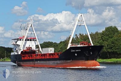
HANNE DANICA
General Cargo
Current Trip
| Time Travelled | 9 days |
|---|---|
| Remaining Time | 5 days |
| Distance Travelled | 2173.44 nm |
| Remaining Distance | 1140.22 nm |
| AVG Speed | 9.2 Knots |
| MAX Speed | 11.9 Knots |
| AVG Wind | 12.4 knots |
| MAX Wind | 24 knots |
| MIN Temp | 17.4°C / 63.32°F |
| MAX Temp | 20.7°C / 69.26°F |
| Draught | 3.2 m |
| Position Received | 7 d ago |
Current Position
| Longitude | -22.33997° |
|---|---|
| Latitude | 30.78688° |
| Status | Under way using engine |
| Speed | 10.8 Knots |
| Course | 290.9° |
| Area | North Atlantic Ocean |
| Station | T-AIS |
| Position Received | 7 d ago |
Info
Information
The current position of HANNE DANICA is in North Atlantic Ocean with coordinates 30.78688° / -22.33997° as reported on 2024-05-05 09:06 by AIS to our vessel tracker app. The vessel's current speed is 10.8 Knots and is heading at the port of WILMINGTON. The estimated time of arrival as calculated by MyShipTracking vessel tracking app is 2024-05-18 11:09 LT
The vessel HANNE DANICA (IMO: 9006239, MMSI: 219363000) is a General Cargo that was built in 1992 ( 32 years old ). It's sailing under the flag of [DK] Denmark.
In this page you can find informations about the vessels current position, last detected port calls, and current voyage information. If the vessels is not in coverage by AIS you will find the latest position.
The current position of HANNE DANICA is detected by our AIS receivers and we are not responsible for the reliability of the data. The last position was recorded while the vessel was in Coverage by the Ais receivers of our vessel tracking app.
The current draught of HANNE DANICA as reported by AIS is 3.2 meters
Weather
| Temperature | 19.6°C / 67.28°F |
|---|---|
| Wind Speed | 12 knots |
| Direction | 190° S |
| Pressure | 1013.3 hPa |
| Humidity | 86.5 % |
| Cloud Coverage | 100 % |
Featured Company
Last Port Calls
| Port | Arrival | Departure | Time In Port |
|---|---|---|---|
| 2024-05-02 21:32 | 2024-05-03 15:11 | 17 h | |
| 2024-04-26 17:02 | 2024-04-26 21:18 | 4 h | |
| 2024-04-19 11:47 | 2024-04-19 21:25 | 9 h | |
| 2024-03-05 20:57 |
Events
| Time | Event | Details | Position / Dest | Info |
|---|---|---|---|---|
| 2024-05-09 12:08 | START Moving |
34.40333 / -40.42500
US ILM
|
Speed: 6 kn Course: 282° |
|
| 2024-05-09 11:56 | STOP Moving |
34.40333 / -40.41833
US ILM
|
Speed: Course: -1° |
|
| 2024-05-05 09:12 | Status Changed | Default Under way using engine |
30.79167 / -22.35833
US ILM
|
Speed: 10.8 kn Course: 290.9° |
| 2024-05-05 09:06 | OUT of Coverage |
30.78688 / -22.33997
North Atlantic Ocean
US ILM
|
Speed: 10.8 kn Course: 290.9° |
|
| 2024-05-05 09:01 | IN Coverage |
30.78191 / -22.32465
North Atlantic Ocean
US ILM
|
Speed: 11 kn Course: 291.7° |
|
| 2024-05-05 09:00 | Status Changed | Under way using engine Default |
30.78099 / -22.32182
US ILM
|
Speed: 10.8 kn Course: 291° |
| 2024-05-05 07:01 | Status Changed | Default Under way using engine |
30.65851 / -21.92680
US ILM
|
Speed: 11.2 kn Course: 289° |
| 2024-05-05 06:56 | OUT of Coverage |
30.65319 / -21.90896
North Atlantic Ocean
US ILM
|
Speed: 11.2 kn Course: 289° |
|
| 2024-05-05 06:52 | Status Changed | Under way using engine Default |
30.64979 / -21.89757
US ILM
|
Speed: 11 kn Course: 289° |
| 2024-05-05 06:49 | Status Changed | Default Under way using engine |
30.64613 / -21.88495
US ILM
|
Speed: 11.3 kn Course: 288.7° |