
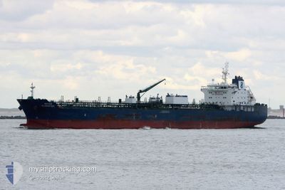
HAFNIA ALABASTER
Tanker
Current Trip
| Trip Time | 21 days |
|---|---|
| Trip Distance | 6374.94 nm |
| AVG Speed | 12.5 Knots |
| MAX Speed | 16 Knots |
| Draught | 11.9 m |
| AVG Wind | 10 knots |
| MAX Wind | 32 knots |
| MIN Temp | 11.5°C / 52.7°F |
| MAX Temp | 28.6°C / 83.48°F |
| Position Received | 9 d ago |
Current Position
| Longitude | --- |
|---|---|
| Latitude | --- |
| Status | Under way using engine |
| Speed | 14.4 Knots |
| Course | 81.9° |
| Area | Singapore Strait |
| Station | T-AIS |
| Position Received | 9 d ago |
Info
Information
The current position of HAFNIA ALABASTER is in Singapore Strait with coordinates 1.23877° / 104.01692° as reported on 2025-12-03 07:18 by AIS to our vessel tracker app. The vessel's current speed is 14.4 Knots and is currently inside the port of TAICANG.
The vessel HAFNIA ALABASTER (IMO: 9727572, MMSI: 538005785) is a Tanker It's sailing under the flag of [MH] Marshall Is.
In this page you can find informations about the vessels current position, last detected port calls, and current voyage information. If the vessels is not in coverage by AIS you will find the latest position.
The current position of HAFNIA ALABASTER is detected by our AIS receivers and we are not responsible for the reliability of the data. The last position was recorded while the vessel was in Coverage by the Ais receivers of our vessel tracking app.
The current draught of HAFNIA ALABASTER as reported by AIS is 11.9 meters
Weather
| Temperature | 9.4°C / 48.92°F |
|---|---|
| Wind Speed | 8 knots |
| Direction | 3° N |
| Pressure | 1025.5 hPa |
| Humidity | 69.4 % |
| Cloud Coverage | 100 % |
Featured Company
Most Visited Ports (Last year)
| Port | Arrivals | |
|---|---|---|
| 6 | ||
| 4 | ||
| 2 | ||
| 2 | ||
| 1 |
Events
| Time | Event | Details | Position / Dest | Info |
|---|---|---|---|---|
| 2025-12-11 11:45 | STOP Moving |
31.58655 / 121.28614
[CN] TAICANG
|
Speed: 0.3 kn Course: 312° |
|
| 2025-12-11 11:41 | PORT ARRIVAL |
|
31.58575 / 121.28756
[CN] TAICANG
|
Speed: 5.3 kn Course: 317° |
| 2025-12-11 03:22 | START Moving |
31.17434 / 122.61430
CN TAC
|
Speed: 4.9 kn Course: 144° |
|
| 2025-12-10 22:00 | STOP Moving |
31.17659 / 122.61169
CN TAC
|
Speed: 0.2 kn Course: 290° |
|
| 2025-12-03 07:25 | Status Changed | Default Under way using engine |
1.24088 / 104.04613
CN TAC
|
Speed: 14.4 kn Course: 81.9° |
| 2025-12-03 07:18 | OUT of Coverage |
1.23877 / 104.01692
Singapore Strait
CN TAC
|
Speed: 14.4 kn Course: 81.9° |
|
| 2025-12-03 07:14 | Status Changed | Under way using engine Default |
1.23707 / 104.00444
CN TAC
|
Speed: 14.5 kn Course: 81° |
| 2025-12-03 07:13 | Status Changed | Default Under way using engine |
1.23610 / 103.99844
CN TAC
|
Speed: 14.5 kn Course: 81° |
| 2025-12-03 05:59 | Draught Changed | 11.9 11.6 |
1.08906 / 103.72905
CN TAC
|
Speed: 14.6 kn Course: 62.1° |
| 2025-12-03 05:59 | Destination Changed | CN TAC AE FJR |
1.08906 / 103.72905
CN TAC
|
Speed: 14.6 kn Course: 62.1° |