
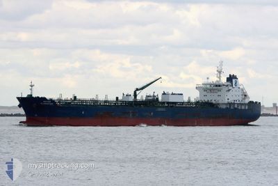
HAFNIA ALABASTER
Tanker C
Current Trip
| Time Travelled | 11 days |
|---|---|
| Remaining Time | --- |
| Distance Travelled | 2031.26 nm |
| Remaining Distance | --- |
| AVG Speed | 12.4 Knots |
| MAX Speed | 14.6 Knots |
| AVG Wind | 6.6 knots |
| MAX Wind | 14.2 knots |
| MIN Temp | 22.2°C / 71.96°F |
| MAX Temp | 30.9°C / 87.62°F |
| Dybgang | 7.7 m |
| Position Modtaget | 1 d siden |
Current Position
| Longitude | 113.73666° |
|---|---|
| Latitude | 22.52593° |
| Status | Under way using engine |
| Fart | 13.1 Knots |
| Kurs | 338.9° |
| Område | South China Sea |
| Station | T-AIS |
| Position Modtaget | 1 d siden |
Info
Information
The current position of HAFNIA ALABASTER is in South China Sea with coordinates 22.52593° / 113.73666° as reported on 2024-05-01 04:39 by AIS to our vessel tracker app. The vessel's current speed is 13.1 Knots
The vessel HAFNIA ALABASTER (IMO: 9727572, MMSI: 538005785) is a Tanker C It's sailing under the flag of [MH] Marshall Is.
In this page you can find informations about the vessels current position, last detected port calls, and current voyage information. If the vessels is not in coverage by AIS you will find the latest position.
The current position of HAFNIA ALABASTER is detected by our AIS receivers and we are not responsible for the reliability of the data. The last position was recorded while the vessel was in Coverage by the Ais receivers of our vessel tracking app.
The current draught of HAFNIA ALABASTER as reported by AIS is 7.7 meters
Weather
| Temperature | 24.4°C / 75.92°F |
|---|---|
| Wind Speed | 5 knots |
| Direction | 62° ENE |
| Pressure | 1012.2 hPa |
| Humidity | 85 % |
| Cloud Coverage | 95 % |
Featured Company
Last Port Calls
| Port | Arrival | Departure | Time In Port |
|---|---|---|---|
| 2024-04-19 06:19 | 2024-04-20 17:39 | 1 d | |
| 2024-04-14 06:58 | 2024-04-14 11:47 | 4 h | |
| 2024-04-13 17:50 | 2024-04-14 06:19 | 12 h | |
| 2024-03-23 14:23 | 2024-03-24 08:57 | 18 h | |
| 2024-03-06 23:17 | 2024-03-06 23:46 | 29 m |
Most Visited Ports (Last year)
| Port | Arrivals | |
|---|---|---|
| 3 | ||
| 2 | ||
| 2 | ||
| 1 | ||
| 1 | ||
| 1 |
Last Trips
| Origin | Departure | Destination | Arrival | Distance | |
|---|---|---|---|---|---|
| 2024-04-14 19:47 | 2024-04-19 14:19 | 28.44 nm | |||
| 2024-04-14 14:19 | 2024-04-14 14:58 | 2.18 nm | |||
| 2024-03-24 10:57 | 2024-04-14 01:50 | 5715.93 nm | |||
| 2024-03-06 20:46 | 2024-03-23 16:23 | 3460.87 nm | |||
| 2024-02-29 10:09 | 2024-03-06 20:17 | 891.48 nm |
Events
| Tid | Hændelsen | Detaljer | Position / Dest | Info |
|---|---|---|---|---|
| 2024-05-01 07:00 | STOP Sejllads | 6.11 nm, South of DONG GUAN |
22.83273 / 113.56381
CNNSA
|
Fart: 0.1 kn Kurs: 354° |
| 2024-05-01 04:45 | Status er ændret | Default Under way using engine |
22.54537 / 113.72948
CNNSA
|
Fart: 13.1 kn Kurs: 338.9° |
| 2024-05-01 04:39 | Udenfor Dækning |
22.52593 / 113.73666
South China Sea
CNNSA
|
Fart: 13.1 kn Kurs: 338.9° |
|
| 2024-05-01 03:45 | ETA er ændret | 2024/05/01 08:00 2024/04/30 10:00 |
22.32627 / 113.79659
CNNSA
|
Fart: 14.4 kn Kurs: 344.6° |
| 2024-05-01 03:32 | Status er ændret | Under way using engine Default |
22.27474 / 113.80594
CNNSA
|
Fart: 14.2 kn Kurs: 10° |
| 2024-05-01 03:25 | Status er ændret | Default Under way using engine |
22.24658 / 113.80221
CNNSA
|
Fart: 13.8 kn Kurs: 10° |
| 2024-05-01 03:19 | Status er ændret | Under way using engine Default |
22.22386 / 113.79805
CNNSA
|
Fart: 13.8 kn Kurs: 11° |
| 2024-05-01 03:16 | Status er ændret | Default Under way using engine |
22.21304 / 113.79586
CNNSA
|
Fart: 13 kn Kurs: 8° |
| 2024-05-01 02:53 | Status er ændret | Under way using engine Default |
22.13703 / 113.79778
CNNSA
|
Fart: 4.9 kn Kurs: 32° |
| 2024-05-01 02:36 | Status er ændret | Default Under way using engine |
22.12354 / 113.78630
CNNSA
|
Fart: 2.5 kn Kurs: 79° |