
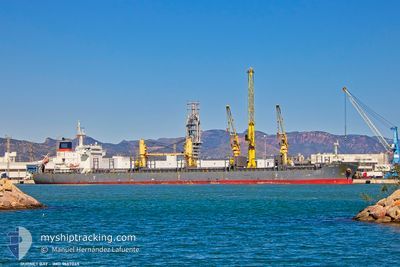
GURNET BAY
Not available
Current Trip
| Trip Time | 2 days |
|---|---|
| Trip Distance | 570.87 nm |
| AVG Speed | 11.9 Knots |
| MAX Speed | 14 Knots |
| Draught | 6.5 m |
| AVG Wind | 6.4 knots |
| MAX Wind | 12 knots |
| MIN Temp | 11.1°C / 51.98°F |
| MAX Temp | 18.8°C / 65.84°F |
| Position Received | 4 d ago |
Current Position
| Longitude | --- |
|---|---|
| Latitude | --- |
| Status | Under way using engine |
| Speed | 12.2 Knots |
| Course | 80.8° |
| Area | Mediterranean Sea - Eastern Basin |
| Station | T-AIS |
| Position Received | 4 d ago |
Info
Information
The current position of GURNET BAY is in Mediterranean Sea - Eastern Basin with coordinates 35.96318° / 29.79752° as reported on 2025-12-02 01:36 by AIS to our vessel tracker app. The vessel's current speed is 12.2 Knots and is currently inside the port of ANTALYA.
The vessel GURNET BAY (IMO: 9667045, MMSI: 255806204) is a Not available It's sailing under the flag of [PT] Portugal.
In this page you can find informations about the vessels current position, last detected port calls, and current voyage information. If the vessels is not in coverage by AIS you will find the latest position.
The current position of GURNET BAY is detected by our AIS receivers and we are not responsible for the reliability of the data. The last position was recorded while the vessel was in Coverage by the Ais receivers of our vessel tracking app.
The current draught of GURNET BAY as reported by AIS is 6.5 meters
Weather
| Temperature | 11.8°C / 53.24°F |
|---|---|
| Wind Speed | 1 knots |
| Direction | 102° ESE |
| Pressure | 1017.6 hPa |
| Humidity | 75.7 % |
| Cloud Coverage | 100 % |
Featured Company
Last Trips
| Origin | Departure | Destination | Arrival | Distance | |
|---|---|---|---|---|---|
| 2025-11-30 06:23 | 2025-12-02 13:09 | 570.87 nm | |||
| 2025-11-08 16:00 | 2025-11-24 17:44 | 4476.84 nm | |||
| 2025-10-28 22:09 | 2025-11-02 15:44 | 1263.22 nm | |||
| 2025-10-28 18:42 | 2025-10-28 20:16 | 8.58 nm | |||
| 2025-09-29 21:54 | 2025-10-12 10:21 | 3289.66 nm |
Events
| Time | Event | Details | Position / Dest | Info |
|---|---|---|---|---|
| 2025-12-02 10:27 | STOP Moving |
36.83630 / 30.61034
[TR] ANTALYA
|
Speed: 0.1 kn Course: 334° |
|
| 2025-12-02 10:09 | PORT ARRIVAL |
|
36.83360 / 30.61361
[TR] ANTALYA
|
Speed: 3.3 kn Course: 225° |
| 2025-12-02 01:45 | Status Changed | Default Under way using engine |
35.96667 / 29.83167
TRAYT
|
Speed: 12.2 kn Course: 80.8° |
| 2025-12-02 01:36 | OUT of Coverage |
35.96318 / 29.79752
Mediterranean Sea - Eastern Basin
TRAYT
|
Speed: 12.2 kn Course: 80.8° |
|
| 2025-12-02 01:22 | Change Sea Area | Turkish part of the Mediterranean Sea - Eastern Basin Greek part of the Mediterranean Sea - Eastern Basin |
35.95515 / 29.73814
Mediterranean Sea - Eastern Basin
TRAYT
|
Speed: 12.1 kn Course: 80.2° |
| 2025-12-02 00:43 | Change Sea Area | Greek part of the Mediterranean Sea - Eastern Basin Turkish part of the Mediterranean Sea - Eastern Basin |
35.93534 / 29.57707
Mediterranean Sea - Eastern Basin
TRAYT
|
Speed: 12.1 kn Course: 80.9° |
| 2025-12-02 00:43 | Status Changed | Under way using engine Default |
35.93534 / 29.57707
TRAYT
|
Speed: 11 kn Course: 80° |
| 2025-12-02 00:30 | IN Coverage |
35.93534 / 29.57707
Mediterranean Sea - Eastern Basin
TRAYT
|
Speed: 12.1 kn Course: 80.9° |
|
| 2025-12-01 22:01 | Status Changed | Default Under way using engine |
35.84296 / 28.89461
TRAYT
|
Speed: 13.1 kn Course: 81.7° |
| 2025-12-01 21:55 | OUT of Coverage |
35.83946 / 28.86773
Mediterranean Sea - Eastern Basin
TRAYT
|
Speed: 13.1 kn Course: 81.7° |