
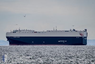
GREEN OCEAN
Cargo
Current Trip
| Time Travelled | 23 h, 48 mins |
|---|---|
| Remaining Time | --- |
| Distance Travelled | 349.57 nm |
| Remaining Distance | --- |
| AVG Speed | 14 Knots |
| MAX Speed | 16.3 Knots |
| AVG Wind | 8.7 knots |
| MAX Wind | 15 knots |
| MIN Temp | 8.2°C / 46.76°F |
| MAX Temp | 16.8°C / 62.24°F |
| Draught | 9.2 m |
| Position Received | 1 m ago |
Current Position
| Longitude | 10.94547° |
|---|---|
| Latitude | 54.96309° |
| Status | Under way using engine |
| Speed | 15.8 Knots |
| Course | 51.9° |
| Area | Kattegat |
| Station | T-AIS |
| Position Received | 1 m ago |
Info
Information
The current position of GREEN OCEAN is in Kattegat with coordinates 54.96309° / 10.94547° as reported on 2024-04-29 15:40 by AIS to our vessel tracker app. The vessel's current speed is 15.8 Knots and is heading at the port of CORPUS CHRISTI. The estimated time of arrival as calculated by MyShipTracking vessel tracking app is 2024-05-19 11:00 LT
The vessel GREEN OCEAN (IMO: 9981910, MMSI: 369543000) is a Cargo It's sailing under the flag of [US] USA.
In this page you can find informations about the vessels current position, last detected port calls, and current voyage information. If the vessels is not in coverage by AIS you will find the latest position.
The current position of GREEN OCEAN is detected by our AIS receivers and we are not responsible for the reliability of the data. The last position was recorded while the vessel was in Coverage by the Ais receivers of our vessel tracking app.
The current draught of GREEN OCEAN as reported by AIS is 9.2 meters
Weather
| Temperature | 11.3°C / 52.34°F |
|---|---|
| Wind Speed | 6 knots |
| Direction | 178° S |
| Pressure | 1023.2 hPa |
| Humidity | 80.6 % |
| Cloud Coverage | 88 % |
Featured Company
Last Port Calls
| Port | Arrival | Departure | Time In Port |
|---|---|---|---|
| 2024-04-27 13:00 | 2024-04-28 15:53 | 1 d | |
| 2024-04-23 04:47 | 2024-04-27 10:21 | 4 d | |
| 2024-03-31 22:43 | 2024-04-04 12:48 | 3 d | |
| 2024-03-28 09:10 | 2024-03-29 00:01 | 14 h | |
| 2024-03-27 10:04 | 2024-03-27 21:55 | 11 h | |
| 2024-03-24 13:30 | 2024-03-25 20:01 | 1 d | |
| 2024-03-24 12:51 | 2024-03-24 13:07 | 16 m | |
| 2024-03-21 18:17 | 2024-03-22 04:49 | 10 h | |
| 2024-02-17 21:43 | 2024-02-18 10:41 | 12 h | |
| 2024-02-01 20:22 | 2024-02-02 17:13 | 20 h |
Most Visited Ports (Last year)
| Port | Arrivals | |
|---|---|---|
| 2 | ||
| 1 | ||
| 1 | ||
| 1 | ||
| 1 | ||
| 1 |
Last Trips
| Origin | Departure | Destination | Arrival | Distance | |
|---|---|---|---|---|---|
| 2024-04-27 12:21 | 2024-04-27 15:00 | 5.47 nm | |||
| 2024-04-04 08:48 | 2024-04-23 06:47 | 5547.86 nm | |||
| 2024-03-28 20:01 | 2024-03-31 18:43 | 896.34 nm | |||
| 2024-03-27 17:55 | 2024-03-28 05:10 | 124.48 nm | |||
| 2024-03-25 16:01 | 2024-03-27 06:04 | 386.06 nm | |||
| 2024-03-24 09:07 | 2024-03-24 09:30 | 0.82 nm | |||
| 2024-03-22 00:49 | 2024-03-24 08:51 | 737.40 nm | |||
| 2024-02-18 19:41 | 2024-03-21 14:17 | 9391.57 nm | |||
| 2024-02-02 09:13 | 2024-02-18 06:43 | 4868.45 nm | |||
| 2024-01-31 18:48 | 2024-02-01 12:22 | 85.50 nm |
Events
| Time | Event | Details | Position / Dest | Info |
|---|---|---|---|---|
| 2024-04-29 14:26 | Change Sea Area | Danish part of the Kattegat Danish part of the Baltic Sea |
54.73797 / 10.78287
Kattegat
USCRP
|
Speed: 12.3 kn Course: 12.2° |
| 2024-04-29 13:47 | Change Sea Area | Danish part of the Baltic Sea German part of the Baltic Sea |
54.63936 / 10.88706
Baltic Sea
USCRP
|
Speed: 12.6 kn Course: 299.7° |
| 2024-04-29 12:26 | Change Sea Area | German part of the Baltic Sea Danish part of the Baltic Sea |
54.56025 / 11.33096
Baltic Sea
USCRP
|
Speed: 12 kn Course: 294.7° |
| 2024-04-29 10:14 | Change Sea Area | Danish part of the Baltic Sea German part of the Baltic Sea |
54.43210 / 12.12722
Baltic Sea
USCRP
|
Speed: 15.3 kn Course: 269.8° |
| 2024-04-29 09:56 | Change Sea Area | German part of the Baltic Sea Danish part of the Baltic Sea |
54.48529 / 12.20355
Baltic Sea
USCRP
|
Speed: 15.5 kn Course: 196.5° |
| 2024-04-29 09:05 | Detected in Sea | Danish part of the Baltic Sea |
54.65618 / 12.40437
Baltic Sea
USCRP
|
Speed: 15.3 kn Course: 235.6° |
| 2024-04-29 08:41 | Change Sea Area | German part of the Baltic Sea Danish part of the Baltic Sea |
54.71278 / 12.55083
Baltic Sea
USCRP
|
Speed: 15.3 kn Course: 236.2° |
| 2024-04-29 08:05 | Detected in Sea | Danish part of the Baltic Sea |
54.77929 / 12.78029
Baltic Sea
USCRP
|
Speed: 15.2 kn Course: 269° |
| 2024-04-29 04:14 | Change Sea Area | German part of the Baltic Sea Danish part of the Kattegat |
54.62708 / 14.45370
Baltic Sea
USCRP
|
Speed: 15.5 kn Course: 260.6° |
| 2024-04-29 03:08 | Change Sea Area | Danish part of the Kattegat Polish part of the Baltic Sea |
54.67225 / 14.93192
Kattegat
USCRP
|
Speed: 15.2 kn Course: 260.8° |