
GRAND CANYON III
Other Type
Current Trip
GREENLINK
| Time Travelled | 5 days |
|---|---|
| Remaining Time | --- |
| Distance Travelled | 148.27 nm |
| Remaining Distance | --- |
| AVG Speed | 7.4 Knots |
| MAX Speed | 14 Knots |
| AVG Wind | 8.7 knots |
| MAX Wind | 17.5 knots |
| MIN Temp | 10.9°C / 51.62°F |
| MAX Temp | 14.6°C / 58.28°F |
| Draught | 6.7 m |
| Position Received | 2 m ago |
Current Position
| Longitude | -5.53957° |
|---|---|
| Latitude | 51.65185° |
| Status | Restricted manoeuverability |
| Speed | 0.5 Knots |
| Course | 212° |
| Area | Celtic Sea |
| Station | T-AIS |
| Position Received | 2 m ago |
Info
Information
The current position of GRAND CANYON III is in Celtic Sea with coordinates 51.65185° / -5.53957° as reported on 2024-05-13 20:23 by AIS to our vessel tracker app. The vessel's current speed is 0.5 Knots
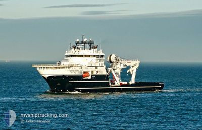
The vessel GRAND CANYON III (IMO: 9695963, MMSI: 257010590) is a Other Type It's sailing under the flag of [NO] Norway.
In this page you can find informations about the vessels current position, last detected port calls, and current voyage information. If the vessels is not in coverage by AIS you will find the latest position.
The current position of GRAND CANYON III is detected by our AIS receivers and we are not responsible for the reliability of the data. The last position was recorded while the vessel was in Coverage by the Ais receivers of our vessel tracking app.
The current draught of GRAND CANYON III as reported by AIS is 6.7 meters
Weather
| Temperature | 12°C / 53.6°F |
|---|---|
| Wind Speed | 10 knots |
| Direction | 155° SSE |
| Pressure | 997.3 hPa |
| Humidity | 91.3 % |
| Cloud Coverage | 100 % |
Featured Company
Events
| Time | Event | Details | Position / Dest | Info |
|---|---|---|---|---|
| 2024-05-13 15:01 | IN Coverage |
51.65045 / -5.51668
Celtic Sea
|
Speed: 0.2 kn Course: 274.3° |
|
| 2024-05-13 13:46 | OUT of Coverage |
51.65002 / -5.51648
Celtic Sea
|
Speed: 0.4 kn Course: 182.1° |
|
| 2024-05-13 13:46 | IN Coverage |
51.65002 / -5.51648
Celtic Sea
|
Speed: 0.4 kn Course: 182.1° |
|
| 2024-05-13 04:46 | OUT of Coverage |
51.65068 / -5.50922
Celtic Sea
|
Speed: 0.2 kn Course: 278.7° |
|
| 2024-05-13 04:02 | IN Coverage |
51.65043 / -5.50597
Celtic Sea
|
Speed: 0.2 kn Course: 279.3° |
|
| 2024-05-13 01:16 | OUT of Coverage |
51.64922 / -5.49300
Celtic Sea
|
Speed: 0.1 kn Course: 248.5° |
|
| 2024-05-12 13:44 | STOP Moving | 18.8 nm, West of PEMBROKE |
51.64820 / -5.46138
GREENLINK
|
Speed: 0.3 kn Course: 271° |
| 2024-05-12 12:51 | START Moving | 12.4 nm, West of PEMBROKE |
51.66125 / -5.29115
GREENLINK
|
Speed: 3.1 kn Course: 186° |
| 2024-05-11 13:56 | STOP Moving | 8.21 nm, South West of PEMBROKE |
51.64293 / -5.16545
GREENLINK
|
Speed: 0.3 kn Course: 103° |
| 2024-05-11 13:13 | START Moving | 12.7 nm, West of PEMBROKE |
51.65980 / -5.29898
GREENLINK
|
Speed: 3.7 kn Course: 106° |