
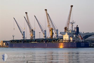
GRAMBA
Cargo
Current Trip
GARGOUB
| Time Travelled | 2 days |
|---|---|
| Remaining Time | --- |
| Distance Travelled | 562.24 nm |
| Remaining Distance | --- |
| AVG Speed | 11.5 Knots |
| MAX Speed | 15.1 Knots |
| AVG Wind | 18.1 knots |
| MAX Wind | 32 knots |
| MIN Temp | 10.2°C / 50.36°F |
| MAX Temp | 18.7°C / 65.66°F |
| Draught | 6.8 m |
| Position Received | 1 d ago |
Current Position
| Longitude | --- |
|---|---|
| Latitude | --- |
| Status | Under way using engine |
| Speed | 13.5 Knots |
| Course | 249.8° |
| Area | Mediterranean Sea - Eastern Basin |
| Station | T-AIS |
| Position Received | 1 d ago |
Info
Information
The current position of GRAMBA is in Mediterranean Sea - Eastern Basin with coordinates 35.60552° / 32.54040° as reported on 2026-01-08 05:38 by AIS to our vessel tracker app. The vessel's current speed is 13.5 Knots
The vessel GRAMBA (IMO: 9917048, MMSI: 563134200) is a Cargo It's sailing under the flag of [SG] Singapore.
In this page you can find informations about the vessels current position, last detected port calls, and current voyage information. If the vessels is not in coverage by AIS you will find the latest position.
The current position of GRAMBA is detected by our AIS receivers and we are not responsible for the reliability of the data. The last position was recorded while the vessel was in Coverage by the Ais receivers of our vessel tracking app.
The current draught of GRAMBA as reported by AIS is 6.8 meters
Weather
| Temperature | 17.7°C / 63.86°F |
|---|---|
| Wind Speed | 18 knots |
| Direction | 301° WNW |
| Pressure | 1021.1 hPa |
| Humidity | 63.7 % |
| Cloud Coverage | 2 % |
Featured Company
Most Visited Ports (Last year)
| Port | Arrivals | |
|---|---|---|
| 1 | ||
| 1 | ||
| 1 | ||
| 1 | ||
| 1 | ||
| 1 |
Last Trips
| Origin | Departure | Destination | Arrival | Distance | |
|---|---|---|---|---|---|
| 2025-12-08 15:43 | 2025-12-31 10:08 | 5060.03 nm | |||
| 2025-12-01 13:15 | 2025-12-05 08:58 | 1123.69 nm | |||
| 2025-11-15 17:56 | 2025-11-29 18:45 | 3734.00 nm | |||
| 2025-11-11 23:40 | 2025-11-14 12:44 | 697.59 nm | |||
| 2025-10-28 09:10 | 2025-11-05 19:40 | 167.11 nm |
Events
| Time | Event | Details | Position / Dest | Info |
|---|---|---|---|---|
| 2026-01-08 05:50 | Status Changed | Default Under way using engine |
35.59020 / 32.48860
GARGOUB
|
Speed: 13.5 kn Course: 249.8° |
| 2026-01-08 05:38 | OUT of Coverage |
35.60552 / 32.54040
Mediterranean Sea - Eastern Basin
GARGOUB
|
Speed: 13.5 kn Course: 249.8° |
|
| 2026-01-08 05:34 | Detected in Sea | Cypriote part of the Mediterranean Sea - Eastern Basin |
35.61092 / 32.55850
Mediterranean Sea - Eastern Basin
GARGOUB
|
Speed: 13.5 kn Course: 249.6° |
| 2026-01-08 05:30 | Status Changed | Under way using engine Default |
35.61586 / 32.57513
GARGOUB
|
Speed: 13.5 kn Course: 250° |
| 2026-01-08 05:16 | IN Coverage |
35.61092 / 32.55850
Mediterranean Sea - Eastern Basin
GARGOUB
|
Speed: 13.5 kn Course: 249.6° |
|
| 2026-01-07 23:01 | Status Changed | Default Under way using engine |
36.09382 / 34.35567
GARGOUB
|
Speed: 14.1 kn Course: 254.3° |
| 2026-01-07 22:56 | OUT of Coverage |
36.09978 / 34.37780
Mediterranean Sea - Eastern Basin
GARGOUB
|
Speed: 14.1 kn Course: 254.3° |
|
| 2026-01-07 22:50 | Status Changed | Under way using engine Default |
36.10515 / 34.40172
GARGOUB
|
Speed: 13.9 kn Course: 254° |
| 2026-01-07 22:49 | Status Changed | Default Under way using engine |
36.10680 / 34.40875
GARGOUB
|
Speed: 13.8 kn Course: 248.5° |
| 2026-01-07 22:42 | Status Changed | Under way using engine Default |
36.11539 / 34.43802
GARGOUB
|
Speed: 13.8 kn Course: 248° |