
GRAMBA
Cargo
Current Trip
| Time Travelled | 55 days |
|---|---|
| Remaining Time | 9 days |
| Distance Travelled | 13357.58 nm |
| Remaining Distance | 2491.88 nm |
| AVG Speed | 10.6 Knop |
| MAX Speed | 14.1 Knop |
| AVG Wind | 12.7 knots |
| MAX Wind | 27 knots |
| MIN Temp | 12.2°C / 53.96°F |
| MAX Temp | 30.7°C / 87.26°F |
| Djupgående | 12.9 m |
| Position mottagen | 1 d sen |
Current Position
| Longitud | 104.21640° |
|---|---|
| Latitude | 1.26841° |
| Status | Under way using engine |
| Fart | 11.1 Knop |
| Kurs | 82.1° |
| Område | Singapore Strait |
| Station | T-AIS |
| Position mottagen | 1 d sen |
Info
Information
The current position of GRAMBA is in Singapore Strait with coordinates 1.26841° / 104.21640° as reported on 2024-04-24 10:37 by AIS to our vessel tracker app. The vessel's current speed is 11.1 Knop and is heading at the port of TIANJIN. The estimated time of arrival as calculated by MyShipTracking vessel tracking app is 2024-05-04 16:38 LT
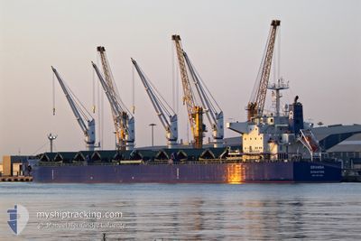
The vessel GRAMBA (IMO: 9917048, MMSI: 563134200) is a Cargo It's sailing under the flag of [SG] Singapore.
In this page you can find informations about the vessels current position, last detected port calls, and current voyage information. If the vessels is not in coverage by AIS you will find the latest position.
The current position of GRAMBA is detected by our AIS receivers and we are not responsible for the reliability of the data. The last position was recorded while the vessel was in Coverage by the Ais receivers of our vessel tracking app.
The current draught of GRAMBA as reported by AIS is 12.9 meters
Weather
| Temperature | 29.8°C / 85.64°F |
|---|---|
| Wind Speed | 7 knots |
| Direction | 35° NE |
| Pressure | 1005.3 hPa |
| Humidity | 73.3 % |
| Cloud Coverage | 100 % |
Featured Company
Last Port Calls
| Port | Arrival | Departure | Time In Port |
|---|---|---|---|
| 2024-02-29 13:48 | 2024-03-01 00:22 | 10 h | |
| 2024-02-10 18:28 | 2024-02-24 10:07 | 13 d | |
| 2024-02-05 17:03 | 2024-02-08 21:54 | 3 d |
Most Visited Ports (Last year)
| Port | Arrivals | |
|---|---|---|
| 3 | ||
| 2 | ||
| 2 | ||
| 1 | ||
| 1 | ||
| 1 |
Events
| Tid | Event | Detaljer | Position / Dest | Information |
|---|---|---|---|---|
| 2024-04-24 10:44 | Status ändrad | Default Under way using engine |
1.27187 / 104.23885
CNTXG
|
Fart: 11.1 kn Kurs: 82.1° |
| 2024-04-24 10:37 | Status ändrad | Under way using engine Default |
1.26841 / 104.21640
CNTXG
|
Fart: 11.2 kn Kurs: 80° |
| 2024-04-24 10:37 | UTANFÖR täckningsområde |
1.26841 / 104.21640
Singapore Strait
CNTXG
|
Fart: 11.1 kn Kurs: 82.1° |
|
| 2024-04-24 10:32 | Status ändrad | Default Under way using engine |
1.26657 / 104.20195
CNTXG
|
Fart: 11.3 kn Kurs: 80.7° |
| 2024-04-24 10:16 | Byter havsområde | Malaysian part of the Singapore Strait Indonesian part of the Singapore Strait |
1.25911 / 104.14935
Singapore Strait
CNTXG
|
Fart: 11.3 kn Kurs: 82.9° |
| 2024-04-24 09:17 | Byter havsområde | Indonesian part of the Singapore Strait Singaporean part of the Singapore Strait |
1.24109 / 103.96703
Singapore Strait
CNTXG
|
Fart: 9.5 kn Kurs: 83.2° |
| 2024-04-24 08:28 | STARTAR förflyttning | 3.31 nm, North East of SINGAPORE |
1.27912 / 103.90542
CNTXG
|
Fart: 4.1 kn Kurs: 88° |
| 2024-04-24 08:24 | Djupgående ändrat | 12.9 12.8 |
1.27824 / 103.90207
CNTXG
|
Fart: 1.6 kn Kurs: 66° |
| 2024-04-24 08:18 | ETA ändrat | 2024/05/04 02:00 2024/04/23 21:15 |
1.27740 / 103.90118
CNTXG
|
Fart: 0.1 kn Kurs: 48° |
| 2024-04-24 08:13 | Status ändrad | Under way using engine At anchor |
1.27734 / 103.90108
CNTXG
|
Fart: Kurs: 51° |