
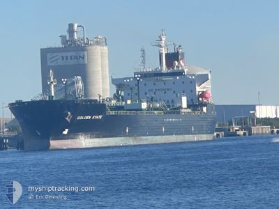
GOLDEN STATE
Oil/Chemical Tanker
Current Trip
| Time Travelled | 11 days |
|---|---|
| Remaining Time | --- |
| Distance Travelled | 2572.48 nm |
| Remaining Distance | --- |
| AVG Speed | 11.6 Knots |
| MAX Speed | 15.7 Knots |
| AVG Wind | 12.4 knots |
| MAX Wind | 26.3 knots |
| MIN Temp | 1.9°C / 35.42°F |
| MAX Temp | 27.7°C / 81.86°F |
| Draught | 11.1 m |
| Position Received | 1 d ago |
Current Position
| Longitude | --- |
|---|---|
| Latitude | --- |
| Status | Under way using engine |
| Speed | 13.3 Knots |
| Course | 178.4° |
| Area | Gulf of Mexico |
| Station | T-AIS |
| Position Received | 1 d ago |
Info
Information
The current position of GOLDEN STATE is in Gulf of Mexico with coordinates 29.07586° / -93.22852° as reported on 2025-12-05 19:21 by AIS to our vessel tracker app. The vessel's current speed is 13.3 Knots and is heading at the port of SAVANNAH. The estimated time of arrival as calculated by MyShipTracking vessel tracking app is 2025-12-09 07:00 LT
The vessel GOLDEN STATE (IMO: 9407562, MMSI: 367342960) is a Oil/Chemical Tanker that was built in 2008 ( 17 years old ). It's sailing under the flag of [US] USA.
In this page you can find informations about the vessels current position, last detected port calls, and current voyage information. If the vessels is not in coverage by AIS you will find the latest position.
The current position of GOLDEN STATE is detected by our AIS receivers and we are not responsible for the reliability of the data. The last position was recorded while the vessel was in Coverage by the Ais receivers of our vessel tracking app.
The current draught of GOLDEN STATE as reported by AIS is 11.1 meters
Weather
| Temperature | 26.3°C / 79.34°F |
|---|---|
| Wind Speed | 10 knots |
| Direction | 218° SW |
| Pressure | 1012.8 hPa |
| Humidity | 74.3 % |
| Cloud Coverage | 27 % |
Featured Company
Last Port Calls
| Port | Arrival | Departure | Time In Port |
|---|---|---|---|
| 2025-11-21 23:30 | 2025-11-25 17:29 | 3 d | |
| 2025-11-12 23:19 | 2025-11-12 23:53 | 34 m | |
| 2025-11-07 19:04 | 2025-11-10 12:37 | 2 d | |
| 2025-11-03 15:26 | 2025-11-06 10:08 | 2 d | |
| 2025-10-29 23:48 | 2025-10-31 23:34 | 1 d | |
| 2025-10-25 07:26 | 2025-10-27 15:34 | 2 d | |
| 2025-10-21 01:16 | 2025-10-22 22:38 | 1 d | |
| 2025-10-16 08:34 | 2025-10-18 09:30 | 2 d | |
| 2025-10-12 06:53 | 2025-10-13 23:54 | 1 d | |
| 2025-10-06 13:10 | 2025-10-09 19:35 | 3 d |
Most Visited Ports (Last year)
| Port | Arrivals | |
|---|---|---|
| 17 | ||
| 16 | ||
| 15 | ||
| 3 | ||
| 3 | ||
| 3 |
Last Trips
| Origin | Departure | Destination | Arrival | Distance | |
|---|---|---|---|---|---|
| 2025-11-12 23:53 | 2025-11-21 23:30 | 1840.93 nm | |||
| 2025-11-10 12:37 | 2025-11-12 23:19 | 813.78 nm | |||
| 2025-11-06 10:08 | 2025-11-07 19:04 | 393.55 nm | |||
| 2025-10-31 23:34 | 2025-11-03 15:26 | 712.07 nm | |||
| 2025-10-27 15:34 | 2025-10-29 23:48 | 705.88 nm | |||
| 2025-10-22 22:38 | 2025-10-25 07:26 | 712.05 nm | |||
| 2025-10-18 09:30 | 2025-10-21 01:16 | 716.02 nm | |||
| 2025-10-13 23:54 | 2025-10-16 08:34 | 708.19 nm | |||
| 2025-10-09 19:35 | 2025-10-12 06:53 | 711.60 nm | |||
| 2025-10-04 12:50 | 2025-10-06 13:10 | 711.01 nm |
Events
| Time | Event | Details | Position / Dest | Info |
|---|---|---|---|---|
| 2025-12-05 19:27 | Status Changed | Default Under way using engine |
29.05685 / -93.22792
SAVANNAH
|
Speed: 13.3 kn Course: 178.4° |
| 2025-12-05 19:21 | OUT of Coverage |
29.07586 / -93.22852
Gulf of Mexico
SAVANNAH
|
Speed: 13.3 kn Course: 178.4° |
|
| 2025-12-05 19:20 | Status Changed | Under way using engine Default |
29.08210 / -93.22868
SAVANNAH
|
Speed: 13.2 kn Course: 178° |
| 2025-12-05 19:18 | Status Changed | Default Under way using engine |
29.08945 / -93.22894
SAVANNAH
|
Speed: 13.2 kn Course: 179° |
| 2025-12-05 19:12 | Status Changed | Under way using engine Default |
29.11096 / -93.22933
SAVANNAH
|
Speed: 13.2 kn Course: 180° |
| 2025-12-05 18:23 | Status Changed | Default Under way using engine |
29.28972 / -93.22769
SAVANNAH
|
Speed: 12.6 kn Course: 182.4° |
| 2025-12-05 12:27 | START Moving | 5.52 nm, South West of LAKE CHARLES |
30.17106 / -93.31876
SAVANNAH
|
Speed: 3.1 kn Course: 185° |
| 2025-12-05 11:53 | Status Changed | Under way using engine Moored |
30.17584 / -93.31873
SAVANNAH
|
Speed: Course: 191° |
| 2025-12-05 11:00 | Status Changed | Moored Default |
30.17584 / -93.31870
SAVANNAH
|
Speed: Course: 191° |
| 2025-12-05 10:54 | Status Changed | Default Moored |
30.17585 / -93.31872
SAVANNAH
|
Speed: Course: 191° |