
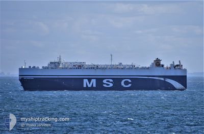
GOLD HOSHI
Vehicles Carrier
Current Trip
ILHFA TO CNSHG
| Time Travelled | 8 days |
|---|---|
| Remaining Time | --- |
| Distance Travelled | 3039.24 nm |
| Remaining Distance | --- |
| AVG Speed | 14.9 Knots |
| MAX Speed | 17.1 Knots |
| AVG Wind | 18.2 knots |
| MAX Wind | 30 knots |
| MIN Temp | 3.9°C / 39.02°F |
| MAX Temp | 29.3°C / 84.74°F |
| Draught | 9.3 m |
| Position Received | 12 d ago |
Current Position
| Longitude | --- |
|---|---|
| Latitude | --- |
| Status | Under way using engine |
| Speed | 13.1 Knots |
| Course | 215.5° |
| Area | Japan Sea |
| Station | T-AIS |
| Position Received | 12 d ago |
Info
Information
The current position of GOLD HOSHI is in Japan Sea with coordinates 34.81485° / 129.22279° as reported on 2024-11-30 05:24 by AIS to our vessel tracker app. The vessel's current speed is 13.1 Knots
The vessel GOLD HOSHI (IMO: 9453298, MMSI: 371715000) is a Vehicles Carrier that was built in 2011 ( 13 years old ). It's sailing under the flag of [PA] Panama.
In this page you can find informations about the vessels current position, last detected port calls, and current voyage information. If the vessels is not in coverage by AIS you will find the latest position.
The current position of GOLD HOSHI is detected by our AIS receivers and we are not responsible for the reliability of the data. The last position was recorded while the vessel was in Coverage by the Ais receivers of our vessel tracking app.
The current draught of GOLD HOSHI as reported by AIS is 9.3 meters
Weather
| Temperature | 27.9°C / 82.22°F |
|---|---|
| Wind Speed | 23 knots |
| Direction | 297° WNW |
| Pressure | 1005.7 hPa |
| Humidity | 79.9 % |
| Cloud Coverage | 100 % |
Featured Company
Last Port Calls
| Port | Arrival | Departure | Time In Port |
|---|---|---|---|
| 2024-12-03 01:44 | 2024-12-04 01:53 | 1 d | |
| 2024-11-29 08:06 | 2024-11-30 02:10 | 18 h | |
| 2024-11-27 21:20 | 2024-11-28 19:20 | 22 h | |
| 2024-10-13 03:39 | 2024-10-16 03:06 | 2 d |
Events
| Time | Event | Details | Position / Dest | Info |
|---|---|---|---|---|
| 2024-12-11 09:10 | START Moving |
.72599 / 108.12871
ILHFA TO CNSHG
|
Speed: 5.2 kn Course: 224° |
|
| 2024-12-11 08:10 | STOP Moving |
.74323 / 108.14530
ILHFA TO CNSHG
|
Speed: 0.1 kn Course: 305° |
|
| 2024-12-04 01:53 | PORT DEPARTURE |
|
37.02765 / 126.69728
ILHFA TO CNSHG
|
Speed: 15.2 kn Course: 327° |
| 2024-12-04 01:23 | START Moving |
36.98156 / 126.81993
[KR] PYEONGTAEK
|
Speed: 6.4 kn Course: 286° |
|
| 2024-12-03 03:08 | STOP Moving |
36.97596 / 126.82799
[KR] PYEONGTAEK
|
Speed: 0.2 kn Course: 334° |
|
| 2024-12-03 01:44 | PORT ARRIVAL |
|
37.00810 / 126.71160
[KR] PYEONGTAEK
|
Speed: 12.5 kn Course: 151° |