
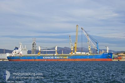
GLORY SEA
Bulk Carrier
Current Trip
| Time Travelled | 11 days |
|---|---|
| Remaining Time | 8 days |
| Distance Travelled | 2964.58 nm |
| Remaining Distance | 2273.55 nm |
| AVG Speed | 10.1 Knots |
| MAX Speed | 12.9 Knots |
| AVG Wind | 10.2 knots |
| MAX Wind | 23.2 knots |
| MIN Temp | 23.9°C / 75.02°F |
| MAX Temp | 29.1°C / 84.38°F |
| Draught | 13 m |
| Position Received | 4 d ago |
Current Position
| Longitude | --- |
|---|---|
| Latitude | --- |
| Status | Under way using engine |
| Speed | 12.6 Knots |
| Course | 279° |
| Area | Laccadive Sea |
| Station | T-AIS |
| Position Received | 4 d ago |
Info
Information
The current position of GLORY SEA is in Laccadive Sea with coordinates 5.83517° / 80.13312° as reported on 2025-02-27 13:07 by AIS to our vessel tracker app. The vessel's current speed is 12.6 Knots and is heading at the port of SUEZ CANAL. The estimated time of arrival as calculated by MyShipTracking vessel tracking app is 2025-03-12 21:12 LT
The vessel GLORY SEA (IMO: 9602980, MMSI: 477353500) is a Bulk Carrier that was built in 2011 ( 14 years old ). It's sailing under the flag of [HK] Hong Kong.
In this page you can find informations about the vessels current position, last detected port calls, and current voyage information. If the vessels is not in coverage by AIS you will find the latest position.
The current position of GLORY SEA is detected by our AIS receivers and we are not responsible for the reliability of the data. The last position was recorded while the vessel was in Coverage by the Ais receivers of our vessel tracking app.
The current draught of GLORY SEA as reported by AIS is 13 meters
Weather
| Temperature | 25.8°C / 78.44°F |
|---|---|
| Wind Speed | 16 knots |
| Direction | 52° NE |
| Pressure | 1014.6 hPa |
| Humidity | 75.7 % |
| Cloud Coverage | 10 % |
Featured Company
Last Port Calls
| Port | Arrival | Departure | Time In Port |
|---|---|---|---|
| 2025-02-13 12:23 | 2025-02-20 23:36 | 7 d | |
| 2025-02-05 14:40 | 2025-02-07 04:06 | 1 d | |
| 2025-01-17 14:39 | 2025-01-17 23:48 | 9 h | |
| 2025-01-09 19:35 | |||
| 2025-01-09 19:19 | |||
| 2025-01-09 16:09 | 2025-01-09 16:24 | 14 m | |
| 2025-01-07 08:22 | 2025-01-07 09:54 | 1 h | |
| 2025-01-07 04:59 | 2025-01-07 06:40 | 1 h | |
| 2025-01-07 02:23 | 2025-01-07 03:12 | 49 m | |
| 2025-01-06 14:21 | 2025-01-06 14:36 | 14 m |
Most Visited Ports (Last year)
| Port | Arrivals | |
|---|---|---|
| 8 | ||
| 4 | ||
| 2 | ||
| 1 | ||
| 1 | ||
| 1 |
Last Trips
| Origin | Departure | Destination | Arrival | Distance | |
|---|---|---|---|---|---|
| 2025-02-07 04:06 | 2025-02-13 12:23 | 1816.50 nm | |||
| 2025-01-09 19:19 | 2025-02-05 14:40 | 5986.19 nm | |||
| 2025-01-09 19:19 | 2025-01-17 14:39 | 1318.00 nm | |||
| 2025-01-09 16:24 | 2025-01-09 19:35 | 38.91 nm | |||
| 2025-01-07 09:54 | 2025-01-09 16:09 | 316.84 nm | |||
| 2025-01-07 06:40 | 2025-01-07 08:22 | 2.67 nm | |||
| 2025-01-07 03:12 | 2025-01-07 04:59 | 13.00 nm | |||
| 2025-01-06 14:36 | 2025-01-07 02:23 | 82.32 nm | |||
| 2025-01-05 20:53 | 2025-01-06 14:21 | 114.87 nm | |||
| 2024-12-28 10:36 | 2025-01-05 20:35 | 1531.66 nm |
Events
| Time | Event | Details | Position / Dest | Info |
|---|---|---|---|---|
| 2025-02-27 13:13 | Status Changed | Default Under way using engine |
5.83968 / 80.11128
SUEZ
|
Speed: 12.6 kn Course: 279° |
| 2025-02-27 13:07 | OUT of Coverage |
5.83517 / 80.13312
Laccadive Sea
SUEZ
|
Speed: 12.6 kn Course: 279° |
|
| 2025-02-27 12:04 | ETA Changed | 2025/03/12 22:00 2025/03/12 12:00 |
5.81520 / 80.35368
SUEZ
|
Speed: 12.5 kn Course: 270° |
| 2025-02-27 11:46 | Change Sea Area | Sri Lankan part of the Laccadive Sea Malaysian part of the Malacca Strait |
5.81458 / 80.41375
Laccadive Sea
SUEZ
|
Speed: 12.3 kn Course: 270° |
| 2025-02-27 11:44 | Status Changed | Under way using engine Default |
5.81455 / 80.42283
SUEZ
|
Speed: 12.4 kn Course: 268° |
| 2025-02-27 11:44 | IN Coverage |
5.81458 / 80.41375
Laccadive Sea
SUEZ
|
Speed: 12.3 kn Course: 270° |