
GLORY SEA
Bulk Carrier
Current Trip
| Time Travelled | 9 days |
|---|---|
| Remaining Time | --- |
| Distance Travelled | 2760.69 nm |
| Remaining Distance | --- |
| AVG Speed | 12.2 Knop |
| MAX Speed | 15.3 Knop |
| AVG Wind | 12.4 knots |
| MAX Wind | 27.9 knots |
| MIN Temp | 11.5°C / 52.7°F |
| MAX Temp | 20.1°C / 68.18°F |
| Djupgående | 6.3 m |
| Position mottagen | 1 m sen |
Current Position
| Longitud | -6.20542° |
|---|---|
| Latitude | 47.87490° |
| Status | Under way using engine |
| Fart | 1.9 Knop |
| Kurs | 344° |
| Område | Celtic Sea |
| Station | T-AIS |
| Position mottagen | 1 m sen |
Info
Information
The current position of GLORY SEA is in Celtic Sea with coordinates 47.87490° / -6.20542° as reported on 2024-05-08 19:51 by AIS to our vessel tracker app. The vessel's current speed is 1.9 Knop and is heading at the port of TALLINN OLD HARBOR. The estimated time of arrival as calculated by MyShipTracking vessel tracking app is 2024-05-15 11:00 LT
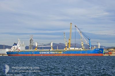
The vessel GLORY SEA (IMO: 9602980, MMSI: 477353500) is a Bulk Carrier that was built in 2011 ( 13 År gammal ). It's sailing under the flag of [HK] Hong Kong.
In this page you can find informations about the vessels current position, last detected port calls, and current voyage information. If the vessels is not in coverage by AIS you will find the latest position.
The current position of GLORY SEA is detected by our AIS receivers and we are not responsible for the reliability of the data. The last position was recorded while the vessel was in Coverage by the Ais receivers of our vessel tracking app.
The current draught of GLORY SEA as reported by AIS is 6.3 meters
Weather
| Temperature | 14°C / 57.2°F |
|---|---|
| Wind Speed | 9 knots |
| Direction | 93° E |
| Pressure | 1026.7 hPa |
| Humidity | 80.3 % |
| Cloud Coverage | 30 % |
Featured Company
Last Port Calls
| Port | Arrival | Departure | Time In Port |
|---|---|---|---|
| 2024-04-24 06:16 | 2024-04-29 09:38 | 5 d | |
| 2024-04-11 05:39 | 2024-04-11 15:01 | 9 h | |
| 2024-03-30 05:22 | 2024-04-07 06:46 | 8 d |
Most Visited Ports (Last year)
| Port | Arrivals | |
|---|---|---|
| 4 | ||
| 2 | ||
| 1 | ||
| 1 | ||
| 1 | ||
| 1 |
Last Trips
| Origin | Departure | Destination | Arrival | Distance | |
|---|---|---|---|---|---|
| 2024-04-07 09:46 | 2024-04-24 09:16 | 1985.27 nm | |||
| 2024-04-07 09:46 | 2024-04-11 07:39 | 971.07 nm | |||
| 2024-02-14 21:19 | 2024-03-30 08:22 | 6939.45 nm |
Events
| Tid | Event | Detaljer | Position / Dest | Information |
|---|---|---|---|---|
| 2024-05-08 17:50 | Status ändrad | Under way using engine Not under command |
47.91652 / -6.19297
EE TLL
|
Fart: 0.6 kn Kurs: 10° |
| 2024-05-08 17:06 | Status ändrad | Not under command Default |
47.91497 / -6.21030
EE TLL
|
Fart: 1.3 kn Kurs: 36° |
| 2024-05-08 17:02 | Status ändrad | Default Not under command |
47.91553 / -6.20868
EE TLL
|
Fart: 1.7 kn Kurs: 51° |
| 2024-05-08 16:24 | Status ändrad | Not under command Under way using engine |
47.90040 / -6.25590
EE TLL
|
Fart: 7.7 kn Kurs: 52° |
| 2024-05-08 12:14 | Byter havsområde | French part of the Celtic Sea French part of the North Atlantic Ocean |
47.07968 / -6.93175
Celtic Sea
EE TLL
|
Fart: 13 kn Kurs: 24° |
| 2024-05-08 06:33 | Status ändrad | Under way using engine Default |
46.03450 / -7.71422
EE TLL
|
Fart: 12.3 kn Kurs: 25° |
| 2024-05-08 06:06 | Status ändrad | Default Under way using engine |
45.97367 / -7.75737
EE TLL
|
Fart: 12.2 kn Kurs: 30° |
| 2024-05-08 04:42 | Byter havsområde | French part of the North Atlantic Ocean Spanish part of the North Atlantic Ocean |
45.70002 / -7.97355
North Atlantic Ocean
EE TLL
|
Fart: 12.7 kn Kurs: 29° |
| 2024-05-08 00:34 | Status ändrad | Under way using engine Default |
44.94783 / -8.55418
EE TLL
|
Fart: 12.6 kn Kurs: 33° |
| 2024-05-08 00:16 | Status ändrad | Default Under way using engine |
44.91580 / -8.58375
EE TLL
|
Fart: 12.1 kn Kurs: 29° |