
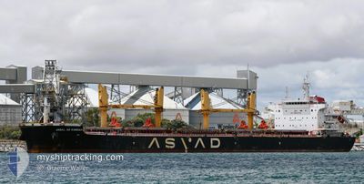
JABAL AR RAWDAH
Cargo
Current Trip
| Trip Time | 19 days |
|---|---|
| Trip Distance | 5221.74 nm |
| AVG Speed | 11.9 Knots |
| MAX Speed | 17.4 Knots |
| Draught | 10.3 m |
| AVG Wind | 12.1 knots |
| MAX Wind | 28 knots |
| MIN Temp | 6.1°C / 42.98°F |
| MAX Temp | 30.1°C / 86.18°F |
| Position Received | 4 d ago |
Current Position
| Longitude | -93.30370° |
|---|---|
| Latitude | 20.93860° |
| Status | Under way using engine |
| Speed | 12.5 Knots |
| Course | 239.6° |
| Area | Gulf of Mexico |
| Station | T-AIS |
| Position Received | 4 d ago |
Info
Information
The current position of JABAL AR RAWDAH is in Gulf of Mexico with coordinates 20.93860° / -93.30370° as reported on 2024-05-10 02:56 by AIS to our vessel tracker app. The vessel's current speed is 12.5 Knots and is currently inside the port of VERACRUZ.
The vessel JABAL AR RAWDAH (IMO: 9722041, MMSI: 538007195) is a Cargo It's sailing under the flag of [MH] Marshall Is.
In this page you can find informations about the vessels current position, last detected port calls, and current voyage information. If the vessels is not in coverage by AIS you will find the latest position.
The current position of JABAL AR RAWDAH is detected by our AIS receivers and we are not responsible for the reliability of the data. The last position was recorded while the vessel was in Coverage by the Ais receivers of our vessel tracking app.
The current draught of JABAL AR RAWDAH as reported by AIS is 10.3 meters
Weather
| Temperature | 27.5°C / 81.5°F |
|---|---|
| Wind Speed | 7 knots |
| Direction | 183° S |
| Pressure | 1001.9 hPa |
| Humidity | 64.1 % |
| Cloud Coverage | 77 % |
Featured Company
Events
| Time | Event | Details | Position / Dest | Info |
|---|---|---|---|---|
| 2024-05-12 11:19 | STOP Moving |
19.20500 / -96.13500
[MX] VERACRUZ
|
Speed: Course: -1° |
|
| 2024-05-12 10:58 | PORT ARRIVAL |
|
19.20333 / -96.12666
[MX] VERACRUZ
|
Speed: 10.7 kn Course: 292° |
| 2024-05-12 10:07 | START Moving | 6.1 nm, East of VERACRUZ |
19.17167 / -96.02333
MX VER
|
Speed: 4 kn Course: -1° |
| 2024-05-10 18:12 | STOP Moving | 6.69 nm, North East of BOCA DEL RIO |
19.16830 / -96.01036
MX VER
|
Speed: 0.2 kn Course: 185° |
| 2024-05-10 03:02 | Status Changed | Default Under way using engine |
20.92766 / -93.32354
MX VER
|
Speed: 12.5 kn Course: 239.6° |
| 2024-05-10 02:56 | OUT of Coverage |
20.93860 / -93.30370
Gulf of Mexico
|
Speed: 12.5 kn Course: 239.6° |
|
| 2024-05-10 02:29 | Status Changed | Under way using engine Default |
20.98911 / -93.21614
MX VER
|
Speed: 12.6 kn Course: 241° |
| 2024-05-10 02:22 | Status Changed | Default Under way using engine |
20.99966 / -93.19605
MX VER
|
Speed: 12.6 kn Course: 241.9° |
| 2024-05-10 02:12 | Status Changed | Under way using engine Default |
21.01662 / -93.16334
MX VER
|
Speed: 12.7 kn Course: 242° |
| 2024-05-10 02:12 | IN Coverage |
21.01662 / -93.16334
Gulf of Mexico
|
Speed: 12.6 kn Course: 241.2° |