
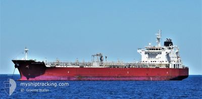
GEM TURQUOISE
Tanker
Current Trip
| Time Travelled | 13 days |
|---|---|
| Remaining Time | --- |
| Distance Travelled | 3657.04 nm |
| Remaining Distance | --- |
| AVG Speed | 12 Knots |
| MAX Speed | 15.1 Knots |
| AVG Wind | 11.8 knots |
| MAX Wind | 22 knots |
| MIN Temp | 13.9°C / 57.02°F |
| MAX Temp | 28.9°C / 84.02°F |
| Draught | 8 m |
| Position Received | 15 h, 47 m ago |
Current Position
| Longitude | --- |
|---|---|
| Latitude | --- |
| Status | Under way using engine |
| Speed | |
| Course | 71° |
| Area | Singapore Strait |
| Station | T-AIS |
| Position Received | 15 h, 47 m ago |
Info
Information
The current position of GEM TURQUOISE is in Singapore Strait with coordinates 1.27863° / 103.64830° as reported on 2025-12-08 16:35 by AIS to our vessel tracker app. The vessel's current speed is 0 Knots
The vessel GEM TURQUOISE (IMO: 9645774, MMSI: 538005119) is a Tanker It's sailing under the flag of [MH] Marshall Is.
In this page you can find informations about the vessels current position, last detected port calls, and current voyage information. If the vessels is not in coverage by AIS you will find the latest position.
The current position of GEM TURQUOISE is detected by our AIS receivers and we are not responsible for the reliability of the data. The last position was recorded while the vessel was in Coverage by the Ais receivers of our vessel tracking app.
The current draught of GEM TURQUOISE as reported by AIS is 8 meters
Weather
| Temperature | 29.6°C / 85.28°F |
|---|---|
| Wind Speed | 10 knots |
| Direction | 15° NNE |
| Pressure | 1006.7 hPa |
| Humidity | 64 % |
| Cloud Coverage | 91 % |
Featured Company
Last Port Calls
| Port | Arrival | Departure | Time In Port |
|---|---|---|---|
| 2025-11-24 06:28 | 2025-11-26 09:04 | 2 d | |
| 2025-11-09 07:17 | 2025-11-10 18:26 | 1 d | |
| 2025-11-07 19:24 | 2025-11-09 05:50 | 1 d | |
| 2025-10-24 16:09 | 2025-10-26 11:42 | 1 d | |
| 2025-10-15 08:32 | 2025-10-17 20:00 | 2 d |
Last Trips
| Origin | Departure | Destination | Arrival | Distance | |
|---|---|---|---|---|---|
| 2025-11-10 18:26 | 2025-11-24 06:28 | 3678.37 nm | |||
| 2025-11-09 05:50 | 2025-11-09 07:17 | 7.17 nm | |||
| 2025-10-26 11:42 | 2025-11-07 19:24 | 894.69 nm | |||
| 2025-10-17 20:00 | 2025-10-24 16:09 | 2024.92 nm | |||
| 2025-09-23 17:14 | 2025-10-15 08:32 | 4608.94 nm |
Events
| Time | Event | Details | Position / Dest | Info |
|---|---|---|---|---|
| 2025-12-08 16:39 | Status Changed | Default Under way using engine |
1.27862 / 103.64829
SG SIN
|
Speed: Course: 71° |
| 2025-12-08 16:35 | OUT of Coverage |
1.27863 / 103.64830
Singapore Strait
|
Speed: Course: 35.2° |
|
| 2025-12-08 16:31 | STOP Moving | 2.67 nm, North West of JURONG ISLAND |
1.27862 / 103.64825
SG SIN
|
Speed: 0.1 kn Course: 73° |
| 2025-12-08 15:13 | START Moving | 4.34 nm, South West of BUKOM ISLAND |
1.17554 / 103.71410
SG SIN
|
Speed: 3.3 kn Course: 321° |
| 2025-12-08 15:07 | Status Changed | Under way using engine At anchor |
1.17294 / 103.71528
SG SIN
|
Speed: 0.4 kn Course: 343° |
| 2025-12-08 14:00 | Status Changed | At anchor Default |
1.17124 / 103.71548
SG SIN
|
Speed: Course: 322° |
| 2025-12-08 13:57 | Status Changed | Default At anchor |
1.17119 / 103.71543
SG SIN
|
Speed: 0.1 kn Course: 326° |
| 2025-12-08 13:18 | Status Changed | At anchor Default |
1.17143 / 103.71552
SG SIN
|
Speed: 0.1 kn Course: 308° |
| 2025-12-08 13:15 | Status Changed | Default At anchor |
1.17164 / 103.71554
SG SIN
|
Speed: Course: 312° |
| 2025-12-08 13:06 | Status Changed | At anchor Default |
1.17160 / 103.71563
SG SIN
|
Speed: 0.1 kn Course: 317° |