
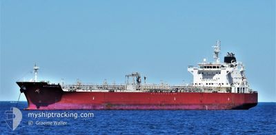
GEM TURQUOISE
Tanker
Current Trip
| Time Travelled | 11 days |
|---|---|
| Remaining Time | 1 h, 30 mins |
| Distance Travelled | 3625.37 nm |
| Remaining Distance | 13.72 nm |
| AVG Speed | 12.7 Knopen |
| MAX Speed | 15.1 Knopen |
| AVG Wind | 12 knots |
| MAX Wind | 22 knots |
| MIN Temp | 13.9°C / 57.02°F |
| MAX Temp | 28.9°C / 84.02°F |
| Diepgang | 8 M |
| Positie ontvangen | Nu |
Current Position
| Lengtegraad | --- |
|---|---|
| Breedtegraat | --- |
| Status | Under way using engine |
| Snelheid | 8.1 Knopen |
| Koers | 260.2° |
| Gebied | Singapore Strait |
| Station | T-AIS |
| Positie ontvangen | Nu |
Info
Information
The current position of GEM TURQUOISE is in Singapore Strait with coordinates 1.26664° / 104.03695° as reported on 2025-12-07 19:24 by AIS to our vessel tracker app. The vessel's current speed is 8.1 Knopen and is heading at the port of SINGAPORE. The estimated time of arrival as calculated by MyShipTracking vessel tracking app is 2025-12-08 04:55 LT
The vessel GEM TURQUOISE (IMO: 9645774, MMSI: 538005119) is a Tanker It's sailing under the flag of [MH] Marshall Is.
In this page you can find informations about the vessels current position, last detected port calls, and current voyage information. If the vessels is not in coverage by AIS you will find the latest position.
The current position of GEM TURQUOISE is detected by our AIS receivers and we are not responsible for the reliability of the data. The last position was recorded while the vessel was in Coverage by the Ais receivers of our vessel tracking app.
The current draught of GEM TURQUOISE as reported by AIS is 8 meters
Weather
| Temperature | 26.3°C / 79.34°F |
|---|---|
| Wind Speed | 13 knots |
| Direction | 359° N |
| Pressure | 1009.5 hPa |
| Humidity | 78.9 % |
| Cloud Coverage | 100 % |
Featured Company
Last Port Calls
| Port | Arrival | Departure | Time In Port |
|---|---|---|---|
| 2025-11-24 06:28 | 2025-11-26 09:04 | 2 d | |
| 2025-11-09 07:17 | 2025-11-10 18:26 | 1 d | |
| 2025-11-07 19:24 | 2025-11-09 05:50 | 1 d | |
| 2025-10-24 16:09 | 2025-10-26 11:42 | 1 d | |
| 2025-10-15 08:32 | 2025-10-17 20:00 | 2 d |
Last Trips
| Origin | Departure | Destination | Arrival | Distance | |
|---|---|---|---|---|---|
| 2025-11-10 18:26 | 2025-11-24 06:28 | 3678.37 nm | |||
| 2025-11-09 05:50 | 2025-11-09 07:17 | 7.17 nm | |||
| 2025-10-26 11:42 | 2025-11-07 19:24 | 894.69 nm | |||
| 2025-10-17 20:00 | 2025-10-24 16:09 | 2024.92 nm | |||
| 2025-09-23 17:14 | 2025-10-15 08:32 | 4608.94 nm |
Events
| Tijd | Evenement | Details | Positie / Bestemming | Info |
|---|---|---|---|---|
| 2025-12-07 19:13 | Wijzig zee gebeid | Indonesian part of the Singapore Strait Malaysian part of the Singapore Strait |
1.27137 / 104.06122
Singapore Strait
SG SIN
|
Snelheid: 8.2 kn Koers: 262.3° |
| 2025-12-07 17:48 | ETA Changed | 2025/12/07 21:30 2025/12/07 22:00 |
1.30142 / 104.25406
SG SIN
|
Snelheid: 7.7 kn Koers: 254.7° |
| 2025-12-07 17:44 | Status Changed | Under way using engine Default |
1.30225 / 104.26255
SG SIN
|
Snelheid: 8.7 kn Koers: 269° |
| 2025-12-07 17:41 | Status Changed | Default Under way using engine |
1.30232 / 104.27026
SG SIN
|
Snelheid: 9.3 kn Koers: 258.1° |
| 2025-12-07 17:16 | Wijzig zee gebeid | Malaysian part of the Singapore Strait Malaysian part of the South China Sea |
1.32446 / 104.32969
Singapore Strait
SG SIN
|
Snelheid: 9.7 kn Koers: 234° |
| 2025-12-07 17:01 | Status Changed | Under way using engine Default |
1.35024 / 104.36176
SG SIN
|
Snelheid: 9.7 kn Koers: 230° |
| 2025-12-07 16:53 | Status Changed | Default Under way using engine |
1.36428 / 104.37805
SG SIN
|
Snelheid: 10.5 kn Koers: 232.3° |
| 2025-12-07 16:47 | Status Changed | Under way using engine Default |
1.37481 / 104.39103
SG SIN
|
Snelheid: 9.7 kn Koers: 238° |
| 2025-12-07 16:45 | Status Changed | Default Under way using engine |
1.37854 / 104.39616
SG SIN
|
Snelheid: 8.9 kn Koers: 229.8° |
| 2025-12-07 16:38 | Status Changed | Under way using engine Default |
1.38895 / 104.41061
SG SIN
|
Snelheid: 9.6 kn Koers: 232° |