
FLORIDA HIGHWAY
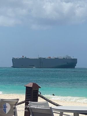
Vehicles Carrier
Current Trip
| Time Travelled | 15 days |
|---|---|
| Remaining Time | --- |
| Distance Travelled | 5422.88 nm |
| Remaining Distance | --- |
| AVG Speed | 14.7 Knots |
| MAX Speed | 14.7 Knots |
| AVG Wind | 11.8 knots |
| MAX Wind | 32 knots |
| MIN Temp | 19.3°C / 66.74°F |
| MAX Temp | 28.7°C / 83.66°F |
| Draught | 8 m |
| Position Received | 4 d ago |
Current Position
| Longitude | --- |
|---|---|
| Latitude | --- |
| Status | Under way using engine |
| Speed | 14.4 Knots |
| Course | 76° |
| Area | Singapore Strait |
| Station | T-AIS |
| Position Received | 4 d ago |
Info
Information
The current position of FLORIDA HIGHWAY is in Singapore Strait with coordinates 1.29353° / 104.32437° as reported on 2026-01-04 16:03 by AIS to our vessel tracker app. The vessel's current speed is 14.4 Knots and is heading at the port of ZHOUSHAN. The estimated time of arrival as calculated by MyShipTracking vessel tracking app is 2026-01-03 19:00 LT
The vessel FLORIDA HIGHWAY (IMO: 9442861, MMSI: 372805000) is a Vehicles Carrier that was built in 2008 ( 18 years old ). It's sailing under the flag of [PA] Panama.
In this page you can find informations about the vessels current position, last detected port calls, and current voyage information. If the vessels is not in coverage by AIS you will find the latest position.
The current position of FLORIDA HIGHWAY is detected by our AIS receivers and we are not responsible for the reliability of the data. The last position was recorded while the vessel was in Coverage by the Ais receivers of our vessel tracking app.
The current draught of FLORIDA HIGHWAY as reported by AIS is 8 meters
Weather
| Temperature | 21.6°C / 70.88°F |
|---|---|
| Wind Speed | 27 knots |
| Direction | 54° NE |
| Pressure | 1016.8 hPa |
| Humidity | 74.6 % |
| Cloud Coverage | 100 % |
Featured Company
Last Port Calls
| Port | Arrival | Departure | Time In Port |
|---|---|---|---|
| 2025-12-24 05:04 | 2025-12-24 21:52 | 16 h | |
| 2025-12-20 09:34 | 2025-12-22 20:30 | 2 d | |
| 2025-12-17 23:58 | 2025-12-18 14:42 | 14 h | |
| 2025-12-09 21:13 | 2025-12-10 15:42 | 18 h | |
| 2025-12-07 22:36 | 2025-12-08 08:41 | 10 h | |
| 2025-12-06 17:17 | 2025-12-07 06:13 | 12 h | |
| 2025-11-29 06:20 | 2025-11-29 18:00 | 11 h | |
| 2025-11-24 10:32 | 2025-11-25 18:17 | 1 d |
Most Visited Ports (Last year)
| Port | Arrivals | |
|---|---|---|
| 11 | ||
| 9 | ||
| 8 | ||
| 8 | ||
| 7 | ||
| 3 |
Last Trips
| Origin | Departure | Destination | Arrival | Distance | |
|---|---|---|---|---|---|
| 2025-12-22 20:30 | 2025-12-24 05:04 | 103.41 nm | |||
| 2025-12-18 14:42 | 2025-12-20 09:34 | 308.00 nm | |||
| 2025-12-10 15:42 | 2025-12-17 23:58 | 3318.20 nm | |||
| 2025-12-08 08:41 | 2025-12-09 21:13 | 225.47 nm | |||
| 2025-12-07 06:13 | 2025-12-07 22:36 | 26.71 nm | |||
| 2025-11-29 18:00 | 2025-12-06 17:17 | 2555.02 nm | |||
| 2025-11-25 18:17 | 2025-11-29 06:20 | 924.03 nm | |||
| 2025-10-26 20:50 | 2025-11-24 10:32 | 10101.71 nm |
Events
| Time | Event | Details | Position / Dest | Info |
|---|---|---|---|---|
| 2026-01-04 16:09 | Status Changed | Default Under way using engine |
1.30418 / 104.34463
SGSIN>>CNZOS
|
Speed: 14.4 kn Course: 76° |
| 2026-01-04 16:03 | OUT of Coverage |
1.29353 / 104.32437
Singapore Strait
|
Speed: 14.4 kn Course: 76° |
|
| 2026-01-04 15:57 | Status Changed | Under way using engine Default |
1.28798 / 104.30370
SGSIN>>CNZOS
|
Speed: 14 kn Course: 74° |
| 2026-01-04 15:57 | Status Changed | Default Under way using engine |
1.28712 / 104.30064
SGSIN>>CNZOS
|
Speed: 13.6 kn Course: 73° |
| 2026-01-04 15:51 | Status Changed | Under way using engine Default |
1.28107 / 104.27985
SGSIN>>CNZOS
|
Speed: 13.6 kn Course: 75° |
| 2026-01-04 15:41 | Status Changed | Default Under way using engine |
1.27267 / 104.24194
SGSIN>>CNZOS
|
Speed: 12.7 kn Course: 80° |
| 2026-01-04 15:11 | Change Sea Area | Malaysian part of the Singapore Strait Indonesian part of the Singapore Strait |
1.26420 / 104.13917
Singapore Strait
|
Speed: 11.8 kn Course: 89° |
| 2026-01-04 14:25 | Change Sea Area | Indonesian part of the Singapore Strait Singaporean part of the Singapore Strait |
1.25612 / 104.01283
Singapore Strait
|
Speed: 10 kn Course: 150° |
| 2026-01-04 14:05 | Destination Changed | SGSIN>>CNZOS PKKHI > SGSIN |
1.28642 / 103.98957
SGSIN>>CNZOS
|
Speed: 5.3 kn Course: 95° |
| 2026-01-04 14:01 | START Moving | 2.51 nm, South West of TANAH MERAH |
1.28688 / 103.98447
PKKHI > SGSIN
|
Speed: 3.1 kn Course: 85° |