
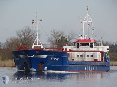
FERRO
General Cargo
Current Trip
| Time Travelled | 5 days |
|---|---|
| Remaining Time | 3 days |
| Distance Travelled | 515.42 nm |
| Remaining Distance | 805.48 nm |
| AVG Speed | 9 Knots |
| MAX Speed | 10.8 Knots |
| AVG Wind | 12.4 knots |
| MAX Wind | 26 knots |
| MIN Temp | 12.7°C / 54.86°F |
| MAX Temp | 17.2°C / 62.96°F |
| Draught | 4.9 m |
| Position Received | 11 h, 3 m ago |
Current Position
| Longitude | -9.78195° |
|---|---|
| Latitude | 41.70658° |
| Status | Under way using engine |
| Speed | 9.7 Knots |
| Course | 0.2° |
| Area | North Atlantic Ocean |
| Station | T-AIS |
| Position Received | 11 h, 3 m ago |
Info
Information
The current position of FERRO is in North Atlantic Ocean with coordinates 41.70658° / -9.78195° as reported on 2024-05-04 08:51 by AIS to our vessel tracker app. The vessel's current speed is 9.7 Knots and is heading at the port of TERNEUZEN. The estimated time of arrival as calculated by MyShipTracking vessel tracking app is 2024-05-08 07:13 LT
The vessel FERRO (IMO: 9005730, MMSI: 314415000) is a General Cargo that was built in 1991 ( 33 years old ). It's sailing under the flag of [BB] Barbados.
In this page you can find informations about the vessels current position, last detected port calls, and current voyage information. If the vessels is not in coverage by AIS you will find the latest position.
The current position of FERRO is detected by our AIS receivers and we are not responsible for the reliability of the data. The last position was recorded while the vessel was in Coverage by the Ais receivers of our vessel tracking app.
The current draught of FERRO as reported by AIS is 4.9 meters
Weather
| Temperature | 14.4°C / 57.92°F |
|---|---|
| Wind Speed | 19 knots |
| Direction | 224° SW |
| Pressure | 1012.4 hPa |
| Humidity | 93.1 % |
| Cloud Coverage | 35 % |
Featured Company
Last Port Calls
| Port | Arrival | Departure | Time In Port |
|---|---|---|---|
| 2024-04-29 07:22 | 2024-04-29 08:08 | 45 m | |
| 2024-04-25 06:03 | 2024-04-26 11:40 | 1 d | |
| 2024-04-22 17:53 | 2024-04-23 20:03 | 1 d | |
| 2024-04-17 23:39 | 2024-04-21 04:59 | 3 d | |
| 2024-04-09 22:03 | 2024-04-11 09:56 | 1 d | |
| 2024-04-07 13:01 | 2024-04-09 11:38 | 1 d | |
| 2024-03-30 15:59 | 2024-04-03 03:56 | 3 d | |
| 2024-03-26 19:48 | 2024-03-27 18:04 | 22 h | |
| 2024-03-22 21:18 | 2024-03-25 18:53 | 2 d | |
| 2024-03-20 13:31 | 2024-03-21 19:40 | 1 d |
Last Trips
| Origin | Departure | Destination | Arrival | Distance | |
|---|---|---|---|---|---|
| 2024-04-26 13:40 | 2024-04-29 09:22 | 513.22 nm | |||
| 2024-04-23 21:03 | 2024-04-25 08:03 | 319.80 nm | |||
| 2024-04-21 06:59 | 2024-04-22 18:53 | 295.51 nm | |||
| 2024-04-11 10:56 | 2024-04-18 01:39 | 1324.98 nm | |||
| 2024-04-09 12:38 | 2024-04-09 23:03 | 96.65 nm | |||
| 2024-04-03 05:56 | 2024-04-07 14:01 | 878.66 nm | |||
| 2024-03-27 19:04 | 2024-03-30 16:59 | 331.03 nm | |||
| 2024-03-25 18:53 | 2024-03-26 20:48 | 201.23 nm | |||
| 2024-03-21 20:40 | 2024-03-22 21:18 | 229.95 nm | |||
| 2024-03-18 14:38 | 2024-03-20 14:31 | 118.93 nm |
Events
| Time | Event | Details | Position / Dest | Info |
|---|---|---|---|---|
| 2024-05-04 09:48 | Status Changed | Default Under way using engine |
41.90689 / -9.78039
NLTNZ
|
Speed: 9.7 kn Course: 0.2° |
| 2024-05-04 08:51 | OUT of Coverage |
41.70658 / -9.78196
North Atlantic Ocean
NLTNZ
|
Speed: 9.7 kn Course: 0.2° |
|
| 2024-05-04 08:09 | IN Coverage |
41.62774 / -9.78392
North Atlantic Ocean
NLTNZ
|
Speed: 9.3 kn Course: 3.4° |
|
| 2024-05-04 07:07 | OUT of Coverage |
41.42738 / -9.79105
North Atlantic Ocean
NLTNZ
|
Speed: 9.1 kn Course: 0° |
|
| 2024-05-04 07:07 | IN Coverage |
41.42738 / -9.79105
North Atlantic Ocean
NLTNZ
|
Speed: 9.1 kn Course: 0° |
|
| 2024-05-04 06:05 | OUT of Coverage |
41.26987 / -9.79010
North Atlantic Ocean
NLTNZ
|
Speed: 9.4 kn Course: 359.4° |
|
| 2024-05-04 05:24 | Status Changed | Under way using engine Default |
41.19167 / -9.78683
NLTNZ
|
Speed: 9.2 kn Course: 357° |
| 2024-05-04 05:24 | IN Coverage |
41.19167 / -9.78683
North Atlantic Ocean
NLTNZ
|
Speed: 9.2 kn Course: 357.2° |
|
| 2024-05-04 03:31 | OUT of Coverage |
40.90237 / -9.77963
North Atlantic Ocean
NLTNZ
|
Speed: 9.5 kn Course: 1.8° |
|
| 2024-05-04 01:35 | Status Changed | Under way using engine Default |
40.53518 / -9.78267
NLTNZ
|
Speed: 9.7 kn Course: 359° |