
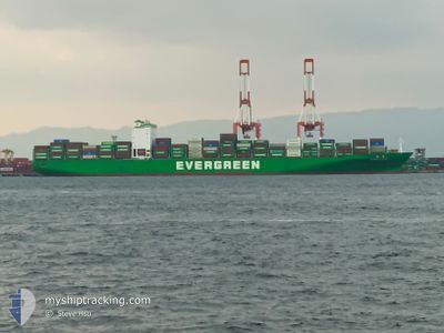
EVER LOYAL
Container Ship
Current Trip
TWKHH=>CNSHA
| Time Travelled | 18 h, 22 mins |
|---|---|
| Remaining Time | --- |
| Distance Travelled | 292.16 nm |
| Remaining Distance | --- |
| AVG Speed | 16.2 Knots |
| MAX Speed | 17.3 Knots |
| AVG Wind | 5.3 knots |
| MAX Wind | 9 knots |
| MIN Temp | 14.4°C / 57.92°F |
| MAX Temp | 17.6°C / 63.68°F |
| Draught | 12.8 m |
| Position Received | 12 d ago |
Current Position
| Longitude | --- |
|---|---|
| Latitude | --- |
| Status | Under way using engine |
| Speed | 2.6 Knots |
| Course | 177° |
| Area | North Pacific Ocean |
| Station | T-AIS |
| Position Received | 12 d ago |
Info
Information
The current position of EVER LOYAL is in North Pacific Ocean with coordinates 8.95848° / -79.57161° as reported on 2025-11-27 13:41 by AIS to our vessel tracker app. The vessel's current speed is 2.6 Knots
The vessel EVER LOYAL (IMO: 9604158, MMSI: 416495000) is a Container Ship that was built in 2014 ( 11 years old ). It's sailing under the flag of [TW] Taiwan.
In this page you can find informations about the vessels current position, last detected port calls, and current voyage information. If the vessels is not in coverage by AIS you will find the latest position.
The current position of EVER LOYAL is detected by our AIS receivers and we are not responsible for the reliability of the data. The last position was recorded while the vessel was in Coverage by the Ais receivers of our vessel tracking app.
The current draught of EVER LOYAL as reported by AIS is 12.8 meters
Weather
| Temperature | 17.7°C / 63.86°F |
|---|---|
| Wind Speed | 8 knots |
| Direction | 246° WSW |
| Pressure | 1014 hPa |
| Humidity | 70.9 % |
| Cloud Coverage | 100 % |
Featured Company
Last Port Calls
| Port | Arrival | Departure | Time In Port |
|---|---|---|---|
| 2025-12-08 05:28 | 2025-12-09 02:05 | 20 h | |
| 2025-12-03 07:46 | 2025-12-04 16:06 | 1 d | |
| 2025-11-26 02:58 | 2025-11-27 08:55 | 1 d | |
| 2025-11-17 09:11 | 2025-11-19 22:58 | 2 d | |
| 2025-10-27 00:00 | 2025-10-27 22:28 | 22 h | |
| 2025-10-23 23:13 | 2025-10-24 20:00 | 20 h | |
| 2025-10-21 21:52 | 2025-10-22 23:28 | 1 d | |
| 2025-10-20 16:18 | 2025-10-21 16:41 | 1 d | |
| 2025-10-16 03:54 | 2025-10-16 18:40 | 14 h | |
| 2025-10-07 04:47 | 2025-10-08 11:02 | 1 d |
Most Visited Ports (Last year)
| Port | Arrivals | |
|---|---|---|
| 5 | ||
| 5 | ||
| 4 | ||
| 4 | ||
| 3 | ||
| 3 |
Last Trips
| Origin | Departure | Destination | Arrival | Distance | |
|---|---|---|---|---|---|
| 2025-12-04 16:06 | 2025-12-08 05:28 | 1306.49 nm | |||
| 2025-11-27 08:55 | 2025-12-03 07:46 | 1542.75 nm | |||
| 2025-11-19 22:58 | 2025-11-26 02:58 | 1781.89 nm | |||
| 2025-10-27 22:28 | 2025-11-17 09:11 | 7116.73 nm | |||
| 2025-10-24 20:00 | 2025-10-27 00:00 | 598.57 nm | |||
| 2025-10-22 23:28 | 2025-10-23 23:13 | 355.11 nm | |||
| 2025-10-21 16:41 | 2025-10-21 21:52 | 59.09 nm | |||
| 2025-10-16 18:40 | 2025-10-20 16:18 | 1675.09 nm | |||
| 2025-10-08 11:02 | 2025-10-16 03:54 | 3358.92 nm | |||
| 2025-10-02 18:04 | 2025-10-07 04:47 | 611.86 nm |
Events
| Time | Event | Details | Position / Dest | Info |
|---|---|---|---|---|
| 2025-12-09 05:05 | START Moving | 0.6 nm, North East of VALPARAISO |
-33.02664 / -71.60963
TWKHH=>CNSHA
|
Speed: 5.8 kn Course: 30° |
| 2025-12-09 05:05 | PORT DEPARTURE |
|
-33.02664 / -71.60963
TWKHH=>CNSHA
|
Speed: 2.4 kn Course: 45° |
| 2025-12-08 08:38 | STOP Moving |
-33.03075 / -71.62655
[CL] VALPARAISO
|
Speed: 0.3 kn Course: 347° |
|
| 2025-12-08 08:28 | PORT ARRIVAL |
|
-33.03371 / -71.62234
[CL] VALPARAISO
|
Speed: 4.5 kn Course: 237° |
| 2025-12-04 21:06 | PORT DEPARTURE |
|
-12.04614 / -77.16539
TWKHH=>CNSHA
|
Speed: 3.3 kn Course: 279° |
| 2025-12-04 20:58 | START Moving |
-12.04767 / -77.15591
[PE] CALLAO
|
Speed: 3.3 kn Course: 279° |
|
| 2025-12-03 13:02 | STOP Moving |
-12.05053 / -77.15228
[PE] CALLAO
|
Speed: 0.3 kn Course: 312° |
|
| 2025-12-03 12:46 | PORT ARRIVAL |
|
-12.04779 / -77.15235
[PE] CALLAO
|
Speed: 5.5 kn Course: 99° |
| 2025-12-03 12:10 | START Moving | 2.61 nm, West of CALLAO |
-12.04708 / -77.19893
TWKHH=>CNSHA
|
Speed: 5.9 kn Course: 81° |
| 2025-12-03 11:46 | STOP Moving | 2.86 nm, West of CALLAO |
-12.04804 / -77.20332
TWKHH=>CNSHA
|
Speed: 0.3 kn Course: 41° |