
EVER LAUREL
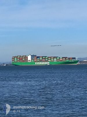
Container Ship
Current Trip
| Trip Time | 13 days |
|---|---|
| Trip Distance | 3429.96 nm |
| AVG Speed | 16 Knots |
| MAX Speed | 19.3 Knots |
| Draught | 12.3 m |
| AVG Wind | 7.6 knots |
| MAX Wind | 20 knots |
| MIN Temp | 19.3°C / 66.74°F |
| MAX Temp | 28.5°C / 83.3°F |
| Position Received | 10 d ago |
Current Position
| Longitude | --- |
|---|---|
| Latitude | --- |
| Status | Under way using engine |
| Speed | 17.1 Knots |
| Course | 122.5° |
| Area | Laccadive Sea |
| Station | T-AIS |
| Position Received | 10 d ago |
Info
Information
The current position of EVER LAUREL is in Laccadive Sea with coordinates 7.61920° / 77.44188° as reported on 2025-12-25 12:31 by AIS to our vessel tracker app. The vessel's current speed is 17.1 Knots and is currently inside the port of PORT KLANG.
The vessel EVER LAUREL (IMO: 9595474, MMSI: 566673000) is a Container Ship that was built in 2012 ( 14 years old ). It's sailing under the flag of [SG] Singapore.
In this page you can find informations about the vessels current position, last detected port calls, and current voyage information. If the vessels is not in coverage by AIS you will find the latest position.
The current position of EVER LAUREL is detected by our AIS receivers and we are not responsible for the reliability of the data. The last position was recorded while the vessel was in Coverage by the Ais receivers of our vessel tracking app.
The current draught of EVER LAUREL as reported by AIS is 12.3 meters
Weather
| Temperature | 25.7°C / 78.26°F |
|---|---|
| Wind Speed | 4 knots |
| Direction | 101° E |
| Pressure | 1013.4 hPa |
| Humidity | 73.6 % |
| Cloud Coverage | 50 % |
Featured Company
Last Port Calls
| Port | Arrival | Departure | Time In Port |
|---|---|---|---|
| 2026-01-03 20:40 | |||
| 2025-12-20 00:30 | 2025-12-21 07:10 | 1 d | |
| 2025-12-15 18:38 | 2025-12-17 14:10 | 1 d | |
| 2025-12-12 09:29 | 2025-12-15 00:46 | 2 d | |
| 2025-12-09 23:08 | 2025-12-11 11:37 | 1 d | |
| 2025-11-30 22:13 | 2025-12-01 14:25 | 16 h | |
| 2025-11-21 23:28 | 2025-11-23 01:05 | 1 d | |
| 2025-11-19 17:11 | 2025-11-20 10:59 | 17 h | |
| 2025-11-12 23:25 | 2025-11-14 00:13 | 1 d | |
| 2025-11-02 11:36 | 2025-11-03 00:08 | 12 h |
Last Trips
| Origin | Departure | Destination | Arrival | Distance | |
|---|---|---|---|---|---|
| 2025-12-21 11:10 | 2026-01-04 04:40 | 3429.96 nm | |||
| 2025-12-17 17:10 | 2025-12-20 04:30 | 521.06 nm | |||
| 2025-12-15 03:46 | 2025-12-15 21:38 | 297.25 nm | |||
| 2025-12-11 15:37 | 2025-12-12 12:29 | 318.92 nm | |||
| 2025-12-01 22:25 | 2025-12-10 03:08 | 3335.83 nm | |||
| 2025-11-23 09:05 | 2025-12-01 06:13 | 1743.32 nm | |||
| 2025-11-20 18:59 | 2025-11-22 07:28 | 377.53 nm | |||
| 2025-11-14 08:13 | 2025-11-20 01:11 | 772.33 nm | |||
| 2025-11-03 08:08 | 2025-11-13 07:25 | 2647.15 nm | |||
| 2025-10-23 21:04 | 2025-11-02 19:36 | 3362.23 nm |
Events
| Time | Event | Details | Position / Dest | Info |
|---|---|---|---|---|
| 2026-01-03 20:57 | STOP Moving |
2.91181 / 101.28044
[MY] PORT KLANG
|
Speed: 0.3 kn Course: 35° |
|
| 2026-01-03 20:40 | PORT ARRIVAL |
|
2.91038 / 101.27570
[MY] PORT KLANG
|
Speed: 5.2 kn Course: 42° |
| 2026-01-03 19:17 | START Moving | 14.21 nm, South of PORT KLANG |
2.76828 / 101.28854
AE JEA>MY PKG
|
Speed: 4.1 kn Course: 221° |
| 2025-12-31 14:24 | STOP Moving | 13.96 nm, South of PORT KLANG |
2.77332 / 101.28619
AE JEA>MY PKG
|
Speed: 0.3 kn Course: 132° |
| 2025-12-31 12:37 | START Moving | 15.4 nm, South West of PORT KLANG |
2.83692 / 101.14671
AE JEA>MY PKG
|
Speed: 3.1 kn Course: 142° |
| 2025-12-31 11:21 | STOP Moving | 15.5 nm, South West of PORT KLANG |
2.83045 / 101.14999
AE JEA>MY PKG
|
Speed: 0.3 kn Course: 208° |
| 2025-12-31 10:05 | START Moving | 18.06 nm, West of PORT KLANG |
2.95113 / 101.04927
AE JEA>MY PKG
|
Speed: 7.2 kn Course: 141° |
| 2025-12-30 12:17 | STOP Moving | 16.04 nm, South West of PORT KLANG |
2.87909 / 101.10724
AE JEA>MY PKG
|
Speed: 0.3 kn Course: 170° |
| 2025-12-30 11:36 | START Moving | 14.3 nm, South West of PORT KLANG |
2.86397 / 101.14954
AE JEA>MY PKG
|
Speed: 7.2 kn Course: 343° |
| 2025-12-30 03:49 | STOP Moving | 15.03 nm, South West of PORT KLANG |
2.88178 / 101.12479
AE JEA>MY PKG
|
Speed: 0.3 kn Course: 336° |