
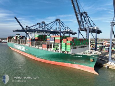
EVER GENTLE
Cargo
Current Trip
LK CMB
| Time Travelled | 16 days |
|---|---|
| Remaining Time | --- |
| Distance Travelled | 7382.89 nm |
| Remaining Distance | --- |
| AVG Speed | 19.2 Knots |
| MAX Speed | 24.7 Knots |
| AVG Wind | 12.8 knots |
| MAX Wind | 24 knots |
| MIN Temp | 16.5°C / 61.7°F |
| MAX Temp | 30.1°C / 86.18°F |
| Draught | 16.3 m |
| Position Received | 6 d ago |
Current Position
| Longitude | 18.14209° |
|---|---|
| Latitude | -34.59571° |
| Status | Under way using engine |
| Speed | 19.3 Knots |
| Course | 293.6° |
| Area | South Atlantic Ocean |
| Station | T-AIS |
| Position Received | 6 d ago |
Info
Information
The current position of EVER GENTLE is in South Atlantic Ocean with coordinates -34.59571° / 18.14209° as reported on 2024-05-04 16:00 by AIS to our vessel tracker app. The vessel's current speed is 19.3 Knots
The vessel EVER GENTLE (IMO: 9820922, MMSI: 636019174) is a Cargo It's sailing under the flag of [LR] Liberia.
In this page you can find informations about the vessels current position, last detected port calls, and current voyage information. If the vessels is not in coverage by AIS you will find the latest position.
The current position of EVER GENTLE is detected by our AIS receivers and we are not responsible for the reliability of the data. The last position was recorded while the vessel was in Coverage by the Ais receivers of our vessel tracking app.
The current draught of EVER GENTLE as reported by AIS is 16.3 meters
Weather
| Temperature | 28.9°C / 84.02°F |
|---|---|
| Wind Speed | 9 knots |
| Direction | 186° S |
| Pressure | 1008.7 hPa |
| Humidity | 76.6 % |
| Cloud Coverage | 64 % |
Featured Company
Most Visited Ports (Last year)
| Port | Arrivals | |
|---|---|---|
| 6 | ||
| 5 | ||
| 5 | ||
| 4 | ||
| 4 | ||
| 3 |
Last Trips
| Origin | Departure | Destination | Arrival | Distance | |
|---|---|---|---|---|---|
| 2024-04-18 21:50 | 2024-04-24 14:30 | 1679.72 nm | |||
| 2024-04-10 08:32 | 2024-04-17 16:05 | 1548.10 nm | |||
| 2024-04-06 11:04 | 2024-04-09 10:51 | 900.20 nm | |||
| 2024-03-30 13:21 | 2024-04-05 14:53 | 1295.22 nm | |||
| 2024-03-01 04:01 | 2024-03-28 19:54 | 958.75 nm |
Events
| Time | Event | Details | Position / Dest | Info |
|---|---|---|---|---|
| 2024-05-04 16:06 | Status Changed | Default Under way using engine |
-34.58379 / 18.10983
LK CMB
|
Speed: 19.3 kn Course: 293.6° |
| 2024-05-04 16:00 | OUT of Coverage |
-34.59571 / 18.14209
South Atlantic Ocean
|
Speed: 19.3 kn Course: 293.6° |
|
| 2024-05-04 15:57 | Status Changed | Under way using engine Default |
-34.60400 / 18.16464
LK CMB
|
Speed: 19.3 kn Course: 294° |
| 2024-05-04 15:50 | Status Changed | Default Under way using engine |
-34.61904 / 18.20536
LK CMB
|
Speed: 19.3 kn Course: 294.8° |
| 2024-05-04 15:44 | Status Changed | Under way using engine Default |
-34.63449 / 18.24028
LK CMB
|
Speed: 19.2 kn Course: 292° |
| 2024-05-04 15:38 | Status Changed | Default Under way using engine |
-34.64490 / 18.27095
LK CMB
|
Speed: 19 kn Course: 291.9° |
| 2024-05-04 15:00 | Status Changed | Under way using engine Default |
-34.72402 / 18.49700
LK CMB
|
Speed: 18.6 kn Course: 295° |
| 2024-05-04 14:58 | Status Changed | Default Under way using engine |
-34.72835 / 18.50904
LK CMB
|
Speed: 18.7 kn Course: 293.5° |
| 2024-05-04 14:53 | Status Changed | Under way using engine Default |
-34.73878 / 18.53698
LK CMB
|
Speed: 18.5 kn Course: 294° |
| 2024-05-04 14:46 | Status Changed | Default Under way using engine |
-34.75348 / 18.57534
LK CMB
|
Speed: 18.2 kn Course: 294.4° |