
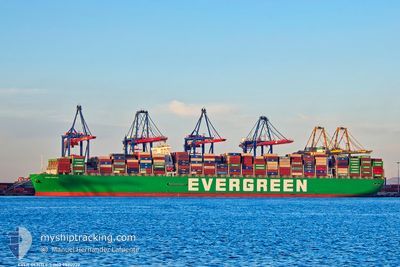
EVER GENTLE
Cargo A
Current Trip
| Time Travelled | 5 days |
|---|---|
| Remaining Time | --- |
| Distance Travelled | 609.60 nm |
| Remaining Distance | 11614.72 nm |
| AVG Speed | 5.8 Noeuds |
| MAX Speed | 20.2 Noeuds |
| AVG Wind | 23.9 knots |
| MAX Wind | 39 knots |
| MIN Temp | 7°C / 44.6°F |
| MAX Temp | 14.5°C / 58.1°F |
| Tirant d eau | 11.3 m |
| Position reçue | 1 m depuis |
Current Position
| Longitude | --- |
|---|---|
| Latitude | --- |
| Etat | Under way using engine |
| Vitesse | 2.3 Noeuds |
| Parcours | 257° |
| Zone | English Channel |
| Station | T-AIS |
| Position reçue | 1 m depuis |
Info
Information
The current position of EVER GENTLE is in English Channel with coordinates 50.02979° / -0.61047° as reported on 2025-12-09 07:37 by AIS to our vessel tracker app. The vessel's current speed is 2.3 Noeuds and is heading at the port of SINGAPORE. The estimated time of arrival as calculated by MyShipTracking vessel tracking app is 2025-12-31 12:00 LT
The vessel EVER GENTLE (IMO: 9820922, MMSI: 636019174) is a Cargo A It's sailing under the flag of [LR] Liberia.
In this page you can find informations about the vessels current position, last detected port calls, and current voyage information. If the vessels is not in coverage by AIS you will find the latest position.
The current position of EVER GENTLE is detected by our AIS receivers and we are not responsible for the reliability of the data. The last position was recorded while the vessel was in Coverage by the Ais receivers of our vessel tracking app.
The current draught of EVER GENTLE as reported by AIS is 11.3 meters
Weather
| Temperature | 12.8°C / 55.04°F |
|---|---|
| Wind Speed | 24 knots |
| Direction | 177° S |
| Pressure | 1005.9 hPa |
| Humidity | 84.2 % |
| Cloud Coverage | 100 % |
Featured Company
Last Port Calls
| Port | Arrival | Departure | Time In Port |
|---|---|---|---|
| 2025-11-30 02:42 | 2025-12-04 01:04 | 3 d | |
| 2025-11-25 06:23 | 2025-11-28 20:55 | 3 d | |
| 2025-11-20 14:09 | 2025-11-22 17:21 | 2 d | |
| 2025-10-22 10:02 | 2025-10-23 02:02 | 16 h | |
| 2025-10-16 12:46 | 2025-10-17 13:24 | 1 d | |
| 2025-10-11 02:56 | 2025-10-12 04:32 | 1 d | |
| 2025-10-05 12:08 | 2025-10-06 15:24 | 1 d |
Last Trips
| Origin | Departure | Destination | Arrival | Distance | |
|---|---|---|---|---|---|
| 2025-11-28 20:55 | 2025-11-30 02:42 | 334.93 nm | |||
| 2025-11-22 17:21 | 2025-11-25 06:23 | 506.48 nm | |||
| 2025-10-23 02:02 | 2025-11-20 14:09 | 10773.01 nm | |||
| 2025-10-17 13:24 | 2025-10-22 10:02 | 1649.03 nm | |||
| 2025-10-12 04:32 | 2025-10-16 12:46 | 1484.84 nm | |||
| 2025-10-06 15:24 | 2025-10-11 02:56 | 836.61 nm | |||
| 2025-09-30 00:44 | 2025-10-05 12:08 | 713.87 nm |
Events
| Heure | Evenement | Détails | Position/ Destination | Info |
|---|---|---|---|---|
| 2025-12-08 17:40 | Démarrage |
50.09010 / -.47400
SINGAPORE
|
Vitesse: 3.2 kn Parcours: 175° |
|
| 2025-12-08 17:34 | Arret |
50.09236 / -.47471
SINGAPORE
|
Vitesse: 0.3 kn Parcours: 131° |
|
| 2025-12-08 10:00 | Démarrage |
49.98247 / -.80292
SINGAPORE
|
Vitesse: 3.1 kn Parcours: 225° |
|
| 2025-12-08 09:26 | Arret |
49.98446 / -.82072
SINGAPORE
|
Vitesse: 0.3 kn Parcours: 261° |
|
| 2025-12-07 19:33 | Démarrage |
49.99200 / -.46951
SINGAPORE
|
Vitesse: 3.1 kn Parcours: 337° |
|
| 2025-12-07 16:40 | Arret |
49.99339 / -.58902
SINGAPORE
|
Vitesse: 0.2 kn Parcours: 338° |
|
| 2025-12-06 23:05 | Démarrage |
49.96641 / -.46030
SINGAPORE
|
Vitesse: 3.1 kn Parcours: 287° |
|
| 2025-12-06 22:50 | Arret |
49.95947 / -.46772
SINGAPORE
|
Vitesse: 0.3 kn Parcours: 260° |
|
| 2025-12-06 18:05 | Démarrage |
49.97305 / -.28258
SINGAPORE
|
Vitesse: 3.1 kn Parcours: 347° |
|
| 2025-12-06 14:27 | Arret |
49.97572 / -.39668
SINGAPORE
|
Vitesse: 0.3 kn Parcours: 344° |