
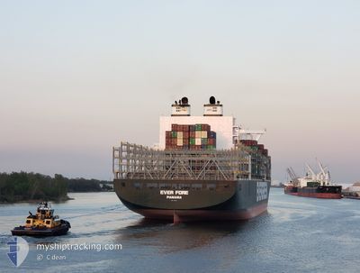
EVER FORE
Cargo
Current Trip
| Time Travelled | 10 days |
|---|---|
| Remaining Time | --- |
| Distance Travelled | 4773.74 nm |
| Remaining Distance | --- |
| AVG Speed | 17.9 Knots |
| MAX Speed | 21 Knots |
| AVG Wind | 14.4 knots |
| MAX Wind | 30 knots |
| MIN Temp | 6.2°C / 43.16°F |
| MAX Temp | 23.6°C / 74.48°F |
| Draught | 13.3 m |
| Position Received | 9 d ago |
Current Position
| Longitude | --- |
|---|---|
| Latitude | --- |
| Status | Under way using engine |
| Speed | 20.1 Knots |
| Course | 279.1° |
| Area | North Pacific Ocean |
| Station | T-AIS |
| Position Received | 9 d ago |
Info
Information
The current position of EVER FORE is in North Pacific Ocean with coordinates 38.28720° / -128.21341° as reported on 2025-12-30 09:03 by AIS to our vessel tracker app. The vessel's current speed is 20.1 Knots and is heading at the port of KAOHSIUNG. The estimated time of arrival as calculated by MyShipTracking vessel tracking app is 2026-01-13 08:01 LT
The vessel EVER FORE (IMO: 9850824, MMSI: 354022000) is a Cargo It's sailing under the flag of [PA] Panama.
In this page you can find informations about the vessels current position, last detected port calls, and current voyage information. If the vessels is not in coverage by AIS you will find the latest position.
The current position of EVER FORE is detected by our AIS receivers and we are not responsible for the reliability of the data. The last position was recorded while the vessel was in Coverage by the Ais receivers of our vessel tracking app.
The current draught of EVER FORE as reported by AIS is 13.3 meters
Weather
| Temperature | 21.2°C / 70.16°F |
|---|---|
| Wind Speed | 12 knots |
| Direction | 317° NW |
| Pressure | 1014.7 hPa |
| Humidity | 57.9 % |
| Cloud Coverage | 37 % |
Featured Company
Last Port Calls
| Port | Arrival | Departure | Time In Port |
|---|---|---|---|
| 2025-12-27 09:52 | 2025-12-29 06:30 | 1 d | |
| 2025-12-26 05:36 | 2025-12-27 09:26 | 1 d | |
| 2025-12-20 03:08 | 2025-12-23 05:04 | 3 d | |
| 2025-12-03 15:53 | 2025-12-05 00:21 | 1 d | |
| 2025-12-01 10:05 | 2025-12-02 08:28 | 22 h | |
| 2025-11-30 04:11 | 2025-11-30 15:11 | 11 h | |
| 2025-11-17 14:48 | 2025-11-18 23:40 | 1 d | |
| 2025-11-10 17:59 | 2025-11-11 04:32 | 10 h |
Most Visited Ports (Last year)
| Port | Arrivals | |
|---|---|---|
| 5 | ||
| 5 | ||
| 5 | ||
| 5 | ||
| 4 | ||
| 3 |
Last Trips
| Origin | Departure | Destination | Arrival | Distance | |
|---|---|---|---|---|---|
| 2025-12-27 09:26 | 2025-12-27 09:52 | 0.58 nm | |||
| 2025-12-23 05:04 | 2025-12-26 05:36 | 600.10 nm | |||
| 2025-12-05 00:21 | 2025-12-20 03:08 | 7029.56 nm | |||
| 2025-12-02 08:28 | 2025-12-03 15:53 | 351.10 nm | |||
| 2025-11-30 15:11 | 2025-12-01 10:05 | 227.13 nm | |||
| 2025-11-18 23:40 | 2025-11-30 04:11 | 3535.26 nm | |||
| 2025-11-11 04:32 | 2025-11-17 14:48 | 590.23 nm | |||
| 2025-10-29 05:35 | 2025-11-10 17:59 | 5439.90 nm |
Events
| Time | Event | Details | Position / Dest | Info |
|---|---|---|---|---|
| 2025-12-30 09:10 | Status Changed | Default Under way using engine |
38.29319 / -128.26222
USOAK-TWKHH
|
Speed: 20.1 kn Course: 279.1° |
| 2025-12-30 09:03 | Detected in Sea | High seas of the North Pacific Ocean |
38.28720 / -128.21341
North Pacific Ocean
USOAK-TWKHH
|
Speed: 20.1 kn Course: 279.1° |
| 2025-12-30 09:03 | OUT of Coverage |
38.28720 / -128.21341
North Pacific Ocean
USOAK-TWKHH
|
Speed: 20.1 kn Course: 279.1° |
|
| 2025-12-30 09:02 | Status Changed | Under way using engine Default |
38.28647 / -128.20766
USOAK-TWKHH
|
Speed: 20.2 kn Course: 279° |
| 2025-12-30 08:09 | Status Changed | Default Under way using engine |
38.23484 / -127.83142
USOAK-TWKHH
|
Speed: 20.2 kn Course: 280.7° |
| 2025-12-30 07:39 | Status Changed | Under way using engine Default |
38.20427 / -127.62636
USOAK-TWKHH
|
Speed: 20 kn Course: 281° |
| 2025-12-30 07:18 | Status Changed | Default Under way using engine |
38.18172 / -127.48228
USOAK-TWKHH
|
Speed: 20.1 kn Course: 281° |
| 2025-12-30 06:48 | Status Changed | Under way using engine Default |
38.15451 / -127.27082
USOAK-TWKHH
|
Speed: 20.2 kn Course: 278° |
| 2025-12-30 06:44 | IN Coverage |
38.15505 / -127.27582
North Pacific Ocean
USOAK-TWKHH
|
Speed: 20.1 kn Course: 277.6° |