
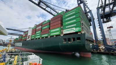
EVER ENVOY
Container Ship
Current Trip
| Trip Time | 3 days |
|---|---|
| Trip Distance | 541.29 nm |
| AVG Speed | 11.3 Knots |
| MAX Speed | 16.2 Knots |
| Draught | 11.3 m |
| AVG Wind | 8.9 knots |
| MAX Wind | 17 knots |
| MIN Temp | 18.7°C / 65.66°F |
| MAX Temp | 24.9°C / 76.82°F |
| Position Received | 3 m ago |
Current Position
| Longitude | --- |
|---|---|
| Latitude | --- |
| Status | Moored |
| Speed | |
| Course | 212° |
| Area | Coral Sea |
| Station | T-AIS |
| Position Received | 3 m ago |
Info
Information
The current position of EVER ENVOY is in Coral Sea with coordinates -27.37011° / 153.17152° as reported on 2025-12-10 21:23 by AIS to our vessel tracker app. The vessel's current speed is 0 Knots and is currently inside the port of BRISBANE.
The vessel EVER ENVOY (IMO: 9241308, MMSI: 235414000) is a Container Ship that was built in 2002 ( 23 years old ). It's sailing under the flag of [GB] United Kingdom.
In this page you can find informations about the vessels current position, last detected port calls, and current voyage information. If the vessels is not in coverage by AIS you will find the latest position.
The current position of EVER ENVOY is detected by our AIS receivers and we are not responsible for the reliability of the data. The last position was recorded while the vessel was in Coverage by the Ais receivers of our vessel tracking app.
The current draught of EVER ENVOY as reported by AIS is 11.3 meters
Weather
| Temperature | 24.3°C / 75.74°F |
|---|---|
| Wind Speed | 6 knots |
| Direction | 92° E |
| Pressure | 1016.2 hPa |
| Humidity | 62.3 % |
| Cloud Coverage | 100 % |
Featured Company
Last Port Calls
| Port | Arrival | Departure | Time In Port |
|---|---|---|---|
| 2025-12-11 02:33 | |||
| 2025-12-05 15:09 | 2025-12-07 22:25 | 2 d | |
| 2025-11-30 00:43 | 2025-12-03 07:56 | 3 d | |
| 2025-11-17 03:00 | 2025-11-17 18:56 | 15 h | |
| 2025-11-10 02:36 | 2025-11-10 14:32 | 11 h | |
| 2025-11-07 12:12 | 2025-11-08 14:20 | 1 d | |
| 2025-11-01 13:57 | 2025-11-02 16:13 | 1 d | |
| 2025-10-21 00:40 | 2025-10-22 19:45 | 1 d | |
| 2025-10-14 13:40 | 2025-10-17 21:45 | 3 d | |
| 2025-10-10 04:57 | 2025-10-13 00:15 | 2 d |
Last Trips
| Origin | Departure | Destination | Arrival | Distance | |
|---|---|---|---|---|---|
| 2025-12-07 22:25 | 2025-12-11 02:33 | 541.29 nm | |||
| 2025-12-03 07:56 | 2025-12-05 15:09 | 602.00 nm | |||
| 2025-11-17 18:56 | 2025-11-30 00:43 | 4819.42 nm | |||
| 2025-11-10 14:32 | 2025-11-17 03:00 | 1530.25 nm | |||
| 2025-11-08 14:20 | 2025-11-10 02:36 | 230.13 nm | |||
| 2025-11-02 16:13 | 2025-11-07 12:12 | 668.54 nm | |||
| 2025-10-22 19:45 | 2025-11-01 13:57 | 3805.51 nm | |||
| 2025-10-17 21:45 | 2025-10-21 00:40 | 544.19 nm | |||
| 2025-10-13 00:15 | 2025-10-14 13:40 | 589.31 nm | |||
| 2025-09-27 13:56 | 2025-10-10 04:57 | 4802.11 nm |
Events
| Time | Event | Details | Position / Dest | Info |
|---|---|---|---|---|
| 2025-12-10 18:41 | Status Changed | Moored Default |
-27.37012 / 153.17161
[AU] BRISBANE
|
Speed: Course: 212° |
| 2025-12-10 18:38 | Status Changed | Default Moored |
-27.37023 / 153.17154
[AU] BRISBANE
|
Speed: Course: 212° |
| 2025-12-10 17:13 | Status Changed | Moored Under way using engine |
-27.37019 / 153.17159
[AU] BRISBANE
|
Speed: Course: 212° |
| 2025-12-10 16:52 | STOP Moving |
-27.36895 / 153.17146
[AU] BRISBANE
|
Speed: 0.3 kn Course: 207° |
|
| 2025-12-10 16:33 | PORT ARRIVAL |
|
-27.34530 / 153.18461
[AU] BRISBANE
|
Speed: 9.5 kn Course: 211.8° |
| 2025-12-10 12:09 | START Moving | 8.84 nm, South East of MOOLOOLABA |
-26.73911 / 153.28684
AU SYD=>AU BNE
|
Speed: 3.1 kn Course: 38° |
| 2025-12-10 12:00 | Status Changed | Under way using engine Under way sailing |
-26.73868 / 153.28339
AU SYD=>AU BNE
|
Speed: 0.5 kn Course: 95° |
| 2025-12-10 12:00 | Status Changed | Under way sailing At anchor |
-26.73866 / 153.28342
AU SYD=>AU BNE
|
Speed: 0.5 kn Course: 93° |
| 2025-12-10 00:19 | ETA Changed | 2025/12/10 09:30 2025/12/10 02:00 |
-26.73819 / 153.28246
AU SYD=>AU BNE
|
Speed: Course: 99° |
| 2025-12-09 05:22 | STOP Moving | 8.62 nm, South East of MOOLOOLABA |
-26.73772 / 153.28306
AU SYD=>AU BNE
|
Speed: 0.1 kn Course: 100° |