
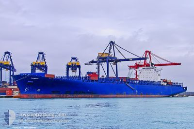
ESL WAFA
Container Ship
Current Trip
KHOR FAKKAN
| Time Travelled | 4 days |
|---|---|
| Remaining Time | --- |
| Distance Travelled | 68.91 nm |
| Remaining Distance | --- |
| AVG Speed | 14.6 Knots |
| MAX Speed | 16 Knots |
| AVG Wind | 8.2 knots |
| MAX Wind | 9.5 knots |
| MIN Temp | 32.3°C / 90.14°F |
| MAX Temp | 36.5°C / 97.7°F |
| Draught | 10.5 m |
| Position Received | 4 d ago |
Current Position
| Longitude | 57.00247° |
|---|---|
| Latitude | 24.67795° |
| Status | Under way using engine |
| Speed | 15.5 Knots |
| Course | 136° |
| Area | Gulf of Oman |
| Station | T-AIS |
| Position Received | 4 d ago |
Info
Information
The current position of ESL WAFA is in Gulf of Oman with coordinates 24.67795° / 57.00247° as reported on 2024-06-02 21:57 by AIS to our vessel tracker app. The vessel's current speed is 15.5 Knots
The vessel ESL WAFA (IMO: 9306160, MMSI: 255915789) is a Container Ship that was built in 2006 ( 18 years old ). It's sailing under the flag of [PT] Portugal.
In this page you can find informations about the vessels current position, last detected port calls, and current voyage information. If the vessels is not in coverage by AIS you will find the latest position.
The current position of ESL WAFA is detected by our AIS receivers and we are not responsible for the reliability of the data. The last position was recorded while the vessel was in Coverage by the Ais receivers of our vessel tracking app.
The current draught of ESL WAFA as reported by AIS is 10.5 meters
Weather
| Temperature | 32.4°C / 90.32°F |
|---|---|
| Wind Speed | 9 knots |
| Direction | 102° ESE |
| Pressure | 1000.6 hPa |
| Humidity | 72 % |
| Cloud Coverage | --- |
Featured Company
Last Port Calls
| Port | Arrival | Departure | Time In Port |
|---|---|---|---|
| 2024-06-02 02:25 | 2024-06-02 21:06 | 18 h | |
| 2024-05-21 19:24 | 2024-05-23 18:48 | 1 d |
Most Visited Ports (Last year)
| Port | Arrivals | |
|---|---|---|
| 1 | ||
| 1 |
Last Trips
| Origin | Departure | Destination | Arrival | Distance | |
|---|---|---|---|---|---|
| 2024-05-23 18:48 | 2024-06-02 02:25 | 848.42 nm |
Events
| Time | Event | Details | Position / Dest | Info |
|---|---|---|---|---|
| 2024-06-02 21:57 | OUT of Coverage |
24.67795 / 57.00247
Gulf of Oman
|
Speed: 15.5 kn Course: 136° |
|
| 2024-06-02 20:10 | Change Sea Area | Omani part of the Gulf of Oman United Arab Emirates part of the Gulf of Oman |
25.04117 / 56.75060
Gulf of Oman
|
Speed: 15.2 kn Course: 180.9° |
| 2024-06-02 17:16 | START Moving | 0.56 nm, North East of KHORFAKKAN |
25.36547 / 56.36788
KHOR FAKKAN
|
Speed: 3.1 kn Course: 55° |
| 2024-06-02 17:06 | PORT DEPARTURE |
|
25.36348 / 56.36667
KHOR FAKKAN
|
Speed: 2.1 kn Course: 153° |
| 2024-06-02 16:52 | Status Changed | Under way using engine Moored |
25.35842 / 56.36823
[AE] KHORFAKKAN
|
Speed: Course: 152° |
| 2024-06-01 22:49 | Status Changed | Moored Under way using engine |
25.35835 / 56.36815
[AE] KHORFAKKAN
|
Speed: Course: 152° |
| 2024-06-01 22:33 | STOP Moving |
25.35873 / 56.36872
[AE] KHORFAKKAN
|
Speed: 0.3 kn Course: 154° |
|
| 2024-06-01 22:25 | PORT ARRIVAL |
|
25.36217 / 56.36755
[AE] KHORFAKKAN
|
Speed: 3 kn Course: 155° |
| 2024-06-01 20:23 | Change Sea Area | United Arab Emirates part of the Gulf of Oman Omani part of the Gulf of Oman |
25.67710 / 56.56515
Gulf of Oman
KHOR FAKKAN
|
Speed: 15.2 kn Course: 201.1° |
| 2024-06-01 19:20 | Change Sea Area | Omani part of the Gulf of Oman Omani part of the Persian Gulf |
25.92978 / 56.67165
Gulf of Oman
KHOR FAKKAN
|
Speed: 15.5 kn Course: 194.2° |