
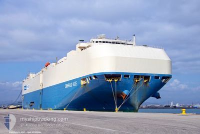
EMERALD ACE
Vehicles Carrier
Current Trip
| Time Travelled | 9 days |
|---|---|
| Remaining Time | --- |
| Distance Travelled | 3714.56 nm |
| Remaining Distance | --- |
| AVG Speed | 16.2 Knots |
| MAX Speed | 19.5 Knots |
| AVG Wind | 13.9 knots |
| MAX Wind | 34.5 knots |
| MIN Temp | 0.3°C / 32.54°F |
| MAX Temp | 27.2°C / 80.96°F |
| Draught | 8.9 m |
| Position Received | 1 d ago |
Current Position
| Longitude | --- |
|---|---|
| Latitude | --- |
| Status | Under way using engine |
| Speed | 17.1 Knots |
| Course | 150.9° |
| Area | North Atlantic Ocean |
| Station | T-AIS |
| Position Received | 1 d ago |
Info
Information
The current position of EMERALD ACE is in North Atlantic Ocean with coordinates 10.80101° / -17.96624° as reported on 2026-01-05 15:18 by AIS to our vessel tracker app. The vessel's current speed is 17.1 Knots and is heading at the port of MUMBAI. The estimated time of arrival as calculated by MyShipTracking vessel tracking app is 2026-01-25 12:00 LT
The vessel EMERALD ACE (IMO: 9539236, MMSI: 538004697) is a Vehicles Carrier that was built in 2012 ( 14 years old ). It's sailing under the flag of [MH] Marshall Is.
In this page you can find informations about the vessels current position, last detected port calls, and current voyage information. If the vessels is not in coverage by AIS you will find the latest position.
The current position of EMERALD ACE is detected by our AIS receivers and we are not responsible for the reliability of the data. The last position was recorded while the vessel was in Coverage by the Ais receivers of our vessel tracking app.
The current draught of EMERALD ACE as reported by AIS is 8.9 meters
Weather
| Temperature | 25.1°C / 77.18°F |
|---|---|
| Wind Speed | 8 knots |
| Direction | 191° S |
| Pressure | 1012.8 hPa |
| Humidity | 77.3 % |
| Cloud Coverage | 55 % |
Featured Company
Last Port Calls
| Port | Arrival | Departure | Time In Port |
|---|---|---|---|
| 2025-12-27 20:53 | 2025-12-29 00:09 | 1 d | |
| 2025-12-26 01:56 | 2025-12-26 16:22 | 14 h | |
| 2025-12-23 11:45 | 2025-12-23 23:43 | 11 h | |
| 2025-12-21 00:57 | 2025-12-23 02:11 | 2 d | |
| 2025-12-19 03:47 | 2025-12-20 04:07 | 1 d | |
| 2025-12-16 10:19 | 2025-12-16 18:46 | 8 h | |
| 2025-12-14 16:59 | 2025-12-14 23:16 | 6 h | |
| 2025-12-07 09:37 | 2025-12-07 18:17 | 8 h | |
| 2025-11-27 06:49 | 2025-11-27 15:17 | 8 h | |
| 2025-11-22 04:01 | 2025-11-26 07:51 | 4 d |
Last Trips
| Origin | Departure | Destination | Arrival | Distance | |
|---|---|---|---|---|---|
| 2025-12-26 16:22 | 2025-12-27 20:53 | 296.59 nm | |||
| 2025-12-23 23:43 | 2025-12-26 01:56 | 586.31 nm | |||
| 2025-12-23 02:11 | 2025-12-23 11:45 | 115.99 nm | |||
| 2025-12-20 04:07 | 2025-12-21 00:57 | 313.64 nm | |||
| 2025-12-16 18:46 | 2025-12-19 03:47 | 887.75 nm | |||
| 2025-12-14 23:16 | 2025-12-16 10:19 | 561.60 nm | |||
| 2025-12-07 18:17 | 2025-12-14 16:59 | 1631.88 nm | |||
| 2025-11-27 15:17 | 2025-12-07 09:37 | 4174.00 nm | |||
| 2025-11-26 07:51 | 2025-11-27 06:49 | 280.36 nm | |||
| 2025-11-12 22:07 | 2025-11-22 04:01 | 2039.66 nm |
Events
| Time | Event | Details | Position / Dest | Info |
|---|---|---|---|---|
| 2026-01-05 15:25 | Status Changed | Default Under way using engine |
10.77229 / -17.95053
INBOM
|
Speed: 17.1 kn Course: 150.9° |
| 2026-01-05 15:18 | Status Changed | Under way using engine Default |
10.80101 / -17.96624
INBOM
|
Speed: 17.5 kn Course: 152° |
| 2026-01-05 15:18 | OUT of Coverage |
10.80101 / -17.96624
North Atlantic Ocean
INBOM
|
Speed: 17.1 kn Course: 150.9° |
|
| 2026-01-05 15:12 | Status Changed | Default Under way using engine |
10.82728 / -17.98062
INBOM
|
Speed: 17.3 kn Course: 150.1° |
| 2026-01-05 15:07 | Change Sea Area | Guinea Bissau part of the North Atlantic Ocean Senegalese part of the North Atlantic Ocean |
10.84869 / -17.99250
North Atlantic Ocean
INBOM
|
Speed: 17.3 kn Course: 150.1° |
| 2026-01-05 15:07 | Status Changed | Under way using engine Default |
10.84869 / -17.99250
INBOM
|
Speed: 17.3 kn Course: 151° |
| 2026-01-05 15:07 | IN Coverage |
10.84869 / -17.99250
North Atlantic Ocean
INBOM
|
Speed: 17.3 kn Course: 150.1° |
|
| 2026-01-05 10:06 | Status Changed | Default Under way using engine |
12.23235 / -18.36339
INBOM
|
Speed: 17.5 kn Course: 178.6° |
| 2026-01-05 10:00 | OUT of Coverage |
12.26318 / -18.36402
North Atlantic Ocean
INBOM
|
Speed: 17.5 kn Course: 178.6° |
|
| 2026-01-05 09:45 | Status Changed | Under way using engine Default |
12.33573 / -18.36575
INBOM
|
Speed: 17.5 kn Course: 179° |