
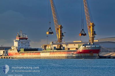
EEBORG
General Cargo
Current Trip
| Time Travelled | 20 h, 19 mins |
|---|---|
| Remaining Time | --- |
| Distance Travelled | 204.56 nm |
| Remaining Distance | --- |
| AVG Speed | 10.1 Knots |
| MAX Speed | 11.4 Knots |
| AVG Wind | 3.3 knots |
| MAX Wind | 7 knots |
| MIN Temp | 10.8°C / 51.44°F |
| MAX Temp | 15.9°C / 60.62°F |
| Draught | 5.2 m |
| Position Received | 1 h, 20 m ago |
Current Position
| Longitude | --- |
|---|---|
| Latitude | --- |
| Status | Under way using engine |
| Speed | 9.9 Knots |
| Course | 105.9° |
| Area | Ionian Sea |
| Station | T-AIS |
| Position Received | 1 h, 20 m ago |
Info
Information
The current position of EEBORG is in Ionian Sea with coordinates 37.79842° / 16.00377° as reported on 2025-12-11 10:16 by AIS to our vessel tracker app. The vessel's current speed is 9.9 Knots and is heading at the port of GEMLIK. The estimated time of arrival as calculated by MyShipTracking vessel tracking app is 2025-12-14 14:00 LT
The vessel EEBORG (IMO: 9568328, MMSI: 246846000) is a General Cargo that was built in 2012 ( 13 years old ). It's sailing under the flag of [NL] Netherlands.
In this page you can find informations about the vessels current position, last detected port calls, and current voyage information. If the vessels is not in coverage by AIS you will find the latest position.
The current position of EEBORG is detected by our AIS receivers and we are not responsible for the reliability of the data. The last position was recorded while the vessel was in Coverage by the Ais receivers of our vessel tracking app.
The current draught of EEBORG as reported by AIS is 5.2 meters
Weather
| Temperature | 15.9°C / 60.62°F |
|---|---|
| Wind Speed | 3 knots |
| Direction | 32° NNE |
| Pressure | 1022.1 hPa |
| Humidity | 65 % |
| Cloud Coverage | 26 % |
Featured Company
Events
| Time | Event | Details | Position / Dest | Info |
|---|---|---|---|---|
| 2025-12-11 10:22 | Status Changed | Default Under way using engine |
37.79333 / 16.02333
TR GEM
|
Speed: 9.9 kn Course: 105.9° |
| 2025-12-11 10:16 | OUT of Coverage |
37.79842 / 16.00377
Ionian Sea
TR GEM
|
Speed: 9.9 kn Course: 105.9° |
|
| 2025-12-11 10:07 | Status Changed | Under way using engine Default |
37.80547 / 15.97645
TR GEM
|
Speed: 9 kn Course: 108° |
| 2025-12-11 09:58 | Status Changed | Default Under way using engine |
37.81333 / 15.94500
TR GEM
|
Speed: 9.8 kn Course: 107° |
| 2025-12-11 06:04 | Change Sea Area | Italian part of the Ionian Sea Italian part of the Tyrrhenian Sea |
38.25701 / 15.64688
Ionian Sea
TR GEM
|
Speed: 10.2 kn Course: 242.3° |
| 2025-12-11 03:22 | Draught Changed | 5.2 5.5 |
38.70482 / 15.47443
TR GEM
|
Speed: 10.9 kn Course: 157.3° |
| 2025-12-11 03:22 | Destination Changed | TR GEM ITSAL |
38.70482 / 15.47443
TR GEM
|
Speed: 10.9 kn Course: 157.3° |
| 2025-12-11 03:22 | ETA Changed | 2025/12/14 11:00 2025/12/06 22:30 |
38.70482 / 15.47443
TR GEM
|
Speed: 10.9 kn Course: 157.3° |
| 2025-12-11 02:06 | Status Changed | Under way using engine Default |
38.91414 / 15.37777
ITSAL
|
Speed: 10.7 kn Course: 157° |
| 2025-12-11 01:59 | IN Coverage |
38.91414 / 15.37777
Tyrrhenian Sea
|
Speed: 10.5 kn Course: 165.5° |