
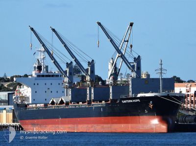
EASTERN HOPE
Cargo
Current Trip
| Time Travelled | 8 days |
|---|---|
| Remaining Time | 2 days |
| Distance Travelled | 2088.16 nm |
| Remaining Distance | 846.66 nm |
| AVG Speed | 11.1 Knots |
| MAX Speed | 13.2 Knots |
| AVG Wind | 12.8 knots |
| MAX Wind | 27 knots |
| MIN Temp | 6.8°C / 44.24°F |
| MAX Temp | 27.5°C / 81.5°F |
| Draught | 9.8 m |
| Position Received | 8 d ago |
Current Position
| Longitude | --- |
|---|---|
| Latitude | --- |
| Status | Under way using engine |
| Speed | 11.6 Knots |
| Course | 141.8° |
| Area | North Pacific Ocean |
| Station | T-AIS |
| Position Received | 8 d ago |
Info
Information
The current position of EASTERN HOPE is in North Pacific Ocean with coordinates 35.26390° / 139.76764° as reported on 2025-02-25 11:10 by AIS to our vessel tracker app. The vessel's current speed is 11.6 Knots and is heading at the port of SINGAPORE. The estimated time of arrival as calculated by MyShipTracking vessel tracking app is 2025-03-08 13:48 LT
The vessel EASTERN HOPE (IMO: 9700847, MMSI: 538005766) is a Cargo It's sailing under the flag of [MH] Marshall Is.
In this page you can find informations about the vessels current position, last detected port calls, and current voyage information. If the vessels is not in coverage by AIS you will find the latest position.
The current position of EASTERN HOPE is detected by our AIS receivers and we are not responsible for the reliability of the data. The last position was recorded while the vessel was in Coverage by the Ais receivers of our vessel tracking app.
The current draught of EASTERN HOPE as reported by AIS is 9.8 meters
Weather
| Temperature | 27.3°C / 81.14°F |
|---|---|
| Wind Speed | 7 knots |
| Direction | 65° ENE |
| Pressure | 1009 hPa |
| Humidity | 80.4 % |
| Cloud Coverage | 100 % |
Featured Company
Last Port Calls
| Port | Arrival | Departure | Time In Port |
|---|---|---|---|
| 2025-02-23 05:44 | 2025-02-25 18:45 | 2 d | |
| 2025-02-18 16:11 | 2025-02-20 06:05 | 1 d | |
| 2025-02-06 07:17 | 2025-02-07 13:29 | 1 d | |
| 2025-01-19 13:54 | 2025-01-21 02:53 | 1 d | |
| 2025-01-13 12:57 | 2025-01-15 13:57 | 2 d | |
| 2025-01-07 06:26 | 2025-01-10 18:05 | 3 d |
Last Trips
| Origin | Departure | Destination | Arrival | Distance | |
|---|---|---|---|---|---|
| 2025-02-20 06:05 | 2025-02-23 05:44 | 25.91 nm | |||
| 2025-02-07 13:29 | 2025-02-18 16:11 | 1890.23 nm | |||
| 2025-01-21 02:53 | 2025-02-06 07:17 | 3628.25 nm | |||
| 2025-01-15 13:57 | 2025-01-19 13:54 | 906.36 nm | |||
| 2025-01-10 18:05 | 2025-01-13 12:57 | 338.26 nm | |||
| 2024-12-09 19:29 | 2025-01-07 06:26 | 3755.81 nm |
Events
| Time | Event | Details | Position / Dest | Info |
|---|---|---|---|---|
| 2025-02-25 11:17 | Status Changed | Default Under way using engine |
35.24300 / 139.77153
SG JUR
|
Speed: 11.6 kn Course: 141.8° |
| 2025-02-25 11:10 | OUT of Coverage |
35.26390 / 139.76764
North Pacific Ocean
SG JUR
|
Speed: 11.6 kn Course: 141.8° |
|
| 2025-02-25 09:52 | Draught Changed | 9.8 5.4 |
35.38428 / 139.81120
SG JUR
|
Speed: 10.7 kn Course: 325.1° |
| 2025-02-25 09:52 | Destination Changed | SG JUR JP KZU |
35.38428 / 139.81120
SG JUR
|
Speed: 10.7 kn Course: 325.1° |
| 2025-02-25 09:52 | ETA Changed | 2025/03/08 17:00 2025/02/19 23:00 |
35.38428 / 139.81120
SG JUR
|
Speed: 10.7 kn Course: 325.1° |
| 2025-02-25 09:45 | PORT DEPARTURE |
|
35.37203 / 139.82581
JP KZU
|
Speed: 3.6 kn Course: 307° |
| 2025-02-25 09:37 | START Moving |
35.36429 / 139.83786
[JP] KIMITSU
|
Speed: 3.2 kn Course: 305° |
|
| 2025-02-25 09:36 | Status Changed | Under way using engine Default |
35.36359 / 139.83913
[JP] KIMITSU
|
Speed: Course: 306° |
| 2025-02-25 09:27 | IN Coverage |
35.36483 / 139.83689
North Pacific Ocean
[JP] KIMITSU
|
Speed: 3.6 kn Course: 302° |
|
| 2025-02-24 22:42 | OUT of Coverage |
35.36312 / 139.84314
North Pacific Ocean
[JP] KIMITSU
|
Speed: Course: 180.6° |