
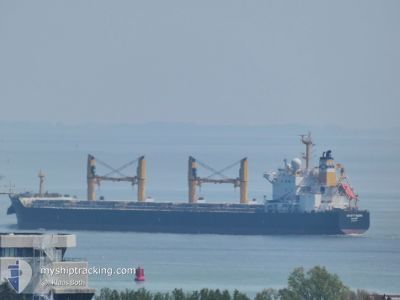
DESERT MOON
Bulk Carrier
Current Trip
| Time Travelled | 7 days |
|---|---|
| Remaining Time | --- |
| Distance Travelled | 2100.03 nm |
| Remaining Distance | --- |
| AVG Speed | 11 Knots |
| MAX Speed | 13.7 Knots |
| AVG Wind | 10.1 knots |
| MAX Wind | 25.6 knots |
| MIN Temp | 14.3°C / 57.74°F |
| MAX Temp | 21.5°C / 70.7°F |
| Draught | 11.1 m |
| Position Received | 4 h, 42 m ago |
Current Position
| Longitude | -8.97860° |
|---|---|
| Latitude | 35.91140° |
| Status | Under way using engine |
| Speed | 11.2 Knots |
| Course | 257.9° |
| Area | North Atlantic Ocean |
| Station | T-AIS |
| Position Received | 4 h, 42 m ago |
Info
Information
The current position of DESERT MOON is in North Atlantic Ocean with coordinates 35.91140° / -8.97860° as reported on 2024-05-14 21:24 by AIS to our vessel tracker app. The vessel's current speed is 11.2 Knots and is heading at the port of HOUSTON. The estimated time of arrival as calculated by MyShipTracking vessel tracking app is 2024-05-30 11:00 LT
The vessel DESERT MOON (IMO: 9543770, MMSI: 538004585) is a Bulk Carrier that was built in 2012 ( 12 years old ). It's sailing under the flag of [MH] Marshall Is.
In this page you can find informations about the vessels current position, last detected port calls, and current voyage information. If the vessels is not in coverage by AIS you will find the latest position.
The current position of DESERT MOON is detected by our AIS receivers and we are not responsible for the reliability of the data. The last position was recorded while the vessel was in Coverage by the Ais receivers of our vessel tracking app.
The current draught of DESERT MOON as reported by AIS is 11.1 meters
Weather
| Temperature | 16.7°C / 62.06°F |
|---|---|
| Wind Speed | 17 knots |
| Direction | 359° N |
| Pressure | 1014.9 hPa |
| Humidity | 67.9 % |
| Cloud Coverage | --- |
Featured Company
Events
| Time | Event | Details | Position / Dest | Info |
|---|---|---|---|---|
| 2024-05-14 21:35 | Status Changed | Default Under way using engine |
35.90333 / -9.03167
USHOU
|
Speed: 11.2 kn Course: 257.9° |
| 2024-05-14 21:24 | Status Changed | Under way using engine Default |
35.91140 / -8.97860
USHOU
|
Speed: 11 kn Course: 260° |
| 2024-05-14 21:24 | OUT of Coverage |
35.91140 / -8.97860
North Atlantic Ocean
USHOU
|
Speed: 11.2 kn Course: 257.9° |
|
| 2024-05-14 20:53 | Status Changed | Default Under way using engine |
35.92500 / -8.87333
USHOU
|
Speed: 11.2 kn Course: 261.8° |
| 2024-05-14 20:43 | Status Changed | Under way using engine Default |
35.93058 / -8.83292
USHOU
|
Speed: 11 kn Course: 261° |
| 2024-05-14 20:25 | IN Coverage |
35.93058 / -8.83292
North Atlantic Ocean
USHOU
|
Speed: 11.2 kn Course: 261.8° |
|
| 2024-05-14 19:58 | Status Changed | Default Under way using engine |
35.94959 / -8.66596
USHOU
|
Speed: 10.7 kn Course: 269.8° |
| 2024-05-14 19:38 | OUT of Coverage |
35.95047 / -8.56398
North Atlantic Ocean
USHOU
|
Speed: 10.7 kn Course: 269.8° |
|
| 2024-05-14 19:18 | Status Changed | Under way using engine Default |
35.94979 / -8.50868
USHOU
|
Speed: 10 kn Course: 270° |
| 2024-05-14 18:50 | Status Changed | Default Under way using engine |
35.95049 / -8.41382
USHOU
|
Speed: 10.9 kn Course: 269.7° |