
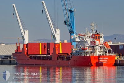
DENIZ AKAY
General Cargo
Current Trip
| Time Travelled | 2 days |
|---|---|
| Remaining Time | 3 days |
| Distance Travelled | 254.42 nm |
| Remaining Distance | 1372.31 nm |
| AVG Speed | 10.3 Knots |
| MAX Speed | 13.1 Knots |
| AVG Wind | 12.5 knots |
| MAX Wind | 23.7 knots |
| MIN Temp | 6.2°C / 43.16°F |
| MAX Temp | 10.9°C / 51.62°F |
| Draught | 8.2 m |
| Position Received | 1 d ago |
Current Position
| Longitude | --- |
|---|---|
| Latitude | --- |
| Status | Under way using engine |
| Speed | 7.1 Knots |
| Course | 252.8° |
| Area | English Channel |
| Station | T-AIS |
| Position Received | 1 d ago |
Info
Information
The current position of DENIZ AKAY is in English Channel with coordinates 50.27053° / -1.33892° as reported on 2025-12-04 05:34 by AIS to our vessel tracker app. The vessel's current speed is 7.1 Knots and is heading at the port of AGADIR. The estimated time of arrival as calculated by MyShipTracking vessel tracking app is 2025-12-09 02:38 LT
The vessel DENIZ AKAY (IMO: 9349447, MMSI: 314001131) is a General Cargo that was built in 2010 ( 15 years old ). It's sailing under the flag of [BB] Barbados.
In this page you can find informations about the vessels current position, last detected port calls, and current voyage information. If the vessels is not in coverage by AIS you will find the latest position.
The current position of DENIZ AKAY is detected by our AIS receivers and we are not responsible for the reliability of the data. The last position was recorded while the vessel was in Coverage by the Ais receivers of our vessel tracking app.
The current draught of DENIZ AKAY as reported by AIS is 8.2 meters
Weather
| Temperature | 10°C / 50°F |
|---|---|
| Wind Speed | 24 knots |
| Direction | 175° S |
| Pressure | 996.8 hPa |
| Humidity | 85.1 % |
| Cloud Coverage | 100 % |
Featured Company
Most Visited Ports (Last year)
| Port | Arrivals | |
|---|---|---|
| 1 | ||
| 1 | ||
| 1 | ||
| 1 | ||
| 1 | ||
| 1 |
Events
| Time | Event | Details | Position / Dest | Info |
|---|---|---|---|---|
| 2025-12-04 05:34 | OUT of Coverage |
50.27053 / -1.33892
English Channel
MA AGA
|
Speed: 7.1 kn Course: 252.8° |
|
| 2025-12-04 05:34 | IN Coverage |
50.27053 / -1.33892
English Channel
MA AGA
|
Speed: 7.1 kn Course: 252.8° |
|
| 2025-12-04 03:32 | OUT of Coverage |
50.35361 / -.87311
English Channel
MA AGA
|
Speed: 11.4 kn Course: 255.9° |
|
| 2025-12-04 01:52 | ETA Changed | 2025/12/09 12:00 2025/12/10 12:00 |
50.43959 / -.37703
MA AGA
|
Speed: 12 kn Course: 252.9° |
| 2025-12-04 00:14 | IN Coverage |
50.52495 / .10259
English Channel
MA AGA
|
Speed: 11.4 kn Course: 256.2° |
|
| 2025-12-03 18:26 | OUT of Coverage |
50.98685 / 1.40656
English Channel
MA AGA
|
Speed: 12.2 kn Course: 225.6° |
|
| 2025-12-03 17:59 | Change Sea Area | United Kingdom part of the English Channel United Kingdom part of the North Sea |
51.05269 / 1.51041
English Channel
MA AGA
|
Speed: 12.8 kn Course: 223.6° |
| 2025-12-03 14:35 | IN Coverage |
51.56318 / 2.10309
North Sea
MA AGA
|
Speed: 9.7 kn Course: 227° |
|
| 2025-12-03 13:00 | OUT of Coverage |
51.74156 / 2.38430
North Sea
MA AGA
|
Speed: 8.7 kn Course: 218.4° |
|
| 2025-12-03 12:20 | Change Sea Area | United Kingdom part of the North Sea Belgian part of the North Sea |
51.81600 / 2.48726
North Sea
MA AGA
|
Speed: 8.9 kn Course: 226° |