
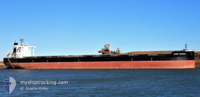
DAWN HORIZON
Cargo
Current Trip
| Time Travelled | 39 days |
|---|---|
| Remaining Time | 1 h, 53 mins |
| Distance Travelled | 6993.35 nm |
| Remaining Distance | 27.26 nm |
| AVG Speed | 10.3 Knots |
| MAX Speed | 17 Knots |
| AVG Wind | 9.8 knots |
| MAX Wind | 26 knots |
| MIN Temp | 11.2°C / 52.16°F |
| MAX Temp | 30°C / 86°F |
| Draught | 8.8 m |
| Position Received | 1 m ago |
Current Position
| Longitude | 118.47476° |
|---|---|
| Latitude | -19.94761° |
| Status | Under way using engine |
| Speed | 12.7 Knots |
| Course | 181° |
| Area | Indian Ocean |
| Station | T-AIS |
| Position Received | 1 m ago |
Info
Information
The current position of DAWN HORIZON is in Indian Ocean with coordinates -19.94761° / 118.47476° as reported on 2024-05-13 10:44 by AIS to our vessel tracker app. The vessel's current speed is 12.7 Knots and is heading at the port of PORT HEDLAND. The estimated time of arrival as calculated by MyShipTracking vessel tracking app is 2024-05-13 20:38 LT
The vessel DAWN HORIZON (IMO: 9638850, MMSI: 356142000) is a Cargo It's sailing under the flag of [PA] Panama.
In this page you can find informations about the vessels current position, last detected port calls, and current voyage information. If the vessels is not in coverage by AIS you will find the latest position.
The current position of DAWN HORIZON is detected by our AIS receivers and we are not responsible for the reliability of the data. The last position was recorded while the vessel was in Coverage by the Ais receivers of our vessel tracking app.
The current draught of DAWN HORIZON as reported by AIS is 8.8 meters
Weather
| Temperature | 26°C / 78.8°F |
|---|---|
| Wind Speed | 7 knots |
| Direction | 21° NNE |
| Pressure | 1012.4 hPa |
| Humidity | 67 % |
| Cloud Coverage | 1 % |
Featured Company
Last Port Calls
| Port | Arrival | Departure | Time In Port |
|---|---|---|---|
| 2024-04-02 18:47 | 2024-04-04 03:54 | 1 d | |
| 2024-03-08 07:47 | 2024-03-10 10:16 | 2 d |
Most Visited Ports (Last year)
| Port | Arrivals | |
|---|---|---|
| 7 | ||
| 5 | ||
| 2 | ||
| 2 | ||
| 1 | ||
| 1 |
Last Trips
| Origin | Departure | Destination | Arrival | Distance | |
|---|---|---|---|---|---|
| 2024-03-10 10:16 | 2024-04-02 18:47 | 3875.61 nm | |||
| 2024-02-19 05:26 | 2024-03-08 07:47 | 3768.95 nm |
Events
| Time | Event | Details | Position / Dest | Info |
|---|---|---|---|---|
| 2024-05-13 09:04 | ETA Changed | 2024/05/13 12:30 2024/05/13 13:00 |
-19.68408 / 118.60563
CN TAC > AU PHE
|
Speed: 10.5 kn Course: 209.4° |
| 2024-05-13 07:33 | Draught Changed | 8.8 17.5 |
-19.45190 / 118.74431
CN TAC > AU PHE
|
Speed: 10.3 kn Course: 211.5° |
| 2024-05-13 07:33 | Destination Changed | CN TAC > AU PHE AUPHE>CNMJS |
-19.45190 / 118.74431
CN TAC > AU PHE
|
Speed: 10.3 kn Course: 211.5° |
| 2024-05-13 07:33 | ETA Changed | 2024/05/13 13:00 2024/04/17 10:00 |
-19.45190 / 118.74431
CN TAC > AU PHE
|
Speed: 10.3 kn Course: 211.5° |
| 2024-05-13 06:50 | Status Changed | Under way using engine Default |
-19.34677 / 118.81140
AUPHE>CNMJS
|
Speed: 10.2 kn Course: 211° |
| 2024-05-13 06:47 | Status Changed | Default Under way using engine |
-19.33936 / 118.81600
AUPHE>CNMJS
|
Speed: 10.3 kn Course: 209.9° |
| 2024-05-13 06:12 | Status Changed | Under way using engine Default |
-19.25181 / 118.86895
AUPHE>CNMJS
|
Speed: 10.3 kn Course: 209° |
| 2024-05-13 06:10 | Status Changed | Default Under way using engine |
-19.24708 / 118.87171
AUPHE>CNMJS
|
Speed: 10.3 kn Course: 209.8° |
| 2024-05-13 06:04 | Change Sea Area | Australian part of the Indian Ocean Philippines part of the Philippine Sea |
-19.23088 / 118.88150
Indian Ocean
|
Speed: 10.3 kn Course: 209.8° |
| 2024-05-13 06:04 | Status Changed | Under way using engine Default |
-19.23088 / 118.88150
AUPHE>CNMJS
|
Speed: 10 kn Course: 209° |