
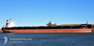
DAWN HORIZON
Cargo
Current Trip
| Time Travelled | 3 days |
|---|---|
| Remaining Time | 10 days |
| Distance Travelled | 616.77 nm |
| Remaining Distance | 3215.51 nm |
| AVG Speed | 11.1 Noeuds |
| MAX Speed | 16 Noeuds |
| AVG Wind | 7.3 knots |
| MAX Wind | 12.5 knots |
| MIN Temp | 16.9°C / 62.42°F |
| MAX Temp | 20.2°C / 68.36°F |
| Tirant d eau | 9 m |
| Position reçue | 1 d depuis |
Current Position
| Longitude | 123.73217° |
|---|---|
| Latitude | 34.81754° |
| Etat | Under way using engine |
| Vitesse | 9.3 Noeuds |
| Parcours | 174.2° |
| Zone | Yellow Sea |
| Station | T-AIS |
| Position reçue | 1 d depuis |
Info
Information
The current position of DAWN HORIZON is in Yellow Sea with coordinates 34.81754° / 123.73217° as reported on 2024-06-05 15:38 by AIS to our vessel tracker app. The vessel's current speed is 9.3 Noeuds and is heading at the port of PORT HEDLAND. The estimated time of arrival as calculated by MyShipTracking vessel tracking app is 2024-06-17 22:37 LT
The vessel DAWN HORIZON (IMO: 9638850, MMSI: 356142000) is a Cargo It's sailing under the flag of [PA] Panama.
In this page you can find informations about the vessels current position, last detected port calls, and current voyage information. If the vessels is not in coverage by AIS you will find the latest position.
The current position of DAWN HORIZON is detected by our AIS receivers and we are not responsible for the reliability of the data. The last position was recorded while the vessel was in Coverage by the Ais receivers of our vessel tracking app.
The current draught of DAWN HORIZON as reported by AIS is 9 meters
Weather
| Temperature | 21.8°C / 71.24°F |
|---|---|
| Wind Speed | 16 knots |
| Direction | 93° E |
| Pressure | 1011.7 hPa |
| Humidity | 89.5 % |
| Cloud Coverage | 100 % |
Featured Company
Last Port Calls
| Port | Arrival | Departure | Time In Port |
|---|---|---|---|
| 2024-06-01 13:28 | 2024-06-04 09:43 | 2 d | |
| 2024-05-15 16:13 | 2024-05-17 03:28 | 1 d | |
| 2024-04-02 18:47 | 2024-04-04 03:54 | 1 d |
Most Visited Ports (Last year)
| Port | Arrivals | |
|---|---|---|
| 8 | ||
| 5 | ||
| 2 | ||
| 1 | ||
| 1 | ||
| 1 |
Last Trips
| Origin | Departure | Destination | Arrival | Distance | |
|---|---|---|---|---|---|
| 2024-05-17 03:28 | 2024-06-01 13:28 | 3828.94 nm | |||
| 2024-04-04 03:54 | 2024-05-15 16:13 | 7022.21 nm | |||
| 2024-03-10 10:16 | 2024-04-02 18:47 | 3875.61 nm |
Events
| Heure | Evenement | Détails | Position/ Destination | Info |
|---|---|---|---|---|
| 2024-06-05 15:38 | Hors de la zone couverte |
34.81754 / 123.73217
Yellow Sea
CNCFD > AUPHE
|
Vitesse: 9.3 kn Parcours: 174.2° |
|
| 2024-06-05 13:27 | Tirant d'eau modifié | 9 17.7 |
35.18028 / 123.68948
CNCFD > AUPHE
|
Vitesse: 10.5 kn Parcours: 174.9° |
| 2024-06-05 13:27 | Changement de destination | CNCFD > AUPHE AU PHE >CN TAO |
35.18028 / 123.68948
CNCFD > AUPHE
|
Vitesse: 10.5 kn Parcours: 174.9° |
| 2024-06-05 13:27 | Changement d'ETA | 2024/06/19 07:00 2024/05/31 20:00 |
35.18028 / 123.68948
CNCFD > AUPHE
|
Vitesse: 10.5 kn Parcours: 174.9° |
| 2024-06-05 13:11 | Etat Changé | Under way using engine Default |
35.22638 / 123.68500
AU PHE >CN TAO
|
Vitesse: 10.6 kn Parcours: 175° |
| 2024-06-05 13:02 | Etat Changé | Default Under way using engine |
35.25445 / 123.68210
AU PHE >CN TAO
|
Vitesse: 10.6 kn Parcours: 174.7° |
| 2024-06-05 11:01 | Detecté en mer | South Korean part of the Yellow Sea |
35.62554 / 123.64038
Yellow Sea
|
Vitesse: 11.2 kn Parcours: 174.9° |
| 2024-06-05 10:44 | Etat Changé | Under way using engine Default |
35.68119 / 123.63392
AU PHE >CN TAO
|
Vitesse: 11.3 kn Parcours: 175° |
| 2024-06-05 10:36 | Dans la zone couverte |
35.68060 / 123.63401
Yellow Sea
|
Vitesse: 11.3 kn Parcours: 174.2° |
|
| 2024-06-05 09:24 | Hors de la zone couverte |
35.92829 / 123.60522
Yellow Sea
|
Vitesse: 11.1 kn Parcours: 173.8° |