
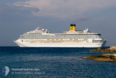
COSTA FORTUNA
Passengers Ship
Current Trip
| Time Travelled | 2 days |
|---|---|
| Remaining Time | 3 h, 39 mins |
| Distance Travelled | 769.45 nm |
| Remaining Distance | 78.45 nm |
| AVG Speed | 13.5 Knots |
| MAX Speed | 20.8 Knots |
| AVG Wind | 12.4 knots |
| MAX Wind | 25 knots |
| MIN Temp | 11.6°C / 52.88°F |
| MAX Temp | 18.1°C / 64.58°F |
| Draught | 8.3 m |
| Position Received | Now |
Current Position
| Longitude | 27.47156° |
|---|---|
| Latitude | 40.66895° |
| Status | Under way using engine |
| Speed | 20.8 Knots |
| Course | 65° |
| Area | Sea of Marmara |
| Station | T-AIS |
| Position Received | Now |
Info
Information
The current position of COSTA FORTUNA is in Sea of Marmara with coordinates 40.66895° / 27.47156° as reported on 2024-04-26 01:34 by AIS to our vessel tracker app. The vessel's current speed is 20.8 Knots and is heading at the port of ISTANBUL. The estimated time of arrival as calculated by MyShipTracking vessel tracking app is 2024-04-26 05:14 LT
The vessel COSTA FORTUNA (IMO: 9239783, MMSI: 247094800) is a Passengers Ship that was built in 2003 ( 21 years old ). It's sailing under the flag of [IT] Italy.
In this page you can find informations about the vessels current position, last detected port calls, and current voyage information. If the vessels is not in coverage by AIS you will find the latest position.
The current position of COSTA FORTUNA is detected by our AIS receivers and we are not responsible for the reliability of the data. The last position was recorded while the vessel was in Coverage by the Ais receivers of our vessel tracking app.
The current draught of COSTA FORTUNA as reported by AIS is 8.3 meters
Weather
| Temperature | 14.6°C / 58.28°F |
|---|---|
| Wind Speed | 6 knots |
| Direction | 289° WNW |
| Pressure | 1008.9 hPa |
| Humidity | 79.8 % |
| Cloud Coverage | --- |
Featured Company
Last Port Calls
| Port | Arrival | Departure | Time In Port |
|---|---|---|---|
| 2024-04-23 10:56 | 2024-04-23 18:28 | 7 h | |
| 2024-04-22 03:58 | 2024-04-22 15:21 | 11 h | |
| 2024-04-21 05:43 | 2024-04-21 15:13 | 9 h | |
| 2024-04-20 02:57 | 2024-04-20 18:10 | 15 h | |
| 2024-04-19 04:11 | 2024-04-19 17:20 | 13 h | |
| 2024-04-18 05:43 | 2024-04-18 15:39 | 9 h | |
| 2024-04-15 04:47 | 2024-04-16 19:47 | 1 d | |
| 2024-04-14 07:47 | 2024-04-14 16:34 | 8 h | |
| 2024-04-12 07:41 | 2024-04-13 12:56 | 1 d | |
| 2024-04-11 04:03 | 2024-04-11 15:19 | 11 h |
Most Visited Ports (Last year)
| Port | Arrivals | |
|---|---|---|
| 25 | ||
| 25 | ||
| 24 | ||
| 15 | ||
| 15 | ||
| 14 |
Last Trips
| Origin | Departure | Destination | Arrival | Distance | |
|---|---|---|---|---|---|
| 2024-04-22 17:21 | 2024-04-23 12:56 | 358.46 nm | |||
| 2024-04-21 17:13 | 2024-04-22 05:58 | 231.71 nm | |||
| 2024-04-20 20:10 | 2024-04-21 07:43 | 210.80 nm | |||
| 2024-04-19 19:20 | 2024-04-20 04:57 | 193.07 nm | |||
| 2024-04-18 17:39 | 2024-04-19 06:11 | 177.01 nm | |||
| 2024-04-16 20:47 | 2024-04-18 07:43 | 605.97 nm | |||
| 2024-04-14 18:34 | 2024-04-15 05:47 | 206.26 nm | |||
| 2024-04-13 13:56 | 2024-04-14 09:47 | 347.81 nm | |||
| 2024-04-11 17:19 | 2024-04-12 08:41 | 271.60 nm | |||
| 2024-04-08 18:28 | 2024-04-11 06:03 | 990.32 nm |
Events
| Time | Event | Details | Position / Dest | Info |
|---|---|---|---|---|
| 2024-04-26 00:10 | Status Changed | Under way using engine Default |
40.47429 / 26.89850
TRIST
|
Speed: 20 kn Course: 68° |
| 2024-04-26 00:10 | IN Coverage |
40.48043 / 26.91627
Sea of Marmara
TRIST
|
Speed: 20.6 kn Course: 65.7° |
|
| 2024-04-25 23:13 | Status Changed | Default Under way using engine |
40.33612 / 26.63602
TRIST
|
Speed: 15.8 kn Course: 46.5° |
| 2024-04-25 23:04 | OUT of Coverage |
40.31041 / 26.60085
Sea of Marmara
TRIST
|
Speed: 15.8 kn Course: 46.5° |
|
| 2024-04-25 21:10 | Change Sea Area | Turkish part of the Sea of Marmara Turkish part of the Aegean Sea |
40.01885 / 26.19469
Sea of Marmara
TRIST
|
Speed: 6.2 kn Course: 72.7° |
| 2024-04-25 20:04 | Change Sea Area | Turkish part of the Aegean Sea Greek part of the Aegean Sea |
39.90272 / 25.87221
Aegean Sea
TRIST
|
Speed: 15.2 kn Course: 74° |
| 2024-04-25 19:25 | Change Sea Area | Greek part of the Aegean Sea Turkish part of the Aegean Sea |
39.91413 / 25.82170
Aegean Sea
TRIST
|
Speed: 5.5 kn Course: 229.7° |
| 2024-04-25 16:08 | Change Sea Area | Turkish part of the Aegean Sea Greek part of the Aegean Sea |
39.89193 / 25.89267
Aegean Sea
TRIST
|
Speed: 11.7 kn Course: 46° |
| 2024-04-25 15:57 | Status Changed | Under way using engine Default |
39.86747 / 25.86302
TRIST
|
Speed: 11.7 kn Course: 37° |
| 2024-04-25 15:48 | Status Changed | Default Under way using engine |
39.84399 / 25.84014
TRIST
|
Speed: 11.8 kn Course: 36.2° |