
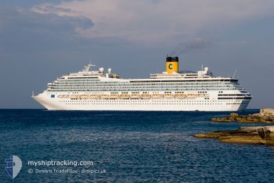
COSTA FORTUNA
Passengers Ship
Current Trip
| Time Travelled | 1 day |
|---|---|
| Remaining Time | 19 h, 44 mins |
| Distance Travelled | 531.22 nm |
| Remaining Distance | 288.79 nm |
| AVG Speed | 14.4 Noeuds |
| MAX Speed | 15.2 Noeuds |
| AVG Wind | 13.1 knots |
| MAX Wind | 25 knots |
| MIN Temp | 13.2°C / 55.76°F |
| MAX Temp | 18.1°C / 64.58°F |
| Tirant d eau | 8.3 m |
| Position reçue | Maintenant |
Current Position
| Longitude | 24.71094° |
|---|---|
| Latitude | 38.14540° |
| Etat | Under way using engine |
| Vitesse | 14.7 Noeuds |
| Parcours | 22.5° |
| Zone | Aegean Sea |
| Station | T-AIS |
| Position reçue | Maintenant |
Info
Information
The current position of COSTA FORTUNA is in Aegean Sea with coordinates 38.14540° / 24.71094° as reported on 2024-04-25 07:13 by AIS to our vessel tracker app. The vessel's current speed is 14.7 Noeuds and is heading at the port of ISTANBUL. The estimated time of arrival as calculated by MyShipTracking vessel tracking app is 2024-04-26 02:58 LT
The vessel COSTA FORTUNA (IMO: 9239783, MMSI: 247094800) is a Passengers Ship that was built in 2003 ( 21 Age ). It's sailing under the flag of [IT] Italy.
In this page you can find informations about the vessels current position, last detected port calls, and current voyage information. If the vessels is not in coverage by AIS you will find the latest position.
The current position of COSTA FORTUNA is detected by our AIS receivers and we are not responsible for the reliability of the data. The last position was recorded while the vessel was in Coverage by the Ais receivers of our vessel tracking app.
The current draught of COSTA FORTUNA as reported by AIS is 8.3 meters
Weather
| Temperature | 17.9°C / 64.22°F |
|---|---|
| Wind Speed | 16 knots |
| Direction | 204° SSW |
| Pressure | 1004.2 hPa |
| Humidity | 69.7 % |
| Cloud Coverage | 100 % |
Featured Company
Last Port Calls
| Port | Arrival | Departure | Time In Port |
|---|---|---|---|
| 2024-04-23 10:56 | 2024-04-23 18:28 | 7 h | |
| 2024-04-22 03:58 | 2024-04-22 15:21 | 11 h | |
| 2024-04-21 05:43 | 2024-04-21 15:13 | 9 h | |
| 2024-04-20 02:57 | 2024-04-20 18:10 | 15 h | |
| 2024-04-19 04:11 | 2024-04-19 17:20 | 13 h | |
| 2024-04-18 05:43 | 2024-04-18 15:39 | 9 h | |
| 2024-04-15 04:47 | 2024-04-16 19:47 | 1 d | |
| 2024-04-14 07:47 | 2024-04-14 16:34 | 8 h | |
| 2024-04-12 07:41 | 2024-04-13 12:56 | 1 d | |
| 2024-04-11 04:03 | 2024-04-11 15:19 | 11 h |
Most Visited Ports (Last year)
| Port | Arrivals | |
|---|---|---|
| 25 | ||
| 25 | ||
| 24 | ||
| 15 | ||
| 15 | ||
| 14 |
Last Trips
| Origin | Departure | Destination | Arrival | Distance | |
|---|---|---|---|---|---|
| 2024-04-22 17:21 | 2024-04-23 12:56 | 358.46 nm | |||
| 2024-04-21 17:13 | 2024-04-22 05:58 | 231.71 nm | |||
| 2024-04-20 20:10 | 2024-04-21 07:43 | 210.80 nm | |||
| 2024-04-19 19:20 | 2024-04-20 04:57 | 193.07 nm | |||
| 2024-04-18 17:39 | 2024-04-19 06:11 | 177.01 nm | |||
| 2024-04-16 20:47 | 2024-04-18 07:43 | 605.97 nm | |||
| 2024-04-14 18:34 | 2024-04-15 05:47 | 206.26 nm | |||
| 2024-04-13 13:56 | 2024-04-14 09:47 | 347.81 nm | |||
| 2024-04-11 17:19 | 2024-04-12 08:41 | 271.60 nm | |||
| 2024-04-08 18:28 | 2024-04-11 06:03 | 990.32 nm |
Events
| Heure | Evenement | Détails | Position/ Destination | Info |
|---|---|---|---|---|
| 2024-04-24 21:20 | Changement de zone | Greek part of the Aegean Sea Greek part of the Mediterranean Sea - Eastern Basin |
36.39230 / 23.01258
Aegean Sea
TRIST
|
Vitesse: 14.8 kn Parcours: 112.5° |
| 2024-04-24 19:37 | Changement de destination | TRIST ITCTA |
36.29850 / 22.54084
TRIST
|
Vitesse: 13.6 kn Parcours: 70.4° |
| 2024-04-24 19:37 | Changement d'ETA | 2024/04/26 04:30 2024/04/23 11:00 |
36.29850 / 22.54084
TRIST
|
Vitesse: 13.6 kn Parcours: 70.4° |
| 2024-04-24 18:36 | Changement de zone | Greek part of the Mediterranean Sea - Eastern Basin Greek part of the Ionian Sea |
36.31813 / 22.24557
Mediterranean Sea - Eastern Basin
|
Vitesse: 14.5 kn Parcours: 99.1° |
| 2024-04-24 18:36 | Etat Changé | Under way using engine Default |
36.31813 / 22.24557
ITCTA
|
Vitesse: 14.5 kn Parcours: 98° |
| 2024-04-24 18:22 | Dans la zone couverte |
36.31813 / 22.24557
Mediterranean Sea - Eastern Basin
|
Vitesse: 14.5 kn Parcours: 99.1° |
|
| 2024-04-24 13:53 | Etat Changé | Default Moored |
36.56113 / 20.87104
ITCTA
|
Vitesse: 14.6 kn Parcours: 102.9° |
| 2024-04-24 13:47 | Hors de la zone couverte |
36.56677 / 20.83985
Ionian Sea
|
Vitesse: 14.6 kn Parcours: 102.9° |
|
| 2024-04-24 13:01 | Etat Changé | Moored Default |
36.60740 / 20.61570
ITCTA
|
Vitesse: 14.6 kn Parcours: 101° |
| 2024-04-24 12:48 | Etat Changé | Default Moored |
36.61944 / 20.54939
ITCTA
|
Vitesse: 14.5 kn Parcours: 103.1° |