
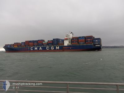
CMA CGM SWORDFISH
Container Ship
Current Trip
| Trip Time | 10 days |
|---|---|
| Trip Distance | 3367.43 nm |
| AVG Speed | 15.8 Knots |
| MAX Speed | 15.8 Knots |
| Draught | 10.2 m |
| AVG Wind | 13.4 knots |
| MAX Wind | 33 knots |
| MIN Temp | -2.9°C / 26.78°F |
| MAX Temp | 8.8°C / 47.84°F |
| Position Received | 2 d ago |
Current Position
| Longitude | --- |
|---|---|
| Latitude | --- |
| Status | Under way using engine |
| Speed | 18.4 Knots |
| Course | 231.8° |
| Area | Japan Sea |
| Station | T-AIS |
| Position Received | 2 d ago |
Info
Information
The current position of CMA CGM SWORDFISH is in Japan Sea with coordinates 41.45567° / 140.46659° as reported on 2025-03-02 11:38 by AIS to our vessel tracker app. The vessel's current speed is 18.4 Knots and is currently inside the port of BUSAN NEW PORT.
The vessel CMA CGM SWORDFISH (IMO: 9331000, MMSI: 215159000) is a Container Ship that was built in 2007 ( 18 years old ). It's sailing under the flag of [MT] Malta.
In this page you can find informations about the vessels current position, last detected port calls, and current voyage information. If the vessels is not in coverage by AIS you will find the latest position.
The current position of CMA CGM SWORDFISH is detected by our AIS receivers and we are not responsible for the reliability of the data. The last position was recorded while the vessel was in Coverage by the Ais receivers of our vessel tracking app.
The current draught of CMA CGM SWORDFISH as reported by AIS is 10.2 meters
Weather
| Temperature | 8.5°C / 47.3°F |
|---|---|
| Wind Speed | 7 knots |
| Direction | 43° NE |
| Pressure | 1019.9 hPa |
| Humidity | 58.6 % |
| Cloud Coverage | 100 % |
Featured Company
Last Port Calls
| Port | Arrival | Departure | Time In Port |
|---|---|---|---|
| 2025-03-05 15:55 | |||
| 2025-02-20 06:11 | 2025-02-22 04:15 | 1 d | |
| 2025-02-10 09:33 | 2025-02-12 05:27 | 1 d | |
| 2025-02-06 14:23 | 2025-02-08 19:40 | 2 d | |
| 2025-01-25 07:08 | 2025-01-25 20:49 | 13 h | |
| 2025-01-23 11:29 | 2025-01-24 07:09 | 19 h | |
| 2025-01-20 05:43 | 2025-01-20 14:53 | 9 h | |
| 2025-01-06 13:51 | 2025-01-07 08:34 | 18 h | |
| 2025-01-05 14:02 | 2025-01-05 15:21 | 1 h |
Most Visited Ports (Last year)
| Port | Arrivals | |
|---|---|---|
| 8 | ||
| 8 | ||
| 7 | ||
| 7 | ||
| 6 | ||
| 4 |
Last Trips
| Origin | Departure | Destination | Arrival | Distance | |
|---|---|---|---|---|---|
| 2025-02-22 04:15 | 2025-03-05 15:55 | 3367.43 nm | |||
| 2025-02-12 05:27 | 2025-02-20 06:11 | 2323.11 nm | |||
| 2025-02-08 19:40 | 2025-02-10 09:33 | 412.01 nm | |||
| 2025-01-25 20:49 | 2025-02-06 14:23 | 6114.82 nm | |||
| 2025-01-24 07:09 | 2025-01-25 07:08 | 236.90 nm | |||
| 2025-01-20 14:53 | 2025-01-23 11:29 | 526.71 nm | |||
| 2025-01-07 08:34 | 2025-01-20 05:43 | 6142.04 nm | |||
| 2025-01-05 15:21 | 2025-01-06 13:51 | 52.41 nm | |||
| 2024-12-31 15:48 | 2025-01-05 14:02 | 948.52 nm |
Events
| Time | Event | Details | Position / Dest | Info |
|---|---|---|---|---|
| 2025-03-05 06:55 | STOP Moving |
35.07568 / 128.77508
[KR] BUSAN NEW PORT
|
Speed: Course: 359° |
|
| 2025-03-05 06:55 | PORT ARRIVAL |
|
35.07568 / 128.77508
[KR] BUSAN NEW PORT
|
Speed: 1.4 kn Course: 356° |
| 2025-03-02 11:43 | Status Changed | Default Under way using engine |
41.43861 / 140.43819
KRPUS
|
Speed: 18.4 kn Course: 231.8° |
| 2025-03-02 11:38 | OUT of Coverage |
41.45567 / 140.46659
Japan Sea
KRPUS
|
Speed: 18.4 kn Course: 231.8° |
|
| 2025-03-02 10:00 | Status Changed | Under way using engine Default |
41.65543 / 141.00626
KRPUS
|
Speed: 16.4 kn Course: 269° |
| 2025-03-02 09:57 | Status Changed | Default Under way using engine |
41.65556 / 141.02081
KRPUS
|
Speed: 17.9 kn Course: 261.6° |
| 2025-03-02 09:22 | Change Sea Area | Japanese part of the Japan Sea Japanese part of the North Pacific Ocean |
41.67168 / 141.25618
Japan Sea
KRPUS
|
Speed: 18 kn Course: 266.4° |
| 2025-03-02 08:05 | Draught Changed | 10.2 9.4 |
41.71474 / 141.73883
KRPUS
|
Speed: 16.5 kn Course: 265.7° |
| 2025-03-02 08:05 | Destination Changed | KRPUS USDUT |
41.71474 / 141.73883
KRPUS
|
Speed: 16.5 kn Course: 265.7° |
| 2025-03-02 08:05 | ETA Changed | 2025/03/04 10:00 2025/02/19 15:00 |
41.71474 / 141.73883
KRPUS
|
Speed: 16.5 kn Course: 265.7° |