
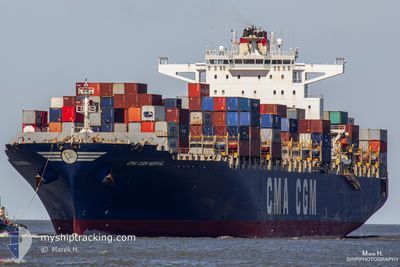
CMA CGM NERVAL
Container Ship
Current Trip
KELAU
| Time Travelled | 3 days |
|---|---|
| Remaining Time | --- |
| Distance Travelled | 177.14 nm |
| Remaining Distance | --- |
| AVG Speed | 12 Knots |
| MAX Speed | 14.6 Knots |
| AVG Wind | 8.2 knots |
| MAX Wind | 14 knots |
| MIN Temp | 25.1°C / 77.18°F |
| MAX Temp | 33.4°C / 92.12°F |
| Draught | 14.3 m |
| Position Received | 16 d ago |
Current Position
| Longitude | --- |
|---|---|
| Latitude | --- |
| Status | Under way using engine |
| Speed | 18.9 Knots |
| Course | 229° |
| Area | Laccadive Sea |
| Station | T-AIS |
| Position Received | 16 d ago |
Info
Information
The current position of CMA CGM NERVAL is in Laccadive Sea with coordinates 6.68790° / 79.42092° as reported on 2025-11-25 07:42 by AIS to our vessel tracker app. The vessel's current speed is 18.9 Knots
The vessel CMA CGM NERVAL (IMO: 9406623, MMSI: 248432000) is a Container Ship that was built in 2010 ( 15 years old ). It's sailing under the flag of [MT] Malta.
In this page you can find informations about the vessels current position, last detected port calls, and current voyage information. If the vessels is not in coverage by AIS you will find the latest position.
The current position of CMA CGM NERVAL is detected by our AIS receivers and we are not responsible for the reliability of the data. The last position was recorded while the vessel was in Coverage by the Ais receivers of our vessel tracking app.
The current draught of CMA CGM NERVAL as reported by AIS is 14.3 meters
Weather
| Temperature | 28.6°C / 83.48°F |
|---|---|
| Wind Speed | 6 knots |
| Direction | 50° NE |
| Pressure | 1013.4 hPa |
| Humidity | 62.3 % |
| Cloud Coverage | 40 % |
Featured Company
Last Port Calls
| Port | Arrival | Departure | Time In Port |
|---|---|---|---|
| 2025-12-05 16:36 | 2025-12-08 14:52 | 2 d | |
| 2025-11-24 19:11 | 2025-11-25 11:19 | 16 h | |
| 2025-11-19 03:14 | 2025-11-20 03:05 | 23 h | |
| 2025-11-14 13:56 | 2025-11-15 10:46 | 20 h | |
| 2025-11-05 11:37 | 2025-11-06 01:28 | 13 h | |
| 2025-10-26 07:06 | 2025-10-27 15:43 | 1 d | |
| 2025-10-20 21:08 | 2025-10-21 18:31 | 21 h |
Most Visited Ports (Last year)
| Port | Arrivals | |
|---|---|---|
| 7 | ||
| 3 | ||
| 3 | ||
| 3 | ||
| 3 | ||
| 2 |
Last Trips
| Origin | Departure | Destination | Arrival | Distance | |
|---|---|---|---|---|---|
| 2025-11-25 11:19 | 2025-12-05 16:36 | 2808.16 nm | |||
| 2025-11-20 03:05 | 2025-11-24 19:11 | 1592.79 nm | |||
| 2025-11-15 10:46 | 2025-11-19 03:14 | 1455.42 nm | |||
| 2025-11-06 01:28 | 2025-11-14 13:56 | 1564.42 nm | |||
| 2025-10-27 15:43 | 2025-11-05 11:37 | 2347.42 nm | |||
| 2025-10-21 18:31 | 2025-10-26 07:06 | 1590.34 nm | |||
| 2025-09-30 11:13 | 2025-10-20 21:08 | 7781.04 nm |
Events
| Time | Event | Details | Position / Dest | Info |
|---|---|---|---|---|
| 2025-12-09 02:36 | STOP Moving | 10.19 nm, North of DAR ES SALAAM |
-6.65635 / 39.33480
KELAU
|
Speed: 0.2 kn Course: 306° |
| 2025-12-08 12:00 | START Moving | 1.13 nm, West of MOMBASA |
-4.05198 / 39.62207
KELAU
|
Speed: 7.4 kn Course: 76° |
| 2025-12-08 11:52 | PORT DEPARTURE |
|
-4.05342 / 39.61825
KELAU
|
Speed: 0.8 kn Course: 298° |
| 2025-12-05 13:36 | PORT ARRIVAL |
|
-4.05078 / 39.61855
[KE] MOMBASA
|
Speed: Course: 260° |
| 2025-12-05 13:28 | STOP Moving | 1.32 nm, West of MOMBASA |
-4.05172 / 39.61867
KELAU
|
Speed: 0.2 kn Course: 268° |
| 2025-12-05 03:56 | START Moving | 17.85 nm, East of MOMBASA |
-4.06530 / 39.93742
KELAU
|
Speed: 3.9 kn Course: 266° |
| 2025-12-04 19:56 | STOP Moving | 17.48 nm, South East of MOMBASA |
-4.16678 / 39.90657
KELAU
|
Speed: 0.3 kn Course: 5° |
| 2025-12-04 12:24 | START Moving | 17.18 nm, East of MOMBASA |
-4.06060 / 39.92650
KELAU
|
Speed: 4.2 kn Course: 21° |
| 2025-12-04 10:40 | STOP Moving | 18.59 nm, East of MOMBASA |
-4.10763 / 39.94456
KELAU
|
Speed: 0.2 kn Course: 352° |