
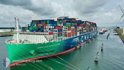
CMA CGM MONTMARTRE
Cargo A
Current Trip
| Time Travelled | 5 days |
|---|---|
| Remaining Time | --- |
| Distance Travelled | 892.17 nm |
| Remaining Distance | 808.78 nm |
| AVG Speed | 16 Knots |
| MAX Speed | 20.8 Knots |
| AVG Wind | 14.3 knots |
| MAX Wind | 24 knots |
| MIN Temp | 8.8°C / 47.84°F |
| MAX Temp | 20.2°C / 68.36°F |
| Draught | 11 m |
| Position Received | 14 d ago |
Current Position
| Longitude | --- |
|---|---|
| Latitude | --- |
| Status | Under way using engine |
| Speed | 16.1 Knots |
| Course | 83.8° |
| Area | Singapore Strait |
| Station | T-AIS |
| Position Received | 14 d ago |
Info
Information
The current position of CMA CGM MONTMARTRE is in Singapore Strait with coordinates 1.28011° / 104.25612° as reported on 2025-02-27 14:00 by AIS to our vessel tracker app. The vessel's current speed is 16.1 Knots and is heading at the port of SHANGHAI. The estimated time of arrival as calculated by MyShipTracking vessel tracking app is 2025-03-04 14:00 LT
The vessel CMA CGM MONTMARTRE (IMO: 9839155, MMSI: 228397700) is a Cargo A It's sailing under the flag of [FR] France.
In this page you can find informations about the vessels current position, last detected port calls, and current voyage information. If the vessels is not in coverage by AIS you will find the latest position.
The current position of CMA CGM MONTMARTRE is detected by our AIS receivers and we are not responsible for the reliability of the data. The last position was recorded while the vessel was in Coverage by the Ais receivers of our vessel tracking app.
The current draught of CMA CGM MONTMARTRE as reported by AIS is 11 meters
Weather
| Temperature | 20°C / 68°F |
|---|---|
| Wind Speed | 16 knots |
| Direction | 90° E |
| Pressure | 1016 hPa |
| Humidity | 95 % |
| Cloud Coverage | 100 % |
Featured Company
Last Port Calls
| Port | Arrival | Departure | Time In Port |
|---|---|---|---|
| 2025-03-07 18:25 | 2025-03-09 09:03 | 1 d | |
| 2025-03-05 03:33 | 2025-03-06 05:54 | 1 d | |
| 2025-02-24 03:05 | 2025-02-27 08:09 | 3 d | |
| 2025-01-25 00:18 | 2025-01-29 13:29 | 4 d | |
| 2025-01-18 23:22 | 2025-01-21 23:09 | 2 d | |
| 2025-01-12 08:43 | 2025-01-15 12:03 | 3 d | |
| 2025-01-08 22:15 | 2025-01-11 18:06 | 2 d | |
| 2025-01-04 05:11 | 2025-01-07 21:16 | 3 d |
Most Visited Ports (Last year)
| Port | Arrivals | |
|---|---|---|
| 5 | ||
| 4 | ||
| 4 | ||
| 4 | ||
| 4 | ||
| 3 |
Last Trips
| Origin | Departure | Destination | Arrival | Distance | |
|---|---|---|---|---|---|
| 2025-03-06 05:54 | 2025-03-07 18:25 | 57.03 nm | |||
| 2025-02-27 08:09 | 2025-03-05 03:33 | 2445.22 nm | |||
| 2025-01-29 13:29 | 2025-02-24 03:05 | 11495.75 nm | |||
| 2025-01-21 23:09 | 2025-01-25 00:18 | 277.29 nm | |||
| 2025-01-15 12:03 | 2025-01-18 23:22 | 286.15 nm | |||
| 2025-01-11 18:06 | 2025-01-12 08:43 | 263.42 nm | |||
| 2025-01-07 21:16 | 2025-01-08 22:15 | 161.66 nm | |||
| 2024-12-09 05:38 | 2025-01-04 05:11 | 11743.45 nm |
Events
| Time | Event | Details | Position / Dest | Info |
|---|---|---|---|---|
| 2025-03-12 09:54 | START Moving | 13.74 nm, South East of NINGBO |
29.77773 / 122.02779
CNSHA
|
Speed: 4.7 kn Course: 75° |
| 2025-03-09 13:13 | STOP Moving | 13.29 nm, South East of NINGBO |
29.78000 / 122.01796
CNSHA
|
Speed: 0.3 kn Course: 225° |
| 2025-03-09 01:16 | START Moving | 4.63 nm, West of YANGSHAN |
30.62693 / 122.04794
CNSHA
|
Speed: 3.4 kn Course: 140° |
| 2025-03-09 01:03 | PORT DEPARTURE |
|
30.63150 / 122.04425
CNSHA
|
Speed: 0.6 kn Course: 309° |
| 2025-03-07 10:26 | STOP Moving |
30.63324 / 122.04560
[CN] YANGSHAN
|
Speed: 0.1 kn Course: 310° |
|
| 2025-03-07 10:25 | PORT ARRIVAL |
|
30.63324 / 122.04560
[CN] YANGSHAN
|
Speed: 0.8 kn Course: 322° |
| 2025-03-07 06:29 | START Moving | 16.36 nm, South of SHENGSI |
30.47615 / 122.50373
CNSHA
|
Speed: 3.1 kn Course: 341° |
| 2025-03-06 00:38 | STOP Moving | 16.56 nm, South of SHENGSI |
30.47307 / 122.50500
CNSHA
|
Speed: 0.1 kn Course: 336° |
| 2025-03-05 22:02 | START Moving | 4.49 nm, West of YANGSHAN |
30.62346 / 122.04970
CNSHA
|
Speed: 4.7 kn Course: 125° |
| 2025-03-05 21:54 | PORT DEPARTURE |
|
30.62346 / 122.04970
CNSHA
|
Speed: 0.2 kn Course: 309° |