
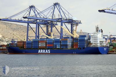
CINZIA A
Container Ship
Current Trip
| Time Travelled | 1 day |
|---|---|
| Remaining Time | 1 day |
| Distance Travelled | 693.91 nm |
| Remaining Distance | 480.08 nm |
| AVG Speed | 16.1 Knots |
| MAX Speed | 17.1 Knots |
| AVG Wind | 10.4 knots |
| MAX Wind | 16 knots |
| MIN Temp | 16.9°C / 62.42°F |
| MAX Temp | 20.1°C / 68.18°F |
| Draught | 11.1 m |
| Position Received | 5 h, 1 m ago |
Current Position
| Longitude | 14.35662° |
|---|---|
| Latitude | 36.78135° |
| Status | Under way using engine |
| Speed | 16.1 Knots |
| Course | 119.2° |
| Area | Mediterranean Sea - Eastern Basin |
| Station | T-AIS |
| Position Received | 5 h, 1 m ago |
Info
Information
The current position of CINZIA A is in Mediterranean Sea - Eastern Basin with coordinates 36.78135° / 14.35662° as reported on 2024-05-13 18:50 by AIS to our vessel tracker app. The vessel's current speed is 16.1 Knots and is heading at the port of PIRAEUS. The estimated time of arrival as calculated by MyShipTracking vessel tracking app is 2024-05-15 03:42 LT
The vessel CINZIA A (IMO: 9226516, MMSI: 215421000) is a Container Ship that was built in 2001 ( 23 years old ). It's sailing under the flag of [MT] Malta.
In this page you can find informations about the vessels current position, last detected port calls, and current voyage information. If the vessels is not in coverage by AIS you will find the latest position.
The current position of CINZIA A is detected by our AIS receivers and we are not responsible for the reliability of the data. The last position was recorded while the vessel was in Coverage by the Ais receivers of our vessel tracking app.
The current draught of CINZIA A as reported by AIS is 11.1 meters
Weather
| Temperature | 19°C / 66.2°F |
|---|---|
| Wind Speed | 11 knots |
| Direction | 177° S |
| Pressure | 1012.8 hPa |
| Humidity | 86.9 % |
| Cloud Coverage | 11 % |
Featured Company
Last Port Calls
| Port | Arrival | Departure | Time In Port |
|---|---|---|---|
| 2024-05-10 22:20 | 2024-05-12 03:22 | 1 d | |
| 2024-05-09 16:16 | 2024-05-10 09:04 | 16 h | |
| 2024-05-08 12:53 | 2024-05-09 12:03 | 23 h | |
| 2024-05-06 08:44 | 2024-05-07 01:32 | 16 h | |
| 2024-05-01 21:40 | 2024-05-02 19:46 | 22 h | |
| 2024-04-30 00:51 | 2024-04-30 21:04 | 20 h | |
| 2024-04-29 07:17 | 2024-04-29 19:20 | 12 h | |
| 2024-04-28 14:06 | 2024-04-29 03:28 | 13 h | |
| 2024-04-26 00:41 | 2024-04-26 19:56 | 19 h | |
| 2024-04-21 09:41 | 2024-04-22 04:06 | 18 h |
Last Trips
| Origin | Departure | Destination | Arrival | Distance | |
|---|---|---|---|---|---|
| 2024-05-10 11:04 | 2024-05-11 00:20 | 141.28 nm | |||
| 2024-05-09 14:03 | 2024-05-09 18:16 | 43.64 nm | |||
| 2024-05-07 03:32 | 2024-05-08 14:53 | 360.25 nm | |||
| 2024-05-02 22:46 | 2024-05-06 10:44 | 1310.46 nm | |||
| 2024-05-01 00:04 | 2024-05-02 00:40 | 301.53 nm | |||
| 2024-04-29 22:20 | 2024-04-30 03:51 | 69.44 nm | |||
| 2024-04-29 06:28 | 2024-04-29 10:17 | 44.63 nm | |||
| 2024-04-26 22:56 | 2024-04-28 17:06 | 354.24 nm | |||
| 2024-04-22 06:06 | 2024-04-26 03:41 | 1209.83 nm | |||
| 2024-04-20 22:48 | 2024-04-21 11:41 | 134.83 nm |
Events
| Time | Event | Details | Position / Dest | Info |
|---|---|---|---|---|
| 2024-05-13 18:53 | Status Changed | Default Under way using engine |
36.77445 / 14.37214
GRPIR
|
Speed: 16.1 kn Course: 119.2° |
| 2024-05-13 18:50 | OUT of Coverage |
36.78135 / 14.35662
Mediterranean Sea - Eastern Basin
GRPIR
|
Speed: 16.1 kn Course: 119.2° |
|
| 2024-05-13 17:22 | Status Changed | Under way using engine Default |
36.96614 / 13.92839
GRPIR
|
Speed: 15 kn Course: 119° |
| 2024-05-13 17:17 | Status Changed | Default Under way using engine |
36.97666 / 13.90333
GRPIR
|
Speed: 15.9 kn Course: 119.5° |
| 2024-05-13 16:32 | Status Changed | Under way using engine Default |
37.07254 / 13.68972
GRPIR
|
Speed: 15.9 kn Course: 116° |
| 2024-05-13 16:25 | IN Coverage |
37.07254 / 13.68972
Mediterranean Sea - Eastern Basin
GRPIR
|
Speed: 15.9 kn Course: 116.8° |
|
| 2024-05-13 12:30 | Status Changed | Default Under way using engine |
37.49207 / 12.47469
GRPIR
|
Speed: 16.2 kn Course: 130.3° |
| 2024-05-13 12:26 | OUT of Coverage |
37.50326 / 12.45876
Mediterranean Sea - Eastern Basin
GRPIR
|
Speed: 16.2 kn Course: 130.3° |
|
| 2024-05-13 12:26 | Status Changed | Under way using engine Default |
37.50360 / 12.45826
GRPIR
|
Speed: 16.2 kn Course: 131° |
| 2024-05-13 12:10 | Status Changed | Default Under way using engine |
37.55099 / 12.38817
GRPIR
|
Speed: 16.4 kn Course: 128.6° |