
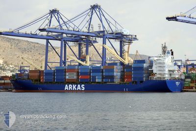
CINZIA A
Container Ship
Current Trip
| Time Travelled | 2 days |
|---|---|
| Remaining Time | 1 day |
| Distance Travelled | 772.63 морская миля |
| Remaining Distance | 483.09 морская миля |
| AVG Speed | 15.3 Узлы |
| MAX Speed | 16.4 Узлы |
| AVG Wind | 16.5 knots |
| MAX Wind | 25.9 knots |
| MIN Temp | 10.1°C / 50.18°F |
| MAX Temp | 15.7°C / 60.26°F |
| Осадка | 11.7 м |
| Позиция Получена | 6 h, 53 m тому назад |
Current Position
| Долгота | 14.90112° |
|---|---|
| Широта | 36.60920° |
| Статус | Under way using engine |
| Скорость | 15 Узлы |
| Курс | 96.6° |
| Район | Mediterranean Sea - Eastern Basin |
| Станция | T-AIS |
| Позиция Получена | 6 h, 53 m тому назад |
Info
Information
The current position of CINZIA A is in Mediterranean Sea - Eastern Basin with coordinates 36.60920° / 14.90112° as reported on 2024-04-24 01:09 by AIS to our vessel tracker app. The vessel's current speed is 15 Узлы and is heading at the port of PIRAEUS. The estimated time of arrival as calculated by MyShipTracking vessel tracking app is 2024-04-25 11:07 LT
The vessel CINZIA A (IMO: 9226516, MMSI: 215421000) is a Container Ship that was built in 2001 ( 23 лет ). It's sailing under the flag of [MT] Malta.
In this page you can find informations about the vessels current position, last detected port calls, and current voyage information. If the vessels is not in coverage by AIS you will find the latest position.
The current position of CINZIA A is detected by our AIS receivers and we are not responsible for the reliability of the data. The last position was recorded while the vessel was in Coverage by the Ais receivers of our vessel tracking app.
The current draught of CINZIA A as reported by AIS is 11.7 meters
Weather
| Temperature | 15.8°C / 60.44°F |
|---|---|
| Wind Speed | 15 knots |
| Direction | 269° W |
| Pressure | 1012 hPa |
| Humidity | 60.2 % |
| Cloud Coverage | --- |
Featured Company
Last Port Calls
| Port | Arrival | Departure | Time In Port |
|---|---|---|---|
| 2024-04-21 09:41 | 2024-04-22 04:06 | 18 h | |
| 2024-04-19 23:20 | 2024-04-20 20:48 | 21 h | |
| 2024-04-18 03:29 | 2024-04-19 20:10 | 1 d | |
| 2024-04-15 14:30 | 2024-04-16 12:51 | 22 h | |
| 2024-04-10 21:16 | 2024-04-12 04:02 | 1 d | |
| 2024-04-08 23:46 | 2024-04-09 22:04 | 22 h | |
| 2024-04-07 17:19 | 2024-04-08 01:34 | 8 h | |
| 2024-04-06 14:04 | 2024-04-07 12:17 | 22 h | |
| 2024-04-04 17:37 | 2024-04-05 11:50 | 18 h | |
| 2024-03-31 07:33 | 2024-04-01 08:05 | 1 d |
Last Trips
| Origin | Departure | Destination | Arrival | Distance | |
|---|---|---|---|---|---|
| 2024-04-20 22:48 | 2024-04-21 11:41 | 134.83 морская миля | |||
| 2024-04-19 22:10 | 2024-04-20 01:20 | 42.77 морская миля | |||
| 2024-04-16 14:51 | 2024-04-18 05:29 | 359.29 морская миля | |||
| 2024-04-12 07:02 | 2024-04-15 16:30 | 1317.42 морская миля | |||
| 2024-04-10 01:04 | 2024-04-11 00:16 | 313.44 морская миля | |||
| 2024-04-08 04:34 | 2024-04-09 02:46 | 88.89 морская миля | |||
| 2024-04-07 15:17 | 2024-04-07 20:19 | 46.84 морская миля | |||
| 2024-04-05 14:50 | 2024-04-06 17:04 | 353.82 морская миля | |||
| 2024-04-01 10:05 | 2024-04-04 20:37 | 1173.60 морская миля | |||
| 2024-03-29 10:01 | 2024-03-31 09:33 | 247.63 морская миля |
Events
| Время | Событие | Детали | Позиция / Направление | Информация |
|---|---|---|---|---|
| 2024-04-24 01:17 | Статус изменился | Default Under way using engine |
36.60606 / 14.94227
GRPIR
|
Скорость: 15 kn Курс: 96.6° |
| 2024-04-24 01:09 | Статус изменился | Under way using engine Default |
36.60920 / 14.90112
GRPIR
|
Скорость: 14.9 kn Курс: 95° |
| 2024-04-24 01:09 | Вне покрытия |
36.60920 / 14.90112
Mediterranean Sea - Eastern Basin
GRPIR
|
Скорость: 15 kn Курс: 96.6° |
|
| 2024-04-24 01:00 | Статус изменился | Default Under way using engine |
36.61280 / 14.85546
GRPIR
|
Скорость: 14.9 kn Курс: 93.1° |
| 2024-04-23 20:56 | Статус изменился | Under way using engine Default |
37.06418 / 13.68910
GRPIR
|
Скорость: 15.4 kn Курс: 118° |
| 2024-04-23 20:56 | В покрытии |
37.06203 / 13.69385
Mediterranean Sea - Eastern Basin
GRPIR
|
Скорость: 15.6 kn Курс: 120.6° |
|
| 2024-04-23 16:52 | Статус изменился | Default Under way using engine |
37.45835 / 12.49890
GRPIR
|
Скорость: 15.6 kn Курс: 133.7° |
| 2024-04-23 16:44 | Вне покрытия |
37.47981 / 12.46639
Mediterranean Sea - Eastern Basin
GRPIR
|
Скорость: 15.6 kn Курс: 133.7° |
|
| 2024-04-23 16:39 | Статус изменился | Under way using engine Default |
37.49525 / 12.44459
GRPIR
|
Скорость: 15 kn Курс: 132° |
| 2024-04-23 16:26 | Статус изменился | Default Under way using engine |
37.53167 / 12.38833
GRPIR
|
Скорость: 15.5 kn Курс: 135.3° |