
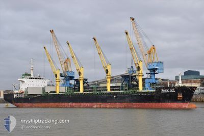
CHINTANA NAREE
Bulk Carrier
Current Trip
| Time Travelled | 4 days |
|---|---|
| Remaining Time | --- |
| Distance Travelled | 1134.82 nm |
| Remaining Distance | --- |
| AVG Speed | 10.4 Knots |
| MAX Speed | 12.7 Knots |
| AVG Wind | 7.4 knots |
| MAX Wind | 17.1 knots |
| MIN Temp | 24°C / 75.2°F |
| MAX Temp | 28.9°C / 84.02°F |
| Draught | 10.4 m |
| Position Received | 1 d ago |
Current Position
| Longitude | --- |
|---|---|
| Latitude | --- |
| Status | Under way using engine |
| Speed | 11.2 Knots |
| Course | 295.4° |
| Area | Malacca Strait |
| Station | T-AIS |
| Position Received | 1 d ago |
Info
Information
The current position of CHINTANA NAREE is in Malacca Strait with coordinates 1.91930° / 102.34584° as reported on 2024-11-07 14:25 by AIS to our vessel tracker app. The vessel's current speed is 11.2 Knots and is heading at the port of GIBRALTAR. The estimated time of arrival as calculated by MyShipTracking vessel tracking app is 2024-12-15 09:00 LT
The vessel CHINTANA NAREE (IMO: 9464039, MMSI: 566699000) is a Bulk Carrier that was built in 2013 ( 11 years old ). It's sailing under the flag of [SG] Singapore.
In this page you can find informations about the vessels current position, last detected port calls, and current voyage information. If the vessels is not in coverage by AIS you will find the latest position.
The current position of CHINTANA NAREE is detected by our AIS receivers and we are not responsible for the reliability of the data. The last position was recorded while the vessel was in Coverage by the Ais receivers of our vessel tracking app.
The current draught of CHINTANA NAREE as reported by AIS is 10.4 meters
Weather
| Temperature | 28.3°C / 82.94°F |
|---|---|
| Wind Speed | 6 knots |
| Direction | 43° NE |
| Pressure | 1011.2 hPa |
| Humidity | 74.6 % |
| Cloud Coverage | 100 % |
Featured Company
Last Port Calls
| Port | Arrival | Departure | Time In Port |
|---|---|---|---|
| 2024-11-01 07:45 | 2024-11-04 17:43 | 3 d | |
| 2024-10-10 04:45 | 2024-10-13 15:01 | 3 d | |
| 2024-10-03 10:09 | 2024-10-06 06:49 | 2 d | |
| 2024-09-28 05:53 | 2024-10-01 06:37 | 3 d | |
| 2024-09-26 07:03 | 2024-09-26 22:11 | 15 h | |
| 2024-09-24 06:14 | 2024-09-25 16:01 | 1 d | |
| 2024-09-18 13:25 | 2024-09-19 17:46 | 1 d | |
| 2024-09-01 18:53 |
Most Visited Ports (Last year)
| Port | Arrivals | |
|---|---|---|
| 2 | ||
| 2 | ||
| 2 | ||
| 1 | ||
| 1 | ||
| 1 |
Last Trips
| Origin | Departure | Destination | Arrival | Distance | |
|---|---|---|---|---|---|
| 2024-10-13 15:01 | 2024-11-01 07:45 | 2869.77 nm | |||
| 2024-10-06 06:49 | 2024-10-10 04:45 | 538.00 nm | |||
| 2024-10-01 06:37 | 2024-10-03 10:09 | 325.71 nm | |||
| 2024-09-26 22:11 | 2024-09-28 05:53 | 327.61 nm | |||
| 2024-09-25 16:01 | 2024-09-26 07:03 | 40.18 nm | |||
| 2024-09-19 17:46 | 2024-09-24 06:14 | 705.23 nm | |||
| 2024-09-01 18:53 | 2024-09-18 13:25 | 3914.75 nm |
Events
| Time | Event | Details | Position / Dest | Info |
|---|---|---|---|---|
| 2024-11-07 14:32 | Status Changed | Default Under way using engine |
1.92730 / 102.32692
GIBRALTAR
|
Speed: 11.2 kn Course: 295.4° |
| 2024-11-07 14:25 | OUT of Coverage |
1.91930 / 102.34584
Malacca Strait
|
Speed: 11.2 kn Course: 295.4° |
|
| 2024-11-07 12:41 | Status Changed | Under way using engine Default |
1.77492 / 102.64866
GIBRALTAR
|
Speed: 12.4 kn Course: 295° |
| 2024-11-07 12:28 | Status Changed | Default Under way using engine |
1.75646 / 102.68980
GIBRALTAR
|
Speed: 12.4 kn Course: 296.4° |
| 2024-11-07 12:21 | Status Changed | Under way using engine Default |
1.74650 / 102.71344
GIBRALTAR
|
Speed: 12.7 kn Course: 287° |
| 2024-11-07 12:08 | Status Changed | Default Under way using engine |
1.73207 / 102.75389
GIBRALTAR
|
Speed: 12.5 kn Course: 296.8° |
| 2024-11-07 12:08 | Status Changed | Under way using engine Default |
1.73106 / 102.75603
GIBRALTAR
|
Speed: 12.4 kn Course: 293° |
| 2024-11-07 12:04 | Status Changed | Default Under way using engine |
1.72697 / 102.76601
GIBRALTAR
|
Speed: 12.4 kn Course: 289.1° |
| 2024-11-07 11:53 | Status Changed | Under way using engine Default |
1.71219 / 102.80090
GIBRALTAR
|
Speed: 12.3 kn Course: 296° |
| 2024-11-07 11:48 | Status Changed | Default Under way using engine |
1.70588 / 102.81746
GIBRALTAR
|
Speed: 12.2 kn Course: 287° |