
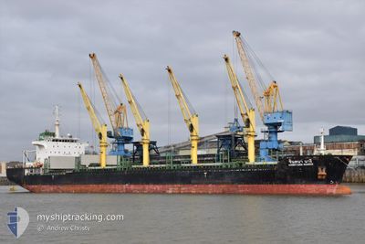
CHINTANA NAREE
Bulk Carrier
Current Trip
| Trip Time | 3 days |
|---|---|
| Trip Distance | 708.27 nm |
| AVG Speed | 10.1 Knots |
| MAX Speed | 13.3 Knots |
| Dybgang | 8.9 m |
| AVG Wind | 17.9 knots |
| MAX Wind | 24 knots |
| MIN Temp | 14.7°C / 58.46°F |
| MAX Temp | 19.4°C / 66.92°F |
| Position Modtaget | 4 d siden |
Current Position
| Longitude | 150.98026° |
|---|---|
| Latitude | -34.37637° |
| Status | Under way using engine |
| Fart | 8.1 Knots |
| Kurs | 214.9° |
| Område | Tasman Sea |
| Station | T-AIS |
| Position Modtaget | 4 d siden |
Info
Information
The current position of CHINTANA NAREE is in Tasman Sea with coordinates -34.37637° / 150.98026° as reported on 2024-04-21 05:29 by AIS to our vessel tracker app. The vessel's current speed is 8.1 Knots and is currently inside the port of PORT KEMBLA.
The vessel CHINTANA NAREE (IMO: 9464039, MMSI: 566699000) is a Bulk Carrier that was built in 2013 ( 11 år gamle ). It's sailing under the flag of [SG] Singapore.
In this page you can find informations about the vessels current position, last detected port calls, and current voyage information. If the vessels is not in coverage by AIS you will find the latest position.
The current position of CHINTANA NAREE is detected by our AIS receivers and we are not responsible for the reliability of the data. The last position was recorded while the vessel was in Coverage by the Ais receivers of our vessel tracking app.
The current draught of CHINTANA NAREE as reported by AIS is 8.9 meters
Weather
| Temperature | 15.6°C / 60.08°F |
|---|---|
| Wind Speed | 12 knots |
| Direction | 226° SW |
| Pressure | 1021.9 hPa |
| Humidity | 68.3 % |
| Cloud Coverage | 2 % |
Featured Company
Last Port Calls
| Port | Arrival | Departure | Time In Port |
|---|---|---|---|
| 2024-04-21 06:15 | |||
| 2024-04-16 11:26 | 2024-04-18 00:12 | 1 d | |
| 2024-04-11 01:41 | 2024-04-12 20:49 | 1 d | |
| 2024-03-11 17:49 | 2024-03-16 05:43 | 4 d | |
| 2024-03-07 03:11 | 2024-03-07 19:32 | 16 h | |
| 2024-02-29 13:36 |
Most Visited Ports (Last year)
| Port | Arrivals | |
|---|---|---|
| 2 | ||
| 1 | ||
| 1 | ||
| 1 | ||
| 1 | ||
| 1 |
Last Trips
| Origin | Departure | Destination | Arrival | Distance | |
|---|---|---|---|---|---|
| 2024-04-18 10:12 | 2024-04-21 16:15 | 708.27 nm | |||
| 2024-04-13 06:19 | 2024-04-16 21:26 | 415.54 nm | |||
| 2024-03-16 09:43 | 2024-04-11 11:11 | 6422.06 nm | |||
| 2024-03-07 23:32 | 2024-03-11 21:49 | 215.46 nm | |||
| 2024-02-29 19:06 | 2024-03-07 07:11 | 934.60 nm |
Events
| Tid | Hændelsen | Detaljer | Position / Dest | Info |
|---|---|---|---|---|
| 2024-04-21 06:39 | STOP Sejllads |
-34.45298 / 150.89632
[AU] PORT KEMBLA
|
Fart: Kurs: 356° |
|
| 2024-04-21 06:15 | Skibe i havn |
|
-34.46580 / 150.90558
[AU] PORT KEMBLA
|
Fart: 8.4 kn Kurs: 212° |
| 2024-04-21 05:35 | Status er ændret | Default Under way using engine |
-34.38849 / 150.97080
AU PKL
|
Fart: 8.1 kn Kurs: 214.9° |
| 2024-04-21 05:29 | Udenfor Dækning |
-34.37637 / 150.98026
Tasman Sea
[AU] PORT KEMBLA
|
Fart: 8.1 kn Kurs: 214.9° |
|
| 2024-04-21 05:14 | Status er ændret | Under way using engine Default |
-34.34389 / 151.00622
AU PKL
|
Fart: 11.9 kn Kurs: 231° |
| 2024-04-21 04:55 | Status er ændret | Default Under way using engine |
-34.30790 / 151.06979
AU PKL
|
Fart: 11.8 kn Kurs: 240.8° |
| 2024-04-21 04:50 | Status er ændret | Under way using engine Default |
-34.30157 / 151.08524
AU PKL
|
Fart: 11.8 kn Kurs: 249° |
| 2024-04-21 04:43 | Status er ændret | Default Under way using engine |
-34.29141 / 151.11198
AU PKL
|
Fart: 11.3 kn Kurs: 245.6° |
| 2024-04-21 04:12 | START Sejllads | 10.72 nm, South of BUNDEENA |
-34.25723 / 151.19539
AU PKL
|
Fart: 3.2 kn Kurs: 123° |
| 2024-04-21 03:55 | Status er ændret | Under way using engine Default |
-34.26170 / 151.19293
AU PKL
|
Fart: 0.6 kn Kurs: 89° |