
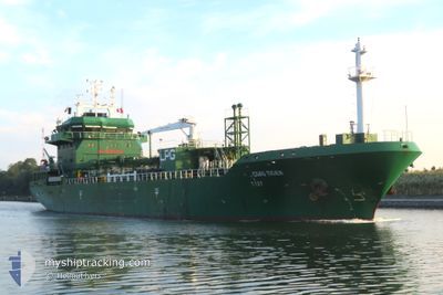
CGAS TIGER
Lpg Tanker
Current Trip
| Time Travelled | 1 day |
|---|---|
| Remaining Time | 17 h, 34 mins |
| Distance Travelled | 539.20 nm |
| Remaining Distance | 193.08 nm |
| AVG Speed | 12.9 Knots |
| MAX Speed | 15.4 Knots |
| AVG Wind | 16.1 knots |
| MAX Wind | 34 knots |
| MIN Temp | 8°C / 46.4°F |
| MAX Temp | 11.3°C / 52.34°F |
| Draught | 5.8 m |
| Position Received | 1 m ago |
Current Position
| Longitude | --- |
|---|---|
| Latitude | --- |
| Status | Under way using engine |
| Speed | 10.6 Knots |
| Course | 139.1° |
| Area | North Sea |
| Station | T-AIS |
| Position Received | 1 m ago |
Info
Information
The current position of CGAS TIGER is in North Sea with coordinates 57.60305° / -1.20203° as reported on 2025-12-12 12:09 by AIS to our vessel tracker app. The vessel's current speed is 10.6 Knots and is heading at the port of TEES. The estimated time of arrival as calculated by MyShipTracking vessel tracking app is 2025-12-13 05:44 LT
The vessel CGAS TIGER (IMO: 9577991, MMSI: 249224000) is a Lpg Tanker that was built in 2012 ( 13 years old ). It's sailing under the flag of [MT] Malta.
In this page you can find informations about the vessels current position, last detected port calls, and current voyage information. If the vessels is not in coverage by AIS you will find the latest position.
The current position of CGAS TIGER is detected by our AIS receivers and we are not responsible for the reliability of the data. The last position was recorded while the vessel was in Coverage by the Ais receivers of our vessel tracking app.
The current draught of CGAS TIGER as reported by AIS is 5.8 meters
Weather
| Temperature | 9.5°C / 49.1°F |
|---|---|
| Wind Speed | 18 knots |
| Direction | 210° SSW |
| Pressure | 1010.9 hPa |
| Humidity | 78.1 % |
| Cloud Coverage | 100 % |
Featured Company
Last Port Calls
| Port | Arrival | Departure | Time In Port |
|---|---|---|---|
| 2025-12-08 20:43 | 2025-12-10 18:08 | 1 d | |
| 2025-12-05 09:00 | 2025-12-06 11:24 | 1 d | |
| 2025-12-02 10:55 | 2025-12-02 22:35 | 11 h | |
| 2025-11-29 12:20 | 2025-11-29 21:57 | 9 h | |
| 2025-11-25 13:24 | 2025-11-26 16:26 | 1 d | |
| 2025-11-20 13:34 | 2025-11-22 15:16 | 2 d | |
| 2025-11-16 06:04 | 2025-11-17 18:33 | 1 d | |
| 2025-11-12 11:07 | 2025-11-13 12:56 | 1 d | |
| 2025-10-28 11:42 | 2025-10-29 18:27 | 1 d | |
| 2025-10-25 01:46 | 2025-10-25 20:31 | 18 h |
Most Visited Ports (Last year)
| Port | Arrivals | |
|---|---|---|
| 11 | ||
| 9 | ||
| 8 | ||
| 7 | ||
| 5 | ||
| 4 |
Last Trips
| Origin | Departure | Destination | Arrival | Distance | |
|---|---|---|---|---|---|
| 2025-12-06 11:24 | 2025-12-08 20:43 | 604.74 nm | |||
| 2025-12-02 22:35 | 2025-12-05 09:00 | 709.78 nm | |||
| 2025-11-29 21:57 | 2025-12-02 10:55 | 642.26 nm | |||
| 2025-11-26 16:26 | 2025-11-29 12:20 | 684.20 nm | |||
| 2025-11-22 15:16 | 2025-11-25 13:24 | 872.23 nm | |||
| 2025-11-17 18:33 | 2025-11-20 13:34 | 502.69 nm | |||
| 2025-11-13 12:56 | 2025-11-16 06:04 | 449.37 nm | |||
| 2025-10-29 18:27 | 2025-11-12 11:07 | 832.13 nm | |||
| 2025-10-25 20:31 | 2025-10-28 11:42 | 608.63 nm | |||
| 2025-10-19 11:39 | 2025-10-25 01:46 | 997.15 nm |
Events
| Time | Event | Details | Position / Dest | Info |
|---|---|---|---|---|
| 2025-12-12 11:40 | Status Changed | Under way using engine Default |
57.67127 / -1.31348
GB TEE
|
Speed: 10.2 kn Course: 138° |
| 2025-12-12 11:39 | Status Changed | Default Under way using engine |
57.67270 / -1.31588
GB TEE
|
Speed: 11.1 kn Course: 137.9° |
| 2025-12-12 10:50 | ETA Changed | 2025/12/13 02:30 2025/12/13 04:30 |
57.76980 / -1.50805
GB TEE
|
Speed: 9.8 kn Course: 142.9° |
| 2025-12-12 10:05 | Status Changed | Under way using engine Default |
57.87355 / -1.66805
GB TEE
|
Speed: 10.7 kn Course: 139° |
| 2025-12-12 09:59 | Status Changed | Default Under way using engine |
57.88810 / -1.69067
GB TEE
|
Speed: 10.4 kn Course: 140.1° |
| 2025-12-12 09:33 | Status Changed | Under way using engine Default |
57.95152 / -1.78660
GB TEE
|
Speed: 12.5 kn Course: 141° |
| 2025-12-12 09:33 | IN Coverage |
57.95152 / -1.78660
North Sea
GB TEE
|
Speed: 12.3 kn Course: 140.6° |
|
| 2025-12-12 06:23 | Status Changed | Default Under way using engine |
58.43418 / -2.57863
GB TEE
|
Speed: 12.4 kn Course: 135.6° |
| 2025-12-12 06:18 | OUT of Coverage |
58.44770 / -2.60368
North Sea
GB TEE
|
Speed: 12.4 kn Course: 135.6° |
|
| 2025-12-12 05:49 | Status Changed | Under way using engine Default |
58.51773 / -2.73432
GB TEE
|
Speed: 12.9 kn Course: 136° |