
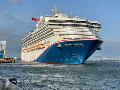
CARNIVAL SUNSHINE
Passengers Ship
Current Trip
| Time Travelled | 14 h, 35 mins |
|---|---|
| Remaining Time | --- |
| Distance Travelled | 130.86 nm |
| Remaining Distance | --- |
| AVG Speed | 19 Knots |
| MAX Speed | 20 Knots |
| AVG Wind | 12.8 knots |
| MAX Wind | 15 knots |
| MIN Temp | 25.9°C / 78.62°F |
| MAX Temp | 27.3°C / 81.14°F |
| Draught | 8.6 m |
| Position Received | 1 d ago |
Current Position
| Longitude | --- |
|---|---|
| Latitude | --- |
| Status | Under way using engine |
| Speed | 16.3 Knots |
| Course | 125.3° |
| Area | North Atlantic Ocean |
| Station | T-AIS |
| Position Received | 1 d ago |
Info
Information
The current position of CARNIVAL SUNSHINE is in North Atlantic Ocean with coordinates 21.86834° / -71.51290° as reported on 2025-12-03 12:44 by AIS to our vessel tracker app. The vessel's current speed is 16.3 Knots
The vessel CARNIVAL SUNSHINE (IMO: 9070058, MMSI: 308017000) is a Passengers Ship that was built in 1996 ( 29 years old ). It's sailing under the flag of [BS] Bahamas.
In this page you can find informations about the vessels current position, last detected port calls, and current voyage information. If the vessels is not in coverage by AIS you will find the latest position.
The current position of CARNIVAL SUNSHINE is detected by our AIS receivers and we are not responsible for the reliability of the data. The last position was recorded while the vessel was in Coverage by the Ais receivers of our vessel tracking app.
The current draught of CARNIVAL SUNSHINE as reported by AIS is 8.6 meters
Weather
| Temperature | 26.6°C / 79.88°F |
|---|---|
| Wind Speed | 11 knots |
| Direction | 66° ENE |
| Pressure | 1017.1 hPa |
| Humidity | 78.8 % |
| Cloud Coverage | 13 % |
Featured Company
Last Port Calls
| Port | Arrival | Departure | Time In Port |
|---|---|---|---|
| 2025-12-04 07:29 | 2025-12-04 17:03 | 9 h | |
| 2025-12-03 10:20 | 2025-12-03 17:54 | 7 h | |
| 2025-12-02 07:28 | 2025-12-02 15:59 | 8 h | |
| 2025-11-29 05:37 | 2025-11-29 18:11 | 12 h | |
| 2025-11-26 07:30 | 2025-11-26 17:07 | 9 h | |
| 2025-11-25 10:21 | 2025-11-25 18:22 | 8 h | |
| 2025-11-24 07:27 | 2025-11-24 16:04 | 8 h | |
| 2025-11-21 05:19 | 2025-11-21 18:29 | 13 h | |
| 2025-11-18 07:25 | 2025-11-18 16:14 | 8 h | |
| 2025-11-17 14:03 | 2025-11-17 21:10 | 7 h |
Most Visited Ports (Last year)
| Port | Arrivals | |
|---|---|---|
| 43 | ||
| 21 | ||
| 21 | ||
| 19 | ||
| 16 | ||
| 10 |
Last Trips
| Origin | Departure | Destination | Arrival | Distance | |
|---|---|---|---|---|---|
| 2025-12-03 17:54 | 2025-12-04 07:29 | 128.58 nm | |||
| 2025-12-02 15:59 | 2025-12-03 10:20 | 336.12 nm | |||
| 2025-11-29 18:11 | 2025-12-02 07:28 | 779.18 nm | |||
| 2025-11-26 17:07 | 2025-11-29 05:37 | 1100.89 nm | |||
| 2025-11-25 18:22 | 2025-11-26 07:30 | 118.96 nm | |||
| 2025-11-24 16:04 | 2025-11-25 10:21 | 335.81 nm | |||
| 2025-11-21 18:29 | 2025-11-24 07:27 | 783.23 nm | |||
| 2025-11-18 16:14 | 2025-11-21 05:19 | 970.53 nm | |||
| 2025-11-17 21:10 | 2025-11-18 07:25 | 155.95 nm | |||
| 2025-11-15 17:51 | 2025-11-17 14:03 | 801.43 nm |
Events
| Time | Event | Details | Position / Dest | Info |
|---|---|---|---|---|
| 2025-12-04 21:03 | PORT DEPARTURE |
|
19.85563 / -70.76058
USORF>BSHMC
|
Speed: 4 kn Course: 31° |
| 2025-12-04 20:54 | START Moving |
19.83700 / -70.77334
[DO] AMBER COVE
|
Speed: 4 kn Course: 31° |
|
| 2025-12-04 11:38 | STOP Moving |
19.83500 / -70.77500
[DO] AMBER COVE
|
Speed: Course: -1° |
|
| 2025-12-04 11:29 | PORT ARRIVAL |
|
19.83667 / -70.77333
[DO] AMBER COVE
|
Speed: 2.1 kn Course: 31° |
| 2025-12-03 22:54 | START Moving | 0.59 nm, West of GRAND TURK |
21.42833 / -71.15833
USORF>BSHMC
|
Speed: 6 kn Course: -1° |
| 2025-12-03 22:54 | PORT DEPARTURE |
|
21.42833 / -71.15833
USORF>BSHMC
|
Speed: 1 kn Course: -1° |
| 2025-12-03 15:26 | STOP Moving |
21.42833 / -71.14667
[TC] GRAND TURK
|
Speed: Course: -1° |
|
| 2025-12-03 15:20 | PORT ARRIVAL |
|
21.42833 / -71.14667
[TC] GRAND TURK
|
Speed: 2 kn Course: -1° |
| 2025-12-03 12:47 | Status Changed | Default Under way using engine |
21.85976 / -71.49983
USORF>BSHMC
|
Speed: 16.3 kn Course: 125.3° |
| 2025-12-03 12:44 | OUT of Coverage |
21.86834 / -71.51290
North Atlantic Ocean
|
Speed: 16.3 kn Course: 125.3° |