
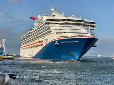
CARNIVAL SUNSHINE
Passengers Ship
Current Trip
USORF>BHGBI
| Time Travelled | 2 days |
|---|---|
| Remaining Time | --- |
| Distance Travelled | 836.97 морская миля |
| Remaining Distance | --- |
| AVG Speed | 16.2 Узлы |
| MAX Speed | 22 Узлы |
| AVG Wind | 14.4 knots |
| MAX Wind | 22.5 knots |
| MIN Temp | 6.1°C / 42.98°F |
| MAX Temp | 23.6°C / 74.48°F |
| Осадка | 8.6 м |
| Позиция Получена | 1 m тому назад |
Current Position
| Долгота | --- |
|---|---|
| Широта | --- |
| Статус | Under way using engine |
| Скорость | 9.8 Узлы |
| Курс | 95.9° |
| Район | North Atlantic Ocean |
| Станция | T-AIS |
| Позиция Получена | 1 m тому назад |
Info
Information
The current position of CARNIVAL SUNSHINE is in North Atlantic Ocean with coordinates 25.72375° / -77.28710° as reported on 2025-12-10 09:16 by AIS to our vessel tracker app. The vessel's current speed is 9.8 Узлы
The vessel CARNIVAL SUNSHINE (IMO: 9070058, MMSI: 308017000) is a Passengers Ship that was built in 1996 ( 29 лет ). It's sailing under the flag of [BS] Bahamas.
In this page you can find informations about the vessels current position, last detected port calls, and current voyage information. If the vessels is not in coverage by AIS you will find the latest position.
The current position of CARNIVAL SUNSHINE is detected by our AIS receivers and we are not responsible for the reliability of the data. The last position was recorded while the vessel was in Coverage by the Ais receivers of our vessel tracking app.
The current draught of CARNIVAL SUNSHINE as reported by AIS is 8.6 meters
Weather
| Temperature | 23.6°C / 74.48°F |
|---|---|
| Wind Speed | 13 knots |
| Direction | 55° NE |
| Pressure | 1012.9 hPa |
| Humidity | 84.2 % |
| Cloud Coverage | 97 % |
Featured Company
Last Port Calls
| Port | Arrival | Departure | Time In Port |
|---|---|---|---|
| 2025-12-07 05:31 | 2025-12-07 17:51 | 12 h | |
| 2025-12-04 07:29 | 2025-12-04 17:03 | 9 h | |
| 2025-12-03 10:20 | 2025-12-03 17:54 | 7 h | |
| 2025-12-02 07:28 | 2025-12-02 15:59 | 8 h | |
| 2025-11-29 05:37 | 2025-11-29 18:11 | 12 h | |
| 2025-11-26 07:30 | 2025-11-26 17:07 | 9 h | |
| 2025-11-25 10:21 | 2025-11-25 18:22 | 8 h | |
| 2025-11-24 07:27 | 2025-11-24 16:04 | 8 h | |
| 2025-11-21 05:19 | 2025-11-21 18:29 | 13 h | |
| 2025-11-18 07:25 | 2025-11-18 16:14 | 8 h |
Most Visited Ports (Last year)
| Port | Arrivals | |
|---|---|---|
| 44 | ||
| 21 | ||
| 20 | ||
| 19 | ||
| 16 | ||
| 10 |
Last Trips
| Origin | Departure | Destination | Arrival | Distance | |
|---|---|---|---|---|---|
| 2025-12-04 17:03 | 2025-12-07 05:31 | 1103.75 морская миля | |||
| 2025-12-03 17:54 | 2025-12-04 07:29 | 128.58 морская миля | |||
| 2025-12-02 15:59 | 2025-12-03 10:20 | 336.12 морская миля | |||
| 2025-11-29 18:11 | 2025-12-02 07:28 | 779.18 морская миля | |||
| 2025-11-26 17:07 | 2025-11-29 05:37 | 1100.89 морская миля | |||
| 2025-11-25 18:22 | 2025-11-26 07:30 | 118.96 морская миля | |||
| 2025-11-24 16:04 | 2025-11-25 10:21 | 335.81 морская миля | |||
| 2025-11-21 18:29 | 2025-11-24 07:27 | 783.23 морская миля | |||
| 2025-11-18 16:14 | 2025-11-21 05:19 | 970.53 морская миля | |||
| 2025-11-17 21:10 | 2025-11-18 07:25 | 155.95 морская миля |
Events
| Время | Событие | Детали | Позиция / Направление | Информация |
|---|---|---|---|---|
| 2025-12-10 09:08 | Статус изменился | Under way using engine Default |
25.72837 / -77.31170
USORF>BHGBI
|
Скорость: 10 kn Курс: 104° |
| 2025-12-10 09:04 | Статус изменился | Default Under way using engine |
25.73035 / -77.32059
USORF>BHGBI
|
Скорость: 9.9 kn Курс: 104.8° |
| 2025-12-10 09:02 | Статус изменился | Under way using engine Default |
25.73217 / -77.32853
USORF>BHGBI
|
Скорость: 10 kn Курс: 106° |
| 2025-12-10 09:02 | В покрытии |
25.73217 / -77.32853
North Atlantic Ocean
|
Скорость: 9.9 kn Курс: 104.8° |
|
| 2025-12-10 07:35 | Статус изменился | Default Under way using engine |
25.82558 / -77.58370
USORF>BHGBI
|
Скорость: 10.2 kn Курс: 113.4° |
| 2025-12-10 07:30 | Вне покрытия |
25.83145 / -77.59862
North Atlantic Ocean
|
Скорость: 10.2 kn Курс: 113.4° |
|
| 2025-12-10 04:42 | Статус изменился | Under way using engine Default |
26.06098 / -78.04619
USORF>BHGBI
|
Скорость: 11 kn Курс: 145° |
| 2025-12-10 04:42 | В покрытии |
26.06098 / -78.04619
North Atlantic Ocean
|
Скорость: 10.6 kn Курс: 145.5° |
|
| 2025-12-09 23:31 | Начало движения | 15.55 nm, East of FREEPORT (BS) |
26.56638 / -78.48919
USORF>BHGBI
|
Скорость: 3.6 kn Курс: 34° |
| 2025-12-09 16:48 | Окончание движения | 15.6 nm, East of FREEPORT (BS) |
26.56829 / -78.48865
USORF>BHGBI
|
Скорость: 0.2 kn Курс: 31° |