
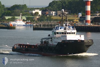
CARLO MAGNO
Anchor Handling Vessel
Current Trip
| Time Travelled | 1 day |
|---|---|
| Remaining Time | --- |
| Distance Travelled | 100.14 nm |
| Remaining Distance | --- |
| AVG Speed | 7.9 Knots |
| MAX Speed | 11 Knots |
| AVG Wind | 15.8 knots |
| MAX Wind | 17 knots |
| MIN Temp | 3°C / 37.4°F |
| MAX Temp | 6.5°C / 43.7°F |
| Draught | 5.7 m |
| Position Received | 1 m ago |
Current Position
| Longitude | --- |
|---|---|
| Latitude | --- |
| Status | Under way using engine |
| Speed | |
| Course | 332° |
| Area | Kattegat |
| Station | T-AIS |
| Position Received | 1 m ago |
Info
Information
The current position of CARLO MAGNO is in Kattegat with coordinates 55.67905° / 12.89436° as reported on 2025-03-03 04:57 by AIS to our vessel tracker app. The vessel's current speed is 0 Knots and is heading at the port of KAMARI. The estimated time of arrival as calculated by MyShipTracking vessel tracking app is 2025-03-02 03:30 LT
The vessel CARLO MAGNO (IMO: 9341251, MMSI: 247153600) is a Anchor Handling Vessel that was built in 2006 ( 19 years old ). It's sailing under the flag of [IT] Italy.
In this page you can find informations about the vessels current position, last detected port calls, and current voyage information. If the vessels is not in coverage by AIS you will find the latest position.
The current position of CARLO MAGNO is detected by our AIS receivers and we are not responsible for the reliability of the data. The last position was recorded while the vessel was in Coverage by the Ais receivers of our vessel tracking app.
The current draught of CARLO MAGNO as reported by AIS is 5.7 meters
Weather
| Temperature | 3.2°C / 37.76°F |
|---|---|
| Wind Speed | 15 knots |
| Direction | 266° W |
| Pressure | 1021.8 hPa |
| Humidity | 90.3 % |
| Cloud Coverage | 100 % |
Featured Company
Last Port Calls
| Port | Arrival | Departure | Time In Port |
|---|---|---|---|
| 2025-02-28 07:53 | 2025-03-01 17:03 | 1 d | |
| 2025-02-19 07:51 | 2025-02-21 19:37 | 2 d | |
| 2025-02-17 08:22 | 2025-02-18 07:18 | 22 h | |
| 2025-02-05 11:25 | 2025-02-16 09:06 | 10 d | |
| 2025-01-23 11:21 | 2025-01-31 11:48 | 8 d | |
| 2025-01-17 16:22 | 2025-01-20 14:56 | 2 d | |
| 2025-01-14 17:42 | 2025-01-14 22:13 | 4 h | |
| 2025-01-13 14:58 | 2025-01-14 14:24 | 23 h |
Most Visited Ports (Last year)
| Port | Arrivals | |
|---|---|---|
| 3 | ||
| 2 | ||
| 2 | ||
| 1 | ||
| 1 | ||
| 1 |
Last Trips
| Origin | Departure | Destination | Arrival | Distance | |
|---|---|---|---|---|---|
| 2025-02-21 20:37 | 2025-02-28 08:53 | 367.16 nm | |||
| 2025-02-18 08:18 | 2025-02-19 08:51 | 194.64 nm | |||
| 2025-02-16 10:06 | 2025-02-17 09:22 | 252.55 nm | |||
| 2025-01-31 11:48 | 2025-02-05 12:25 | 811.38 nm | |||
| 2025-01-20 15:56 | 2025-01-23 11:21 | 310.21 nm | |||
| 2025-01-14 23:13 | 2025-01-17 17:22 | 699.08 nm | |||
| 2025-01-14 15:24 | 2025-01-14 18:42 | 35.70 nm | |||
| 2024-12-15 07:50 | 2025-01-13 15:58 | 4689.01 nm |
Events
| Time | Event | Details | Position / Dest | Info |
|---|---|---|---|---|
| 2025-03-02 12:36 | STOP Moving | 4.88 nm, North West of MALMO |
55.67888 / 12.89396
KAMARINA POSITION
|
Speed: 0.2 kn Course: 352° |
| 2025-03-02 11:10 | START Moving | 3.7 nm, North West of KLAGSHAMN |
55.55084 / 12.79788
KAMARINA POSITION
|
Speed: 3.2 kn Course: 13° |
| 2025-03-02 03:11 | STOP Moving | 3.88 nm, North West of KLAGSHAMN |
55.55070 / 12.79199
KAMARINA POSITION
|
Speed: 0.3 kn Course: 21° |
| 2025-03-02 01:07 | Change Sea Area | Swedish part of the Kattegat Swedish part of the Baltic Sea |
55.34017 / 12.68757
Kattegat
KAMARINA POSITION
|
Speed: 7.5 kn Course: 6° |
| 2025-03-01 20:05 | ETA Changed | 2025/03/02 03:30 2025/03/02 07:00 |
55.22440 / 13.77816
KAMARINA POSITION
|
Speed: 10.2 kn Course: 272.3° |
| 2025-03-01 18:29 | Change Sea Area | Swedish part of the Baltic Sea Danish part of the Kattegat |
55.18259 / 14.26994
Baltic Sea
KAMARINA POSITION
|
Speed: 10.7 kn Course: 287° |
| 2025-03-01 17:03 | PORT DEPARTURE |
|
55.09536 / 14.67766
KAMARINA POSITION
|
Speed: 8.6 kn Course: 311° |
| 2025-03-01 16:59 | START Moving |
55.09000 / 14.68838
[DK] ROENNE
|
Speed: 3.6 kn Course: 284° |
|
| 2025-03-01 14:38 | STOP Moving |
55.08896 / 14.69253
[DK] ROENNE
|
Speed: 0.3 kn Course: 313° |
|
| 2025-03-01 14:24 | START Moving |
55.09640 / 14.69042
[DK] ROENNE
|
Speed: 5.6 kn Course: 255° |