
C HAMBURG
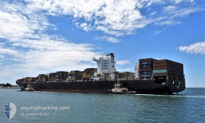
Container Ship
Current Trip
| Time Travelled | 12 days |
|---|---|
| Remaining Time | --- |
| Distance Travelled | 4837.28 nm |
| Remaining Distance | --- |
| AVG Speed | 17 Knots |
| MAX Speed | 21.5 Knots |
| AVG Wind | 14 knots |
| MAX Wind | 31 knots |
| MIN Temp | 13.4°C / 56.12°F |
| MAX Temp | 28.6°C / 83.48°F |
| Draught | 14.1 m |
| Position Received | 16 h, 19 m ago |
Current Position
| Longitude | 17.87441° |
|---|---|
| Latitude | -34.08282° |
| Status | Under way using engine |
| Speed | 18.7 Knots |
| Course | 322.3° |
| Area | South Atlantic Ocean |
| Station | T-AIS |
| Position Received | 16 h, 19 m ago |
Info
Information
The current position of C HAMBURG is in South Atlantic Ocean with coordinates -34.08282° / 17.87441° as reported on 2024-08-31 11:20 by AIS to our vessel tracker app. The vessel's current speed is 18.7 Knots and is heading at the port of LONDON. The estimated time of arrival as calculated by MyShipTracking vessel tracking app is 2024-09-14 12:00 LT
The vessel C HAMBURG (IMO: 9450375, MMSI: 636020327) is a Container Ship that was built in 2009 ( 15 years old ). It's sailing under the flag of [LR] Liberia.
In this page you can find informations about the vessels current position, last detected port calls, and current voyage information. If the vessels is not in coverage by AIS you will find the latest position.
The current position of C HAMBURG is detected by our AIS receivers and we are not responsible for the reliability of the data. The last position was recorded while the vessel was in Coverage by the Ais receivers of our vessel tracking app.
The current draught of C HAMBURG as reported by AIS is 14.1 meters
Weather
| Temperature | 14.5°C / 58.1°F |
|---|---|
| Wind Speed | 16 knots |
| Direction | 124° SE |
| Pressure | 1022.4 hPa |
| Humidity | 78.5 % |
| Cloud Coverage | --- |
Featured Company
Last Port Calls
| Port | Arrival | Departure | Time In Port |
|---|---|---|---|
| 2024-08-18 07:23 | 2024-08-20 07:27 | 2 d | |
| 2024-08-14 15:49 | 2024-08-15 20:51 | 1 d | |
| 2024-08-07 03:15 | 2024-08-08 05:06 | 1 d | |
| 2024-08-05 09:23 | 2024-08-06 09:39 | 1 d | |
| 2024-07-26 16:30 | 2024-07-29 07:57 | 2 d | |
| 2024-07-17 15:52 | 2024-07-18 22:31 | 1 d | |
| 2024-07-09 18:21 | 2024-07-12 15:59 | 2 d | |
| 2024-07-05 23:48 | 2024-07-08 02:31 | 2 d |
Last Trips
| Origin | Departure | Destination | Arrival | Distance | |
|---|---|---|---|---|---|
| 2024-08-15 20:51 | 2024-08-18 07:23 | 713.07 nm | |||
| 2024-08-08 05:06 | 2024-08-14 15:49 | 1624.30 nm | |||
| 2024-08-06 09:39 | 2024-08-07 03:15 | 12.25 nm | |||
| 2024-07-29 07:57 | 2024-08-05 09:23 | 2352.76 nm | |||
| 2024-07-18 22:31 | 2024-07-26 16:30 | 1462.85 nm | |||
| 2024-07-12 15:59 | 2024-07-17 15:52 | 986.21 nm | |||
| 2024-07-08 02:31 | 2024-07-09 18:21 | 602.65 nm | |||
| 2024-06-24 04:58 | 2024-07-05 23:48 | 4801.84 nm |
Events
| Time | Event | Details | Position / Dest | Info |
|---|---|---|---|---|
| 2024-08-31 11:24 | Status Changed | Default Under way using engine |
-34.06512 / 17.85765
LONDON
|
Speed: 18.7 kn Course: 322.3° |
| 2024-08-31 11:20 | OUT of Coverage |
-34.08282 / 17.87441
South Atlantic Ocean
LONDON
|
Speed: 18.7 kn Course: 322.3° |
|
| 2024-08-31 11:09 | Status Changed | Under way using engine Default |
-34.12653 / 17.91551
LONDON
|
Speed: 18.8 kn Course: 322° |
| 2024-08-31 11:08 | Status Changed | Default Under way using engine |
-34.13025 / 17.91900
LONDON
|
Speed: 18.8 kn Course: 323.4° |
| 2024-08-31 11:06 | Status Changed | Under way using engine Default |
-34.14062 / 17.92874
LONDON
|
Speed: 19 kn Course: 324° |
| 2024-08-31 10:52 | Status Changed | Default Under way using engine |
-34.19843 / 17.98253
LONDON
|
Speed: 18.8 kn Course: 320.2° |
| 2024-08-31 10:51 | Status Changed | Under way using engine Default |
-34.20176 / 17.98568
LONDON
|
Speed: 19.1 kn Course: 324° |
| 2024-08-31 10:44 | Status Changed | Default Under way using engine |
-34.23169 / 18.01418
LONDON
|
Speed: 19.2 kn Course: 322.7° |
| 2024-08-31 10:44 | Status Changed | Under way using engine Default |
-34.23259 / 18.01506
LONDON
|
Speed: 19.3 kn Course: 318° |
| 2024-08-31 10:40 | Status Changed | Default Under way using engine |
-34.24891 / 18.03091
LONDON
|
Speed: 19.1 kn Course: 322.5° |