
C HAMBURG
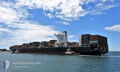
Container Ship
Current Trip
| Time Travelled | 9 days |
|---|---|
| Remaining Time | --- |
| Distance Travelled | 4393.43 nm |
| Remaining Distance | --- |
| AVG Speed | 18.6 Knopen |
| MAX Speed | 23.7 Knopen |
| AVG Wind | 13 knots |
| MAX Wind | 25 knots |
| MIN Temp | 15.8°C / 60.44°F |
| MAX Temp | 29.9°C / 85.82°F |
| Diepgang | 13.5 M |
| Positie ontvangen | 1 m geleden |
Current Position
| Lengtegraad | 17.73040° |
|---|---|
| Breedtegraat | -33.90610° |
| Status | Under way using engine |
| Snelheid | 19.7 Knopen |
| Koers | 325° |
| Gebied | South Atlantic Ocean |
| Station | T-AIS |
| Positie ontvangen | 1 m geleden |
Info
Information
The current position of C HAMBURG is in South Atlantic Ocean with coordinates -33.90610° / 17.73040° as reported on 2024-04-20 03:31 by AIS to our vessel tracker app. The vessel's current speed is 19.7 Knopen and is heading at the port of TANGER MED. The estimated time of arrival as calculated by MyShipTracking vessel tracking app is 2024-05-01 07:00 LT
The vessel C HAMBURG (IMO: 9450375, MMSI: 636020327) is a Container Ship that was built in 2009 ( 15 Jaar oud ). It's sailing under the flag of [LR] Liberia.
In this page you can find informations about the vessels current position, last detected port calls, and current voyage information. If the vessels is not in coverage by AIS you will find the latest position.
The current position of C HAMBURG is detected by our AIS receivers and we are not responsible for the reliability of the data. The last position was recorded while the vessel was in Coverage by the Ais receivers of our vessel tracking app.
The current draught of C HAMBURG as reported by AIS is 13.5 meters
Weather
| Temperature | 16.3°C / 61.34°F |
|---|---|
| Wind Speed | 9 knots |
| Direction | 152° SSE |
| Pressure | 1014.6 hPa |
| Humidity | 96.2 % |
| Cloud Coverage | 100 % |
Featured Company
Last Port Calls
| Port | Arrival | Departure | Time In Port |
|---|---|---|---|
| 2024-04-08 23:49 | 2024-04-10 12:09 | 1 d | |
| 2024-04-05 09:21 | 2024-04-06 09:53 | 1 d | |
| 2024-03-31 08:50 | 2024-04-01 04:17 | 19 h | |
| 2024-03-29 19:06 | 2024-03-31 01:51 | 1 d | |
| 2024-03-22 06:31 | 2024-03-23 23:50 | 1 d | |
| 2024-03-14 21:11 | 2024-03-17 02:46 | 2 d | |
| 2024-03-10 16:23 | 2024-03-13 10:18 | 2 d | |
| 2024-03-06 02:44 | 2024-03-08 16:42 | 2 d | |
| 2024-02-18 16:32 | 2024-02-19 16:50 | 1 d | |
| 2024-02-13 00:21 | 2024-02-15 16:16 | 2 d |
Most Visited Ports (Last year)
| Port | Arrivals | |
|---|---|---|
| 7 | ||
| 5 | ||
| 5 | ||
| 5 | ||
| 3 | ||
| 3 |
Last Trips
| Origin | Departure | Destination | Arrival | Distance | |
|---|---|---|---|---|---|
| 2024-04-06 15:23 | 2024-04-09 05:19 | 696.81 nm | |||
| 2024-04-01 12:17 | 2024-04-05 14:51 | 1602.61 nm | |||
| 2024-03-31 09:51 | 2024-03-31 16:50 | 5.49 nm | |||
| 2024-03-24 07:50 | 2024-03-30 03:06 | 2355.60 nm | |||
| 2024-03-17 13:16 | 2024-03-22 14:31 | 1395.68 nm | |||
| 2024-03-13 21:18 | 2024-03-15 07:41 | 524.16 nm | |||
| 2024-03-09 03:42 | 2024-03-11 03:23 | 604.21 nm | |||
| 2024-02-19 20:50 | 2024-03-06 13:44 | 5368.17 nm | |||
| 2024-02-15 20:16 | 2024-02-18 20:32 | 238.64 nm | |||
| 2024-01-22 02:51 | 2024-02-13 04:21 | 7985.48 nm |
Events
| Tijd | Evenement | Details | Positie / Bestemming | Info |
|---|---|---|---|---|
| 2024-04-20 03:27 | Status Changed | Under way using engine Default |
-33.92180 / 17.74452
TANGER MED
|
Snelheid: 19.7 kn Koers: 325° |
| 2024-04-20 02:58 | Status Changed | Default Under way using engine |
-34.04843 / 17.85718
TANGER MED
|
Snelheid: 19.3 kn Koers: 323.7° |
| 2024-04-20 02:44 | Status Changed | Under way using engine Default |
-34.10999 / 17.91308
TANGER MED
|
Snelheid: 19.5 kn Koers: 325° |
| 2024-04-20 02:39 | Status Changed | Default Under way using engine |
-34.13071 / 17.93113
TANGER MED
|
Snelheid: 19.5 kn Koers: 323.9° |
| 2024-04-20 02:30 | Status Changed | Under way using engine Default |
-34.17314 / 17.96762
TANGER MED
|
Snelheid: 19.3 kn Koers: 323° |
| 2024-04-20 02:19 | Status Changed | Default Under way using engine |
-34.22068 / 18.01067
TANGER MED
|
Snelheid: 19.6 kn Koers: 323.5° |
| 2024-04-20 02:02 | Status Changed | Under way using engine Default |
-34.29332 / 18.07695
TANGER MED
|
Snelheid: 19.4 kn Koers: 324° |
| 2024-04-20 01:50 | Status Changed | Default Under way using engine |
-34.34791 / 18.12552
TANGER MED
|
Snelheid: 19.5 kn Koers: 326.1° |
| 2024-04-20 00:08 | Status Changed | Under way using engine Default |
-34.67486 / 18.65070
TANGER MED
|
Snelheid: 19.8 kn Koers: 292° |
| 2024-04-20 00:07 | Status Changed | Default Under way using engine |
-34.67703 / 18.65746
TANGER MED
|
Snelheid: 19.8 kn Koers: 297.7° |