
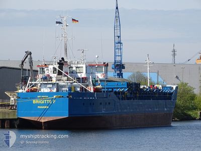
BRIGITTE F
General Cargo
Current Trip
| Time Travelled | 1 day |
|---|---|
| Remaining Time | --- |
| Distance Travelled | 29.48 nm |
| Remaining Distance | --- |
| AVG Speed | 6.5 Knots |
| MAX Speed | 9 Knots |
| AVG Wind | 12.1 knots |
| MAX Wind | 19 knots |
| MIN Temp | 4.3°C / 39.74°F |
| MAX Temp | 6.2°C / 43.16°F |
| Draught | 3 m |
| Position Received | 2 m ago |
Current Position
| Longitude | --- |
|---|---|
| Latitude | --- |
| Status | At anchor |
| Speed | 0.7 Knots |
| Course | 267° |
| Area | North Sea |
| Station | T-AIS |
| Position Received | 2 m ago |
Info
Information
The current position of BRIGITTE F is in North Sea with coordinates 53.65663° / 6.17804° as reported on 2025-03-05 00:42 by AIS to our vessel tracker app. The vessel's current speed is 0.7 Knots
The vessel BRIGITTE F (IMO: 8504234, MMSI: 352001875) is a General Cargo that was built in 1985 ( 40 years old ). It's sailing under the flag of [PA] Panama.
In this page you can find informations about the vessels current position, last detected port calls, and current voyage information. If the vessels is not in coverage by AIS you will find the latest position.
The current position of BRIGITTE F is detected by our AIS receivers and we are not responsible for the reliability of the data. The last position was recorded while the vessel was in Coverage by the Ais receivers of our vessel tracking app.
The current draught of BRIGITTE F as reported by AIS is 3 meters
Weather
| Temperature | 6.2°C / 43.16°F |
|---|---|
| Wind Speed | 19 knots |
| Direction | 230° SW |
| Pressure | 1021.9 hPa |
| Humidity | 77.6 % |
| Cloud Coverage | 16 % |
Featured Company
Last Port Calls
| Port | Arrival | Departure | Time In Port |
|---|---|---|---|
| 2025-03-02 12:58 | 2025-03-03 20:21 | 1 d | |
| 2025-03-01 03:20 | 2025-03-01 04:24 | 1 h | |
| 2025-02-27 19:14 | 2025-02-28 16:04 | 20 h | |
| 2025-02-26 17:30 | 2025-02-27 14:14 | 20 h | |
| 2025-02-25 06:24 | 2025-02-26 02:14 | 19 h | |
| 2025-02-21 02:32 | 2025-02-24 17:15 | 3 d | |
| 2025-02-17 13:12 | 2025-02-19 00:58 | 1 d | |
| 2025-02-07 21:00 | 2025-02-12 13:15 | 4 d | |
| 2025-01-31 02:21 | 2025-02-05 11:05 | 5 d | |
| 2025-01-26 17:17 | 2025-01-28 14:18 | 1 d |
Last Trips
| Origin | Departure | Destination | Arrival | Distance | |
|---|---|---|---|---|---|
| 2025-03-01 04:24 | 2025-03-02 12:58 | 189.16 nm | |||
| 2025-02-28 16:04 | 2025-03-01 03:20 | 87.31 nm | |||
| 2025-02-27 14:14 | 2025-02-27 19:14 | 45.65 nm | |||
| 2025-02-26 02:14 | 2025-02-26 17:30 | 120.69 nm | |||
| 2025-02-24 17:15 | 2025-02-25 06:24 | 119.86 nm | |||
| 2025-02-19 00:58 | 2025-02-21 02:32 | 395.90 nm | |||
| 2025-02-12 13:15 | 2025-02-17 13:12 | 453.50 nm | |||
| 2025-02-05 11:05 | 2025-02-07 21:00 | 483.21 nm | |||
| 2025-01-28 14:18 | 2025-01-31 02:21 | 462.69 nm | |||
| 2025-01-24 13:23 | 2025-01-26 17:17 | 411.73 nm |
Events
| Time | Event | Details | Position / Dest | Info |
|---|---|---|---|---|
| 2025-03-04 21:01 | Status Changed | At anchor Default |
53.65623 / 6.17823
FOR ORDER
|
Speed: 0.2 kn Course: 265° |
| 2025-03-04 20:46 | IN Coverage |
53.65623 / 6.17823
North Sea
FOR ORDER
|
Speed: 0.4 kn Course: 257.9° |
|
| 2025-03-04 18:27 | Status Changed | Default At anchor |
53.65601 / 6.17517
FOR ORDER
|
Speed: 0.2 kn Course: 105° |
| 2025-03-04 18:22 | Status Changed | At anchor Default |
53.65593 / 6.17521
FOR ORDER
|
Speed: 0.2 kn Course: 103° |
| 2025-03-04 18:22 | OUT of Coverage |
53.65593 / 6.17521
North Sea
FOR ORDER
|
Speed: 0.2 kn Course: 305.6° |
|
| 2025-03-04 18:10 | IN Coverage |
53.65593 / 6.17521
North Sea
FOR ORDER
|
Speed: 0.2 kn Course: 305.6° |
|
| 2025-03-04 14:07 | Status Changed | Default At anchor |
53.65671 / 6.17772
FOR ORDER
|
Speed: 0.4 kn Course: 238° |
| 2025-03-04 14:01 | Status Changed | At anchor Default |
53.65691 / 6.17750
FOR ORDER
|
Speed: 0.2 kn Course: 215° |
| 2025-03-04 14:01 | IN Coverage |
53.65691 / 6.17750
North Sea
FOR ORDER
|
Speed: 0.4 kn Course: 295.6° |
|
| 2025-03-04 14:01 | OUT of Coverage |
53.65691 / 6.17750
North Sea
FOR ORDER
|
Speed: 0.4 kn Course: 295.6° |