
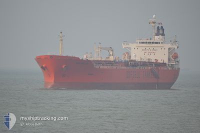
BOW HECTOR
Oil/Chemical Tanker
Current Trip
| Time Travelled | 6 days |
|---|---|
| Remaining Time | --- |
| Distance Travelled | 2013.75 nm |
| Remaining Distance | --- |
| AVG Speed | 13.2 Knots |
| MAX Speed | 16.2 Knots |
| AVG Wind | 12.8 knots |
| MAX Wind | 26.8 knots |
| MIN Temp | 4.2°C / 39.56°F |
| MAX Temp | 18.7°C / 65.66°F |
| Draught | 7.1 m |
| Position Received | 3 d ago |
Current Position
| Longitude | --- |
|---|---|
| Latitude | --- |
| Status | Under way using engine |
| Speed | 14.4 Knots |
| Course | 268° |
| Area | North Atlantic Ocean |
| Station | T-AIS |
| Position Received | 3 d ago |
Info
Information
The current position of BOW HECTOR is in North Atlantic Ocean with coordinates 48.90232° / -12.67262° as reported on 2026-01-01 23:02 by AIS to our vessel tracker app. The vessel's current speed is 14.4 Knots and is heading at the port of HOUSTON. The estimated time of arrival as calculated by MyShipTracking vessel tracking app is 2026-01-15 06:00 LT
The vessel BOW HECTOR (IMO: 9363493, MMSI: 257570000) is a Oil/Chemical Tanker that was built in 2009 ( 17 years old ). It's sailing under the flag of [NO] Norway.
In this page you can find informations about the vessels current position, last detected port calls, and current voyage information. If the vessels is not in coverage by AIS you will find the latest position.
The current position of BOW HECTOR is detected by our AIS receivers and we are not responsible for the reliability of the data. The last position was recorded while the vessel was in Coverage by the Ais receivers of our vessel tracking app.
The current draught of BOW HECTOR as reported by AIS is 7.1 meters
Weather
| Temperature | 18.7°C / 65.66°F |
|---|---|
| Wind Speed | 26 knots |
| Direction | 183° S |
| Pressure | 1018.4 hPa |
| Humidity | 85.7 % |
| Cloud Coverage | 78 % |
Featured Company
Last Port Calls
| Port | Arrival | Departure | Time In Port |
|---|---|---|---|
| 2025-12-28 09:04 | 2025-12-30 21:19 | 2 d | |
| 2025-11-07 07:27 | 2025-11-08 06:26 | 22 h | |
| 2025-11-05 15:43 | 2025-11-06 06:35 | 14 h | |
| 2025-11-01 17:48 | 2025-11-03 08:40 | 1 d |
Last Trips
| Origin | Departure | Destination | Arrival | Distance | |
|---|---|---|---|---|---|
| 2025-11-08 06:26 | 2025-12-28 09:04 | 14201.91 nm | |||
| 2025-11-06 06:35 | 2025-11-07 07:27 | 320.15 nm | |||
| 2025-11-03 08:40 | 2025-11-05 15:43 | 735.93 nm | |||
| 2025-10-29 23:33 | 2025-11-01 17:48 | 567.24 nm |
Events
| Time | Event | Details | Position / Dest | Info |
|---|---|---|---|---|
| 2026-01-01 23:06 | Status Changed | Default Under way using engine |
48.90173 / -12.69617
USHOU
|
Speed: 14.4 kn Course: 268° |
| 2026-01-01 23:02 | Status Changed | Under way using engine Default |
48.90232 / -12.67262
USHOU
|
Speed: 14.4 kn Course: 268° |
| 2026-01-01 23:02 | OUT of Coverage |
48.90232 / -12.67262
North Atlantic Ocean
USHOU
|
Speed: 14.4 kn Course: 268° |
|
| 2026-01-01 23:02 | Detected in Sea | Irish part of the North Atlantic Ocean |
48.90232 / -12.67262
North Atlantic Ocean
USHOU
|
Speed: 14.4 kn Course: 268° |
| 2026-01-01 22:43 | IN Coverage |
48.90232 / -12.67262
North Atlantic Ocean
USHOU
|
Speed: 14.4 kn Course: 268° |
|
| 2025-12-31 17:26 | Status Changed | Default Under way using engine |
50.11165 / -2.22572
USHOU
|
Speed: 12 kn Course: 254° |
| 2025-12-31 17:19 | Detected in Sea | Guernsey part of the English Channel |
50.11770 / -2.19117
English Channel
USHOU
|
Speed: 12 kn Course: 254° |
| 2025-12-31 17:19 | OUT of Coverage |
50.11770 / -2.19117
English Channel
USHOU
|
Speed: 12 kn Course: 254° |
|
| 2025-12-31 17:19 | Status Changed | Under way using engine Default |
50.11797 / -2.18950
USHOU
|
Speed: 11.9 kn Course: 255° |
| 2025-12-31 17:11 | IN Coverage |
50.11770 / -2.19117
English Channel
USHOU
|
Speed: 12 kn Course: 254° |