
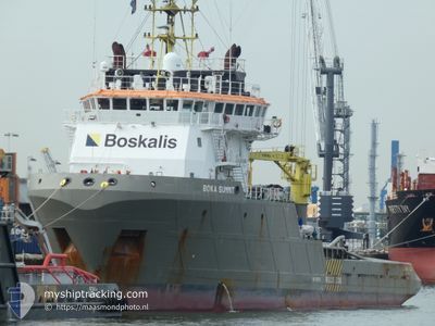
BOKA SUMMIT
Tug
Current Trip
BRRIO
| Time Travelled | 8 days |
|---|---|
| Remaining Time | --- |
| Distance Travelled | 1344.89 nm |
| Remaining Distance | --- |
| AVG Speed | 7.2 Knots |
| MAX Speed | 14 Knots |
| AVG Wind | 10.9 knots |
| MAX Wind | 19 knots |
| MIN Temp | 15.5°C / 59.9°F |
| MAX Temp | 25.6°C / 78.08°F |
| Draught | 6.3 m |
| Position Received | 4 d ago |
Current Position
| Longitude | -18.84385° |
|---|---|
| Latitude | 20.96295° |
| Status | Under way using engine |
| Speed | 7.9 Knots |
| Course | 210.1° |
| Area | North Atlantic Ocean |
| Station | T-AIS |
| Position Received | 4 d ago |
Info
Information
The current position of BOKA SUMMIT is in North Atlantic Ocean with coordinates 20.96295° / -18.84385° as reported on 2024-04-22 00:54 by AIS to our vessel tracker app. The vessel's current speed is 7.9 Knots
The vessel BOKA SUMMIT (IMO: 9315575, MMSI: 248972000) is a Tug that was built in 2005 ( 19 years old ). It's sailing under the flag of [MT] Malta.
In this page you can find informations about the vessels current position, last detected port calls, and current voyage information. If the vessels is not in coverage by AIS you will find the latest position.
The current position of BOKA SUMMIT is detected by our AIS receivers and we are not responsible for the reliability of the data. The last position was recorded while the vessel was in Coverage by the Ais receivers of our vessel tracking app.
The current draught of BOKA SUMMIT as reported by AIS is 6.3 meters
Weather
| Temperature | 25.5°C / 77.9°F |
|---|---|
| Wind Speed | 11 knots |
| Direction | 18° NNE |
| Pressure | 1010.8 hPa |
| Humidity | 79 % |
| Cloud Coverage | 100 % |
Featured Company
Most Visited Ports (Last year)
| Port | Arrivals | |
|---|---|---|
| 2 | ||
| 2 | ||
| 2 | ||
| 2 | ||
| 1 | ||
| 1 |
Events
| Time | Event | Details | Position / Dest | Info |
|---|---|---|---|---|
| 2024-04-22 01:01 | Status Changed | Default Under way using engine |
20.94833 / -18.85167
BRRIO
|
Speed: 7.9 kn Course: 210.1° |
| 2024-04-22 00:54 | Change Sea Area | Western Saharan part of the North Atlantic Ocean Spanish (Canary Islands) part of the North Atlantic Ocean |
20.96295 / -18.84385
North Atlantic Ocean
|
Speed: 7.9 kn Course: 210.1° |
| 2024-04-22 00:54 | Status Changed | Under way using engine Default |
20.96295 / -18.84385
BRRIO
|
Speed: 7 kn Course: 211° |
| 2024-04-22 00:54 | OUT of Coverage |
20.96295 / -18.84385
North Atlantic Ocean
|
Speed: 7.9 kn Course: 210.1° |
|
| 2024-04-22 00:43 | IN Coverage |
20.96295 / -18.84385
North Atlantic Ocean
|
Speed: 7.9 kn Course: 210.1° |
|
| 2024-04-19 11:47 | Status Changed | Default Under way using engine |
27.70645 / -15.31398
BRRIO
|
Speed: 7.5 kn Course: 208.4° |
| 2024-04-19 11:32 | OUT of Coverage |
27.73132 / -15.29857
North Atlantic Ocean
|
Speed: 7.5 kn Course: 208.4° |
|
| 2024-04-19 08:39 | ETA Changed | 2024/04/07 07:00 2024/04/18 07:00 |
28.08628 / -15.35251
BRRIO
|
Speed: 8.3 kn Course: 105.3° |
| 2024-04-19 08:33 | Destination Changed | BRRIO ESLPA |
28.08891 / -15.36919
BRRIO
|
Speed: 8.3 kn Course: 98.9° |
| 2024-04-19 08:29 | Status Changed | Under way using engine At anchor |
28.08974 / -15.37858
ESLPA
|
Speed: 8.2 kn Course: 86.1° |