
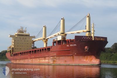
AAL GEELONG
General Cargo
Current Trip
| Time Travelled | 11 days |
|---|---|
| Remaining Time | --- |
| Distance Travelled | 3146.46 nm |
| Remaining Distance | 2483.74 nm |
| AVG Speed | 11.6 Knots |
| MAX Speed | 15.1 Knots |
| AVG Wind | 6.4 knots |
| MAX Wind | 15 knots |
| MIN Temp | 26.2°C / 79.16°F |
| MAX Temp | 31.2°C / 88.16°F |
| Draught | 6.8 m |
| Position Received | 8 d ago |
Current Position
| Longitude | 103.58209° |
|---|---|
| Latitude | 1.19879° |
| Status | Under way using engine |
| Speed | 13.8 Knots |
| Course | 279.3° |
| Area | Singapore Strait |
| Station | T-AIS |
| Position Received | 8 d ago |
Info
Information
The current position of AAL GEELONG is in Singapore Strait with coordinates 1.19879° / 103.58209° as reported on 2024-05-01 12:53 by AIS to our vessel tracker app. The vessel's current speed is 13.8 Knots and is heading at the port of SINGAPORE.
The vessel AAL GEELONG (IMO: 9393539, MMSI: 210998000) is a General Cargo that was built in 2009 ( 15 years old ). It's sailing under the flag of [CY] Cyprus.
In this page you can find informations about the vessels current position, last detected port calls, and current voyage information. If the vessels is not in coverage by AIS you will find the latest position.
The current position of AAL GEELONG is detected by our AIS receivers and we are not responsible for the reliability of the data. The last position was recorded while the vessel was in Coverage by the Ais receivers of our vessel tracking app.
The current draught of AAL GEELONG as reported by AIS is 6.8 meters
Weather
| Temperature | 28.9°C / 84.02°F |
|---|---|
| Wind Speed | 6 knots |
| Direction | 24° NNE |
| Pressure | 1009.7 hPa |
| Humidity | 67.3 % |
| Cloud Coverage | 40 % |
Featured Company
Events
| Time | Event | Details | Position / Dest | Info |
|---|---|---|---|---|
| 2024-05-01 13:00 | Status Changed | Default Under way using engine |
1.20352 / 103.55482
SGSIN PEBGA
|
Speed: 13.8 kn Course: 279.3° |
| 2024-05-01 12:53 | Change Sea Area | Malaysian part of the Singapore Strait Indonesian part of the Singapore Strait |
1.19879 / 103.58209
Singapore Strait
|
Speed: 13.8 kn Course: 279.3° |
| 2024-05-01 12:53 | OUT of Coverage |
1.19879 / 103.58209
Singapore Strait
|
Speed: 13.8 kn Course: 279.3° |
|
| 2024-05-01 12:10 | Change Sea Area | Indonesian part of the Singapore Strait Singaporean part of the Singapore Strait |
1.13579 / 103.72732
Singapore Strait
|
Speed: 12.5 kn Course: 282.9° |
| 2024-05-01 10:39 | START Moving | 2.04 nm, East of SINGAPORE |
1.26073 / 103.88837
SGSIN PEBGA
|
Speed: 4.6 kn Course: 76° |
| 2024-05-01 10:26 | Status Changed | Under way using engine At anchor |
1.25998 / 103.88707
SGSIN PEBGA
|
Speed: 0.3 kn Course: 354° |
| 2024-05-01 00:00 | ETA Changed | 2025/04/30 18:30 2024/04/30 18:30 |
1.26287 / 103.88824
SGSIN PEBGA
|
Speed: Course: 200° |
| 2024-04-30 20:54 | Status Changed | At anchor Default |
1.26275 / 103.88820
SGSIN PEBGA
|
Speed: Course: 214° |
| 2024-04-30 20:51 | Status Changed | Default At anchor |
1.26271 / 103.88818
SGSIN PEBGA
|
Speed: Course: 215° |
| 2024-04-30 18:57 | STOP Moving | 1.92 nm, East of SINGAPORE |
1.26092 / 103.88642
SGSIN PEBGA
|
Speed: 0.2 kn Course: 48° |